Windy today and tomorrow along with some cold-fronts for the front-range
Jan 15, 2026
01/15/26 8:30am: Already windy out there in/near the foothills. Getting some wind-gusts of 20-40mph at my house in Westminster. As I mentioned yesterday going to be windy today and especially tomorrow, especially over parts of the northern front-range.
An initial cold-front will arrive on the front-range after 9pm this evening. Then a stronger cold-front Fri night into Sat. Snow showers / light snow possible for parts of the northeast plains, northern front-range and parts of the north-central / front-range mountains from Fri morning through Sat am, see my post from last night for details on that.
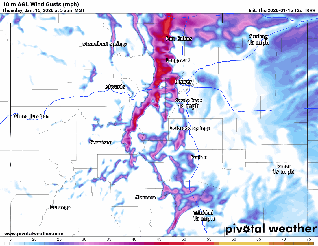
But in terms of wind, some strong wind for Den/Bou and the adjacent foothills today, especially from 11am-5pm: westerly wind-gusts of 30-50 mph at lower elevations (40-70 mph at higher elevations).
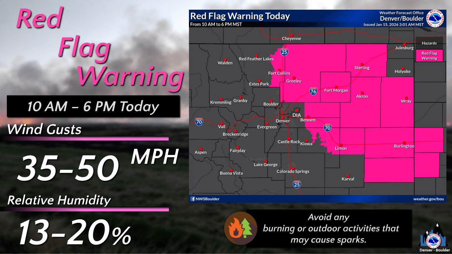
There is a Red Flag Warning in place for areas just north and east of Denver today through 6pm
Then very windy over parts of the northern front-range tomorrow again, especially from 12pm-8pm, and especially from Longmont north to Ft. Collins Greeley areas and west into the foothills: those areas can expect wind-gusts of 50-90 mph tomorrow afternoon. For the rest of Den/Bou gusts of 30-60 mph tomorrow afternoon (and it will be chilly).
Less wind on Saturday but will remain chilly. I'll have more on the expected light mountains snow later.
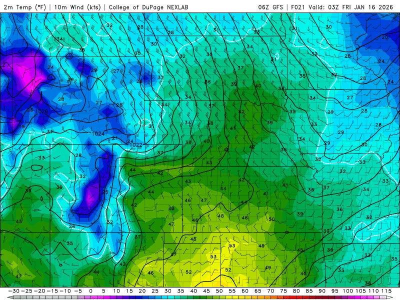
First image loop shows forecast wind-gusts over the next 48hrs (5am this morning through 5am Sat) from latest HRRR model. Second image shows the Red Flag Warning for today from Den/Bou NWS office. Third image shows the initial cold-front moving into the northern front-range after 8pm this evening.

Like what you read?
Receive daily weather reports straight to your inbox with Seth's Daily Newsletter. Sign up below.