Windy in over the Front Range mountains over the next couple days, some snow for the Northern Mountains
Jan 27, 2026
01/27/26 8:45am: Morning, its Tuesday. It will be windy over the Front Range mountains today, Wed and Thu. It will turn windier for Den/Bou and the lower elevations on Wed evening into Thu (as a short-wave moves through). Some snow still expected for the northern mountains on Wed night through mid-day Thu.
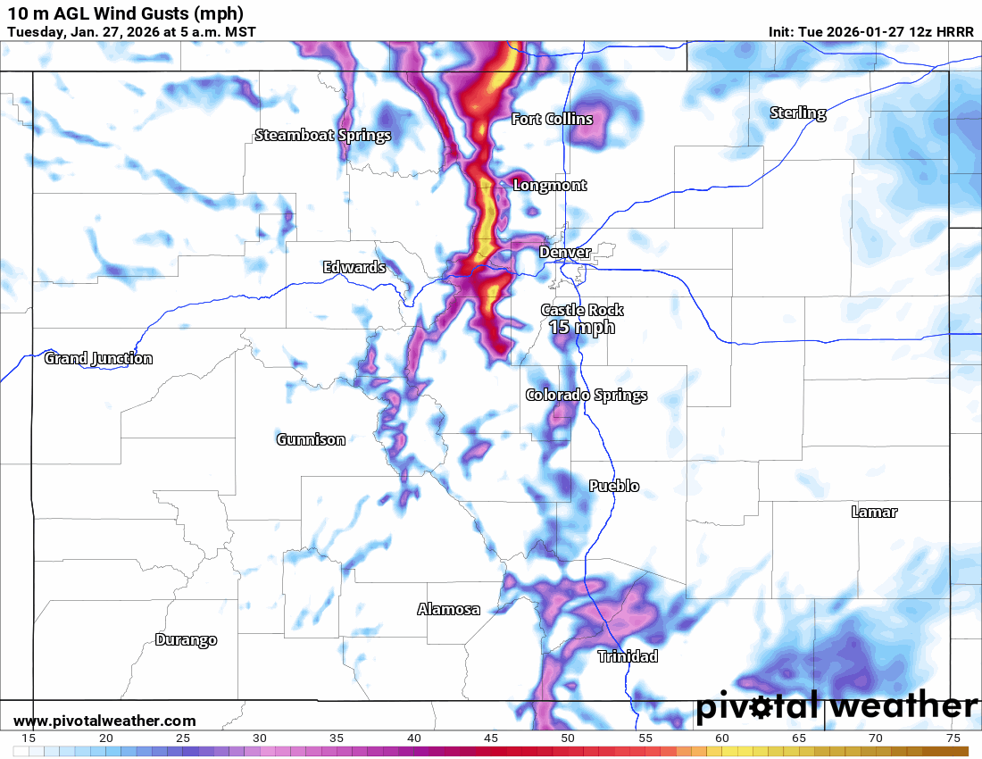
For today it will be windy along the Front Range, especially from Ft. Collins to Cheyenne, WY and also in the foothills and mountains along/east of the Cont. Divide from 11am-8pm today with westerly wind-gusts of 30-60mph. For Den/Bou proper, wind-gusts of 15-30 mph (so not that bad).
For tomorrow, it will turn more windy across much of the north-central mountains (Summit, ClearCreek, Grand, western Boulder/Larimer counties etc) from 12pm Wed through 5pm Thu... windiest as the main short-wave moves through (10pm Wed to 4am Thu), westerly wind-gusts of 40-70mph in spots, strongest near the Cont. Divide.
Also windy for Den/Bou and western suburbs near the foothills on Wed night into Thu: westerly wind-gusts of 20-40mph.
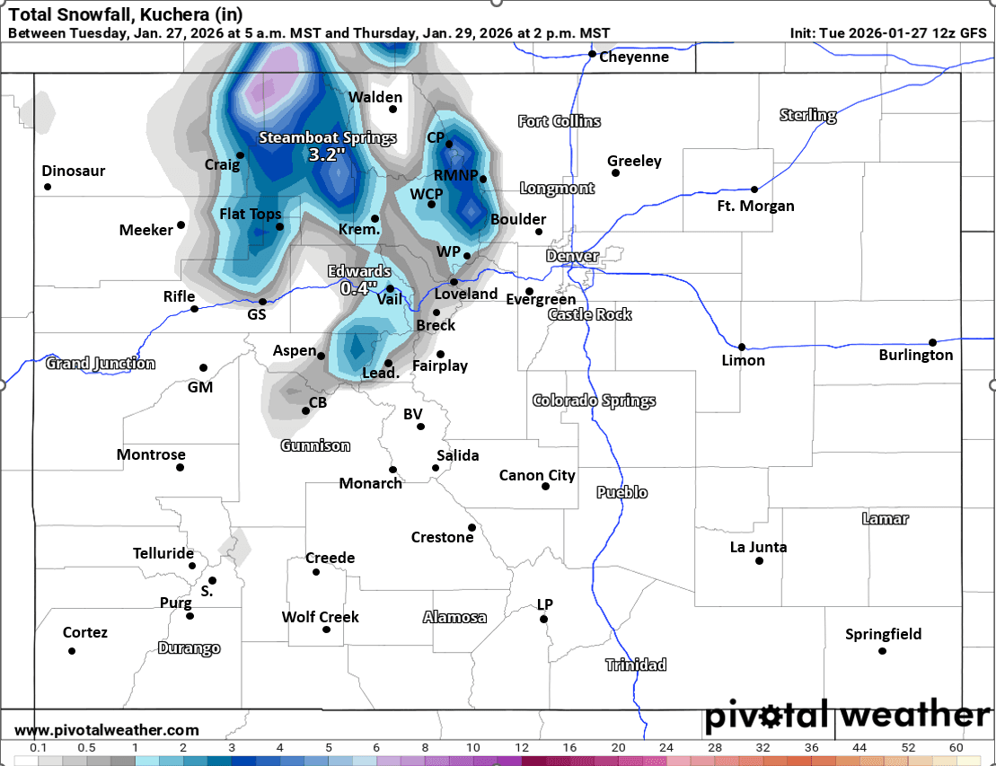
Then some snow for the north-central mountains from about 10pm Wed to 12pm Thu, best chances along/north of I-70 and especially for Park Range (near Steamboat) to Medicine Bow Range (near Cameron Pass), with 2-5" for the northern mountains. For the local ski areas and I-70 mountains corridor 1/2" to 3" in spots by Thu mid-day, favoring areas near Cont. Divide: Loveland Pass, Berthoud Pass, Winter Park, IPW, RMNP, secondarily near Vail Pass.
With some semi-moist northwest flow in place for Thu into Fri, likely mor snow-showers at times for the higher parts of the north-central mountains, but not much snow accum. So snow showers and continued breezy over the mountains on Thu and Fri before turning more sunny again by Sat.
Then dry and warmer from about Sat through next Tue, warm and sunny this weekend.
Next storm system likely around, next Wed (February 4th).
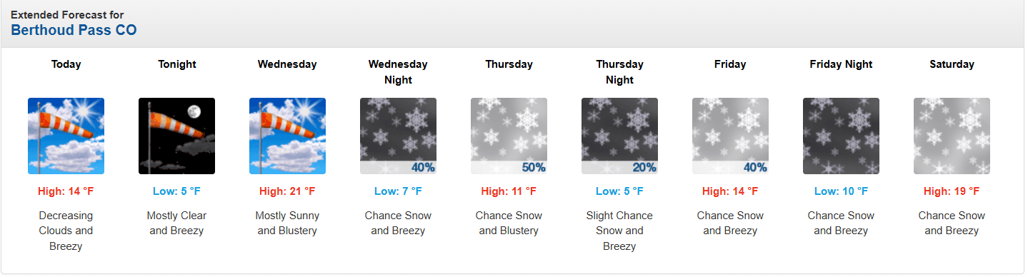
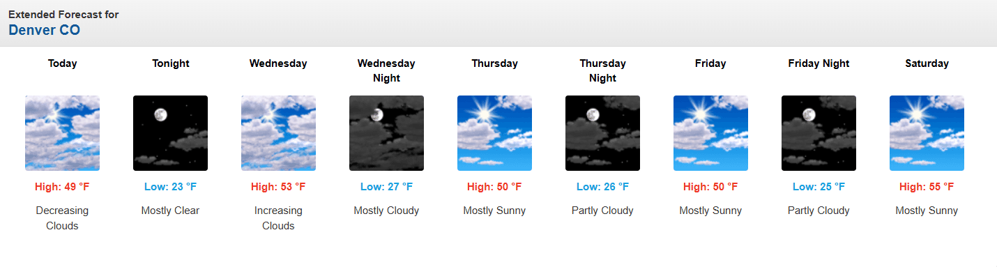
First image loop shows forecast wind-gusts over the next 48hrs (5am this morning to 5am Thu) from latest HRRR model. Second image shows forecast total snowfall from now through 2pm Thu from very latest GFS (take with grain of salt, doesn't resolve mountain / valley features). Images 3 and 4 compare 5-day forecasts for Berthoud Pass and Denver from NWS.

Like what you read?
Receive daily weather reports straight to your inbox with Seth's Daily Newsletter. Sign up below.