Warm start to week, several clipper will bring snow to the mountains Wed-Sun.
Dec 15, 2025
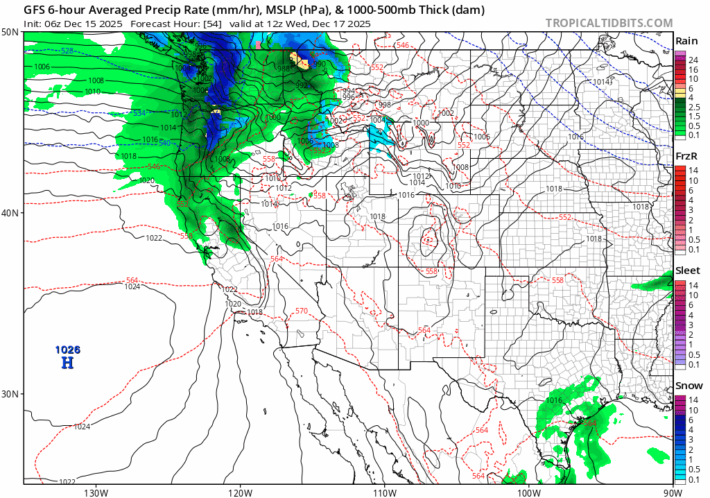
12/15/25 8am: Morning, its Monday. We do have some weather to talk about (that's not warm temps and sun, lol). Models show a series of short-waves coming in on northwest flow impacting the state starting Wed evening into Thu, Thu into Fri and Sat into Sun, several rounds of light to moderate snow for the mountains and it will turning windy and colder for the mountains towards the end of this week / weekend.
Some rain/snow for Den/Bou and the front-range as well on Wed night into early Thu prior to this very warm for the next couple days (Mon through Wed am: the 60 deg high temp record will be broken as I mentioned).
For the north-central mountains, including Routt, Pitkin, Eagle, Summit, ClearCreek, Grand, western Boulder/Larimer counties (I-70 mountain corridor): next round of snow expected primarily from 5pm Wed to 5am Thu: 2-5" of snow for the ski areas and higher terrain, favoring the Front Range mountains from Loveland to Berthoud to Winter Park, to IPW, RMNP, Cameron Pass areas.
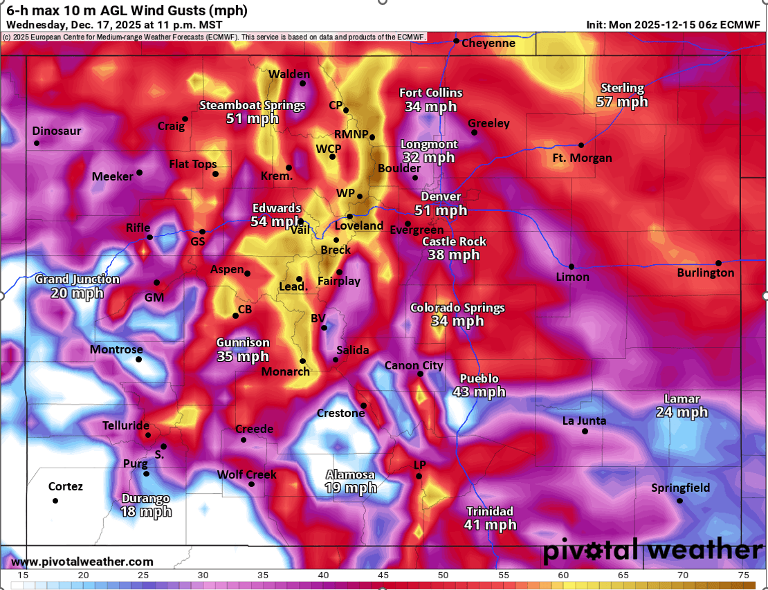
It will be turning quite windy in the mountains with stronger northwest wind-gusts of 30-70mph from 11am Wed through 11am Thu (windiest Wed night). Strongest winds will be along/east of the Cont. Divide especially on Thu.
For Den/Bou and the front-range, likely a round of rain/snow (snow above 7k ft) from 5pm Wed to 2am Thu. Some cold rain showers for Den/Bou, won't be too much. Maybe a Trace-2" of snow for parts of the foothills and Palmer Divide, will be spotty.
Also looks like some strong wind for the front-range (Den/Bou) from about 5pm Wed through 5pm Thu: northwest wind-gusts of 20-50mph, stronger in the foothills.
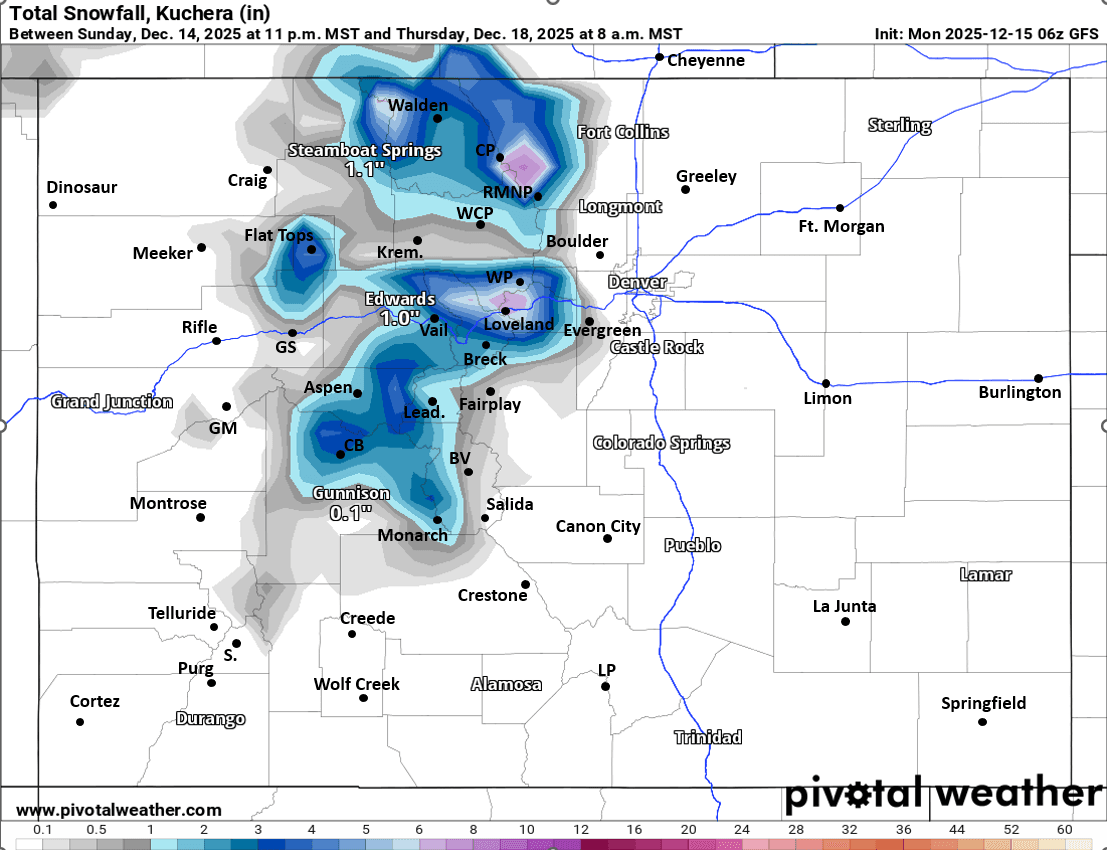
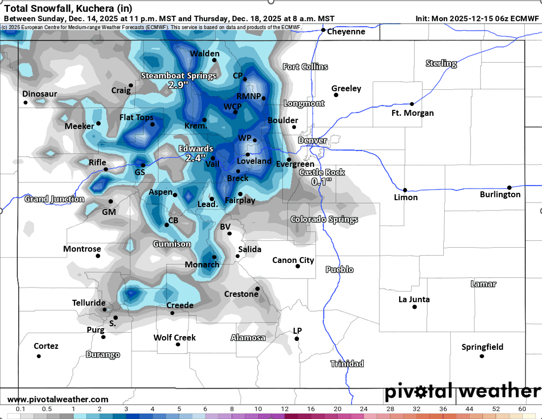
More light snow for the north-central mountains from 5pm Thu to 5am Fri (1-4" additional). Then even more snow for the mountains and ski areas likely from 8am Sat through 5am Sun: additional 1-5" likely favoring northern / northwest CO.
More snow possible for the mountains. Sun into Mon as well but that part is uncertain.
First image loop shows forecast precip-type/rate and MSLP from Wed morning through Tue morning (12/17 through 12/23). Second image shows forecast 6-hour max wind-gusts from 5pm-11pm on Wed showing strong winds. Images 3 and 4 compare forecast total snowfall from now through 8am Thu from latest GFS and ECMWF models, take snow amounts with grain of salt.

Like what you read?
Receive daily weather reports straight to your inbox with Seth's Daily Newsletter. Sign up below.