Warm and windy today, dry for the weekend. Snow returns to the mountains next Wed night
Dec 11, 2025
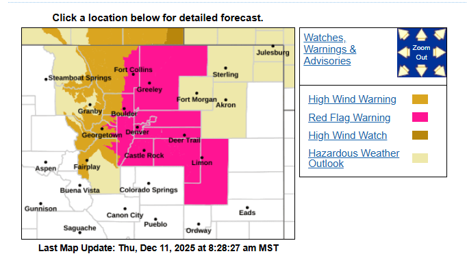
12/11/25 8:40am: The wind blows, especially with no snow lol. Warm and windy today. Not great to see Red Flag Warnings in place along the front-range in mid-December but that is what we are dealing with today (warm and windy).
Another windy day especially for parts of the Front Range mountains, foothills and western suburbs (Ft. Collins to Boulder to Golden).
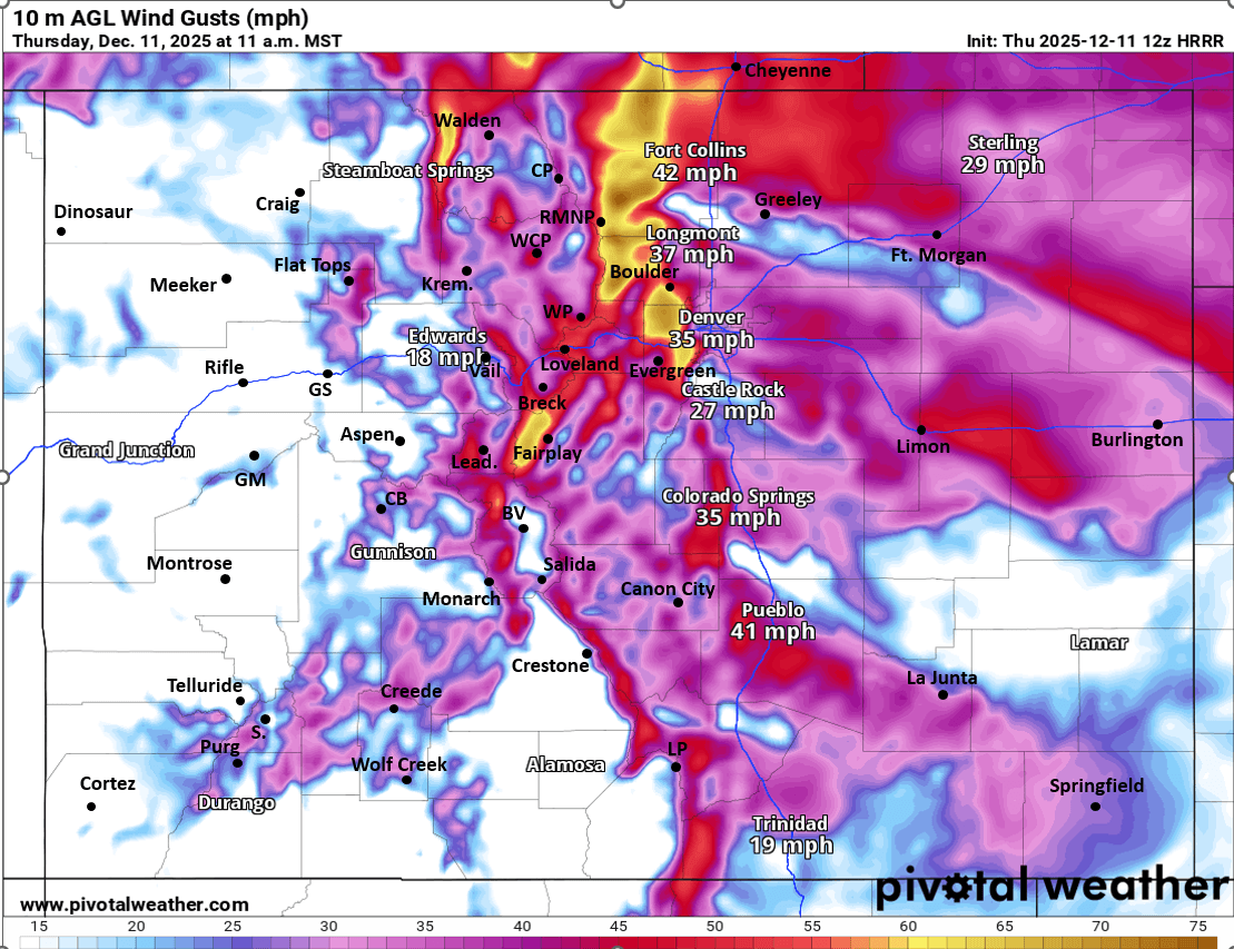
Much of the eastern north-central mountains (and front-range mountains) are under a High Wind Warning through about 12pm today (although strong wind will likely continue through 5pm): westerly wind-gusts of 30-60mph, strongest along/east of the Cont. Divide.
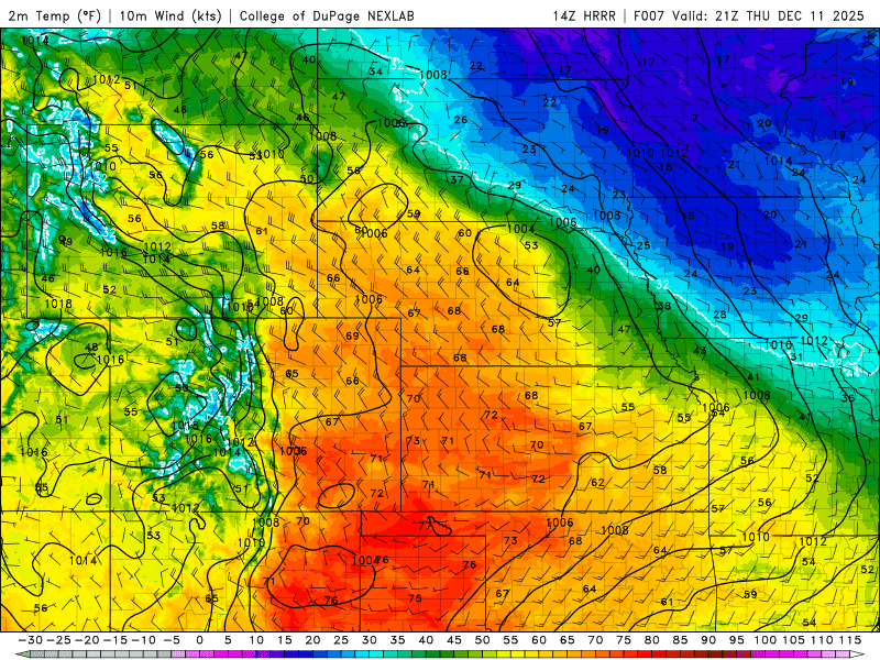
Windy and warm in Den/Bou today, high temps potentially above 65 if we can get the wave-cloud to move east (otherwise cooler). Westerly wind gusts of 20-40mph today, strongest near the foothills. Red Flag Warning from 9am-5pm today.
Not quite as windy tomorrow, but still pretty breezy in spots, especially in the Front Range mountains and foothills again between 11am-5pm Fri.
It will be cooler on the front-range (Den/Bou) on Fri (highs back in the 50s) behind a dry, surface front expected to move down the front-range early tomorrow am.
Then warm and dry for the weekend. Pretty dry overall from Sat through Wed.
Snow likely returns to the north central mountains next Wed afternoon into Thu am (17th/18th) with several inches possible in spots (even at the ski areas).
Then maybe more snow for the mountains Fri into Sat (19th/20th), but that is uncertain.
First image shows the Red Flag Warnings and High Wind Warnings for today from Den/Bou NWS office. Second image shows forecast wind-gusts at 11am today from latest HRRR. Third image shows forecast temps at 2pm today from HRRR (warm).

Like what you read?
Receive daily weather reports straight to your inbox with Seth's Daily Newsletter. Sign up below.