Warm and windy today, a look at evolving forecast for the weekend: storm Sun/Mon now?
Nov 11, 2025
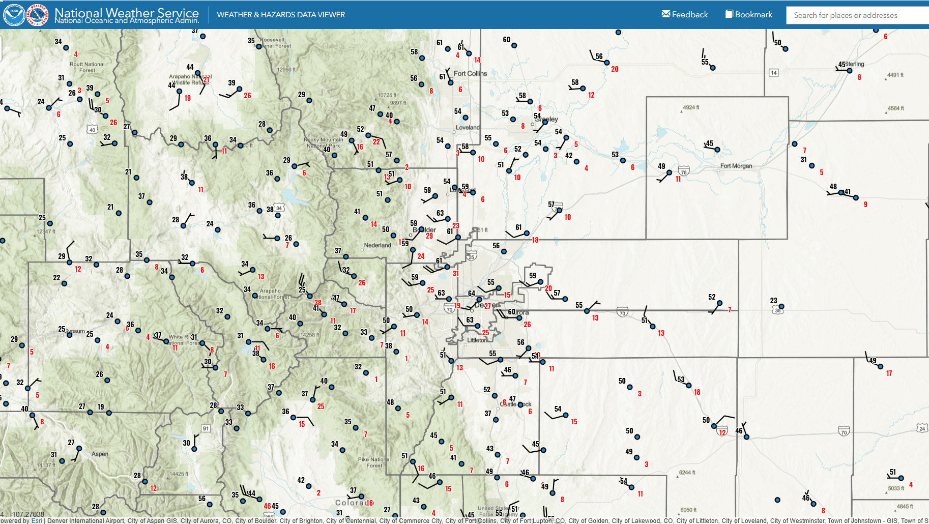
11/11/25 8am: Morning. Yesterday at this time it was 27 degs in Denver, right now its 61!...another great example of how the westerly downslope winds can really warm the airmass even during the winter. The west / southwest wind overnight and the cloud-cover (which prevents radiative cooling) has kept low temperatures very warm along the front-range. Recent surface map (first image) shows the warm temps near the foothills (with some stronger southwest winds developing now).
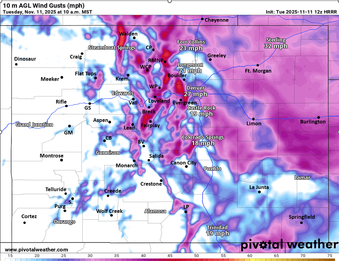
For the rest of today it will be warm and windy over CO. Windy through 5pm with west / southwest wind-gusts of 20-50mph, strongest over the northern Front Range mountains and foothills above 8k ft and also near the CO/WY border and parts of the Palme Divide (second image shows the forecast wind-gusts at 10am today).
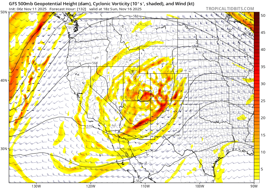
Anyway, in terms of the weekend storm system (meandering upper-level low), the models are all over the place in terms of where the low tracks as it moves east on Sun into Mon. Latest GFS has it moving up across the state from southwest to northeast and this would bring a bigger shot of rain/snow to the mountains and front-range. ECMWF and GEM to some degree keep it further south and weaker with more limited impacts.
Bottom line, it now appear most of the rain/snow for the state will be from 11am Sun through 5pm Mon.
Heaviest snow is still expected in the San Juans (maybe 6-12" there).
Some snow for north-central mountains and I-70 corridor on Sun into Mon, maybe 3-9" in spots by Mon night but uncertainty is high.
Maybe some rain/snow for the front-range, mostly from the Palmer Divide north on late Sun night into Mon am, snow-level likely down to about 7500ft by early Mon am (maybe some light snow for the foothills and Palmer Divide), uncertainty is very high.
I'll have more on the Sun/Mon storm later.
First image shows latest surface map over north-central CO showing latest temps and wind. Second image shows the wind-gust forecast at 10am today from latest HRRR. Image 3 shows the disorganized upper-level low at 11am Sun from latest GFS (does it move up across CO?)
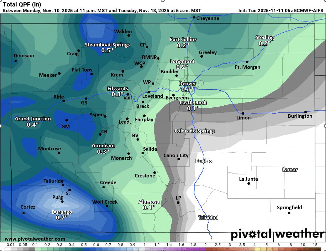
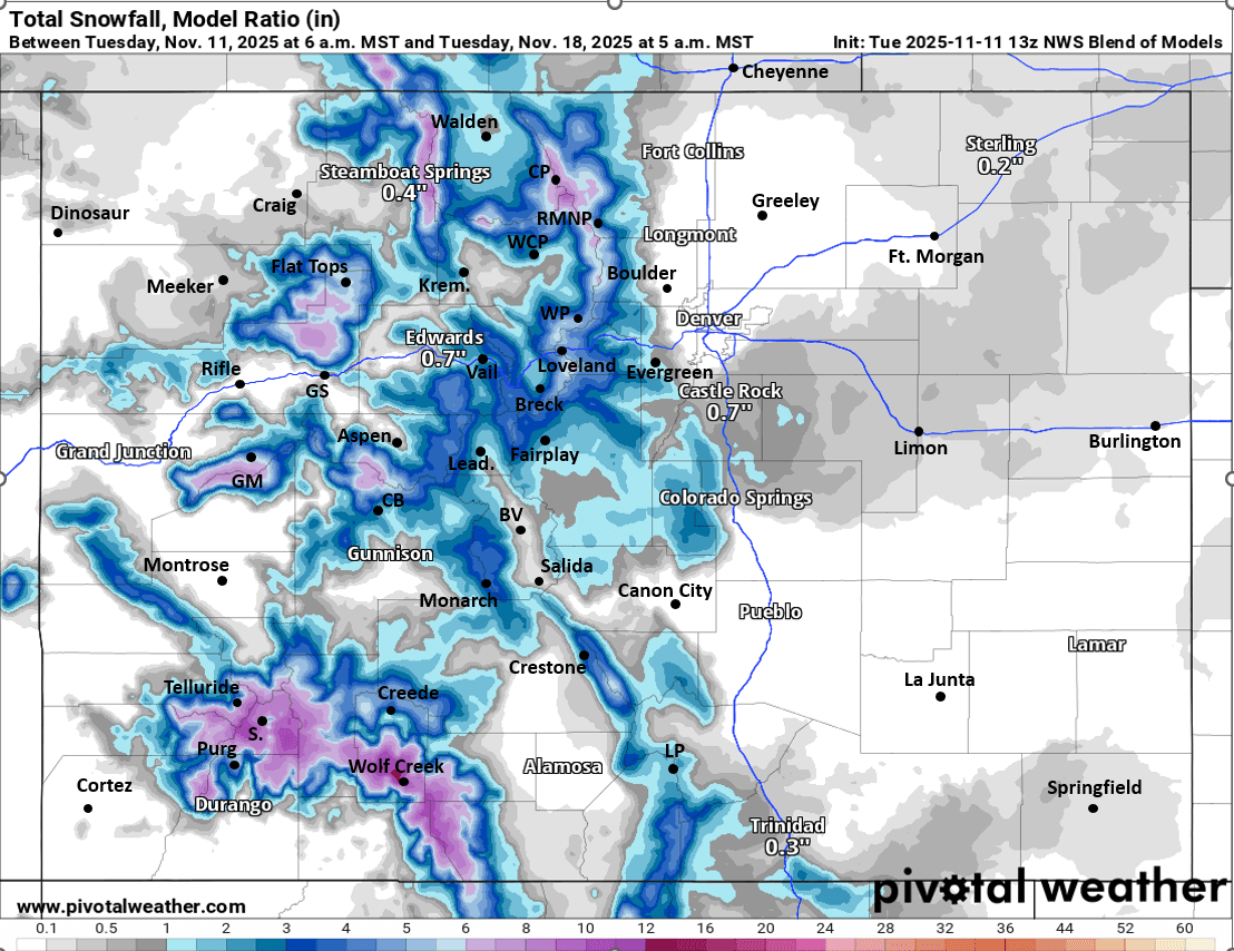
Image 4 shows strongest signals for total liquid precip from the ECMWF AI model (AIFS), this typically shows where best chances for precip (rain/snow) will be but broad-brushes the details. Fifth image shows forecast total snowfall from now through next Tue (11/18) from NWS Blend of Models, take with a big grain of salt but shows where current signals are for snow (details will change)

Like what you read?
Receive daily weather reports straight to your inbox with Seth's Daily Newsletter. Sign up below.