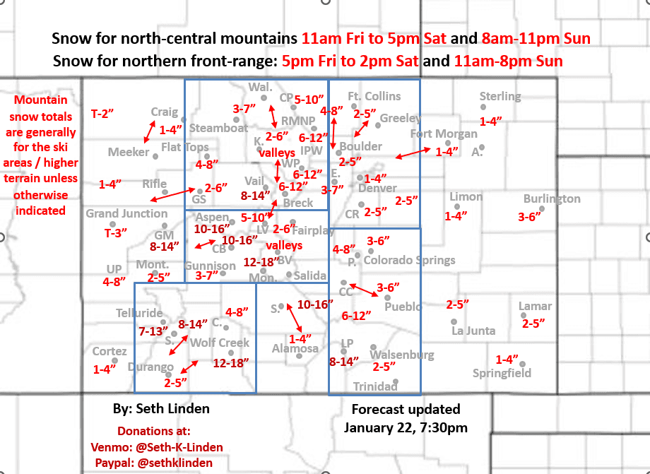
Updated snowfall map through Sun pm (for really two storm systems)
Jan 22, 2026
01/22/26 8pm: Alright, I have an updated snowfall map below for the approaching storm system(s) for total snowfall through Sunday night.
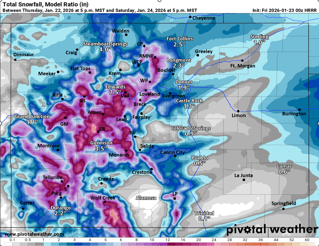
The forecast is on track but its looking more complicated as models really show two distinct waves (or even three depending on how you look at it) impacting CO through late Sun. The good thing is, overall snow totals haven't changed much but models can't agree on where heaviest amounts will be and the exact timing of these waves. Devil is always in the details in CO lol.
But I think the snow is going to pile up in spots by Sun night (especially in the mountains) and with the very cold temps, we should have some high snow-ratios.
But realize we won't know the final snow-totals until Mon morning (so don't try to say its a bust on Sat, when we are only half-way through the storm lol).
For the north-central mountains, I-70 mountain corridor and local ski areas:
....the first round of snow will be mostly from 11am Fri to 5pm Sat
....next round of snow from 8am-11pm Sun
Probably 2/3rds of the snow for the mountains by Sat pm, the remaining 1/3rd by Sun pm. Still looking at a good 7-14" for the ski areas, with highest amounts locally west and south of Vail Pass. But all of Summit and Grand co ski areas should do well.
Still looks like highest amounts in the mountains will be in parts of the Elk Range (near/west of Crested Butte and Aspen), Collegiate Range (near Monarch), San Juans (near Wolf Creek and Silverton) and northern Sangre's (upper Crestones): 10-18"+ for those areas. Refer to map.
For Den/Bou and the front-range the forecast is looking very complicated. But also now looks like two waves of snow:
...first round mostly from 5pm Fri to 2pm Sat (or later according to HRRR: showing it Sat evening)
...second round of snow likely from 11am-8pm Sun but that is a bit more uncertain
Initially from Fri night to Sat am, fairly weak upslope on the front-range with some cold air in place, so spotty snowfall favoring areas closer to Ft. Collins initially then Den/Bou later.
Best upslope and snowfall for Den/Bou may hold off until either later Sat or during second wave on Sun...and then it may pile up some in spots (its going to be cold, so fluffy snow). For example latest ECMWF shows 3-5" for the metro area by Sun pm, but other models have 1-3". A good 1-4" seems likely with 3-8" for the foothills. Also could be some banded snowfall in spots. Refer to map.
Higher amounts on the front-range still maybe between Colorado Springs to Pueblo: 3-6" for those areas with higher amounts in foothills but its a bit uncertain.
Even the western slope, Grand Junction will get some snow with this storm system: 1-4" in spots, with more like 2-5" for areas closer to Montrose and Durango, Pagosa areas.
And of course, as I have mentioned earlier going to be very cold on the front-range tomorrow (highs in the teens), and very cold across the entire state on Saturday and Sunday (highs in the single digits in the mountains, low teens on the plains, 20s Sun).
That is all for now. This is going to be fun. Getting stoked for pow 🙂
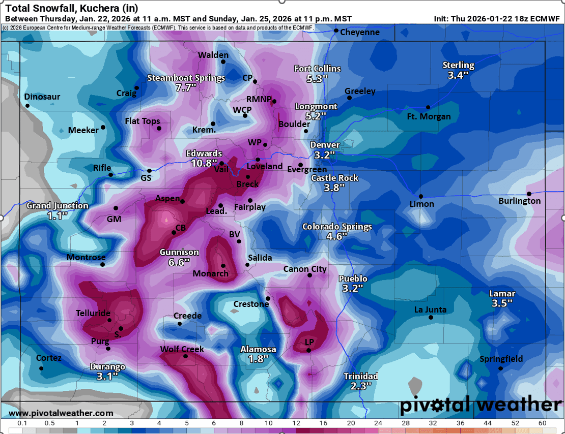
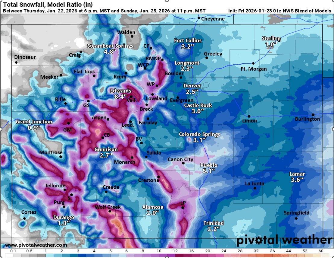
First image is my updated total snowfall map through 11pm Sun. Second image shows forecast total snowfall from now through just 5pm Sat from latest high-res HRRR model (really only the first part of the event). Images 3 and 4 compare forecast total snowfall from now through 11pm Sun form latest ECMWF model and NWS Blend of Models (and these include both waves)....take modeled snow amounts with a grain of salt, refer to map for the forecast.

Like what you read?
Receive daily weather reports straight to your inbox with Seth's Daily Newsletter. Sign up below.