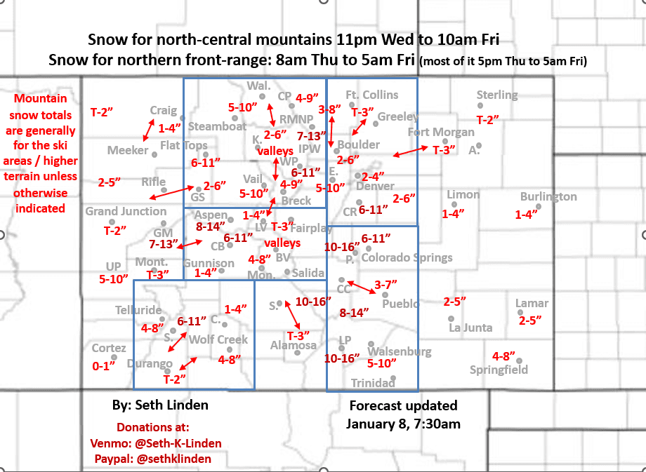
Updated snowfall map for the current storm, through Fri am
Jan 8, 2026
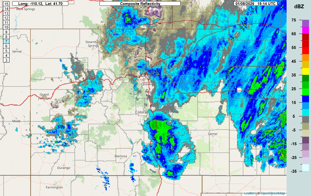
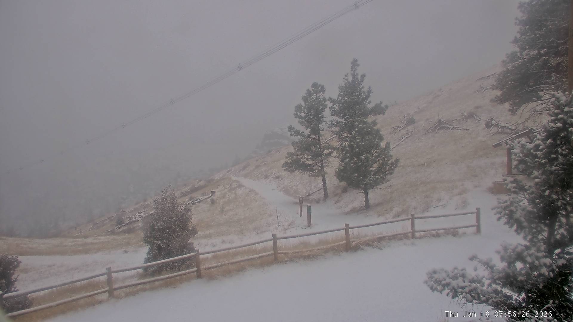
01/08/26 8:20am: Morning from Silverthorne, I'm up here for some skiing later and some work lol. Looks like its snowier on the front-range (over Den/Bou) right now than it is up here (but the main cold-front is approaching so it will get snowy up here as well). Great to see some good snow falling along the front-range. Latest web cams show snowy conditions in Boulder (image 2).
Also good to see 4-8" at Steamboat already this morning with 1-4" at some of the local ski areas (like Vail and Winter Park).
Anyway I wanted to get out an updated snowfall map as the forecast is changing some. Latest trends show the main wave / upper-level low tracking further south, so this puts the focus for heaviest snowfall over southeastern CO (and less for northern CO but still some good snow for Den/Bou). So I have had to make some adjustments to my map. We knew this was a very tricky forecast going into it and the uncertainty still remains high.
Latest radar shows snow over the front-range (with this first wave) and a batch of heavier snow moving towards Aspen, Beaver Creek Vail as the main cold-front starts to move in (from the second wave).
A round of snow for the north-central mountains today between 9am-4pm (heaviest 11am-3pm initially), then maybe a slight break, then more snow from 8pm tonight through 10am tomorrow morning. Still looking at generally 5-11" of new snow for the local ski areas, with highest amounts along/east of the Cont. Divide (Front Range mountains), secondarily near Beaver Creek and towards Aspen (similar 5-10" amounts for Steamboat)
Heavy snow likely in the Elks today into tomorrow: 8-14" in spots with heavy to moderate snow for parts of western San Juans: 5-11"
For Den/Bou a round of snow this morning, then likely just snow-showers through mid-day / early afternoon. Then more moderate / heavy snow from 5pm tonight through 5am Fri. Still looks like generally 2-6" for the metro area with highest amounts near the foothills and from Boulder south (the upslope notch will be favored).
For the foothills west of Den/Bou I did decrease amounts as the focus now appears to be south, closer to Pikes Peak area. But for the northern foothills generally 5-11" of new snow with highest amounts from Nederland, south and especially closer to Idaho Springs to Evergreen/Conifer to Bailery and west of Springs. Similar amounts for the Palmer Divide (Castle Rock / Monument etc).
Biggest shift is models show much heavier snow near Colorado Springs tonight into tomorrow morning: 6-11" down there, with 10-16" near Pikes Peak (Woodland Park, areas above 8k ft down there).
Also very heavy snow tonight for the Wet Mountains and Sangres and near Walsenburg and Trinidad (10-16" for mountains 5-10" for lower elevations across southeast CO).
The storm clears out of northern CO a bit earlier now on Friday, ending on the front-range after 6am Fri, ending in the mountains around 10am Fri. Should be some good pow in spots I hope.
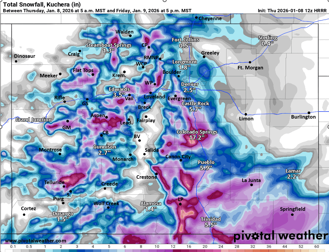
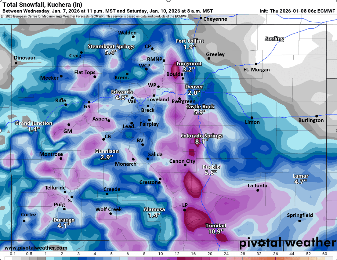
First image is my updated and final snowfall forecast map valid through 11am Fri. Second image is current composite radar over the state. Third image is current view of the foothills near Boulder. Image 4 and 5 compare forecast total snowfall from now through 5am Sat from very latest HRRR and ECMWF models, take modeled amounts with grain of salt (GFS is still showing higher amounts, I'll post in the comments, we shall see).
How are conditions in your neck of the woods this morning?

Like what you read?
Receive daily weather reports straight to your inbox with Seth's Daily Newsletter. Sign up below.