Thunderstorm details for Fri and Sat
Aug 28, 2026
8/28/26 10am: Happy Friday! Lets take a quick look at some thunderstorm details for the next couple of days.
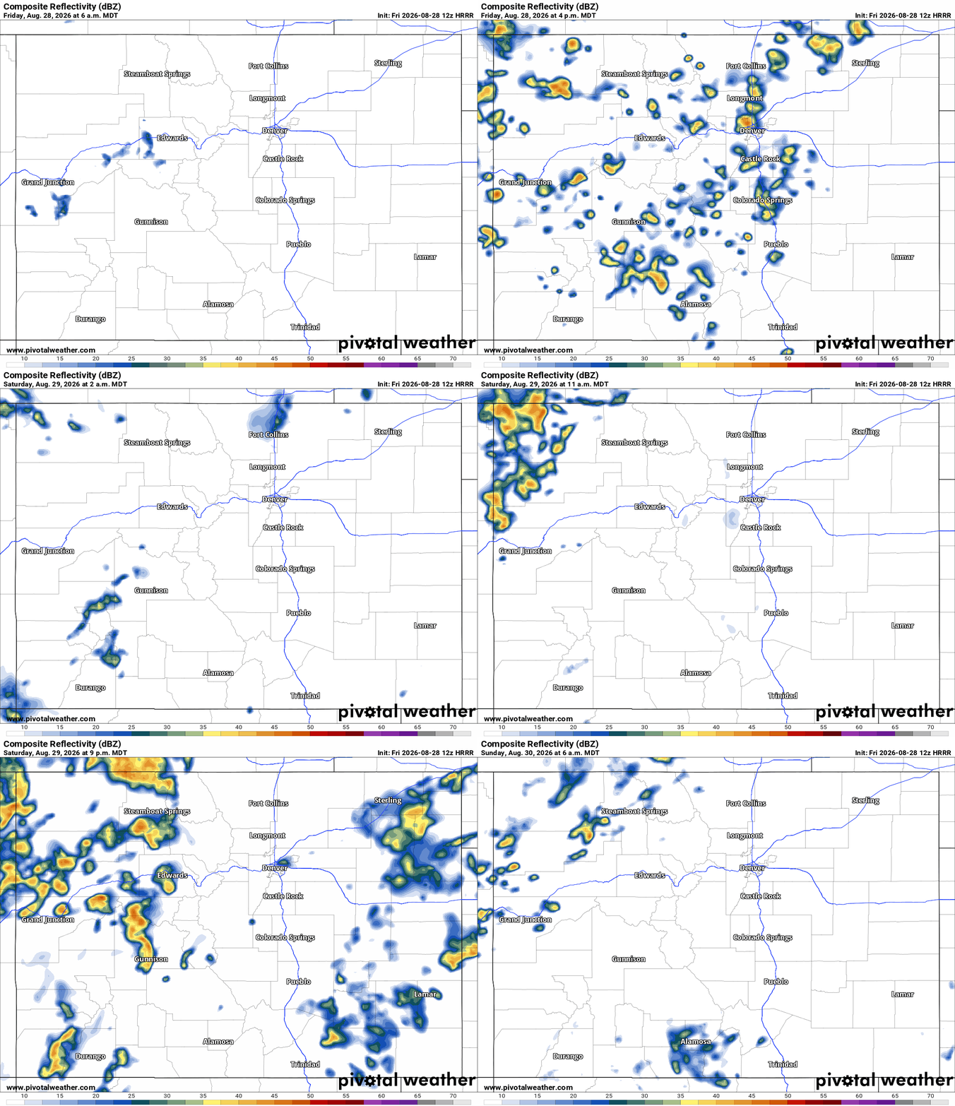
First for today, for both the north-central mountains and front-range a chance for isolated to scattered thunderstorms from 2pm-8pm.
For Den/Bou and the front-range, possibly a few stronger storms in spots between 4pm-6pm, hit or miss
Then things get more active and interesting for Sat. As I mentioned yesterday models shows a cold-front pushing into the state from west to east on Sat evening into Sun morning.
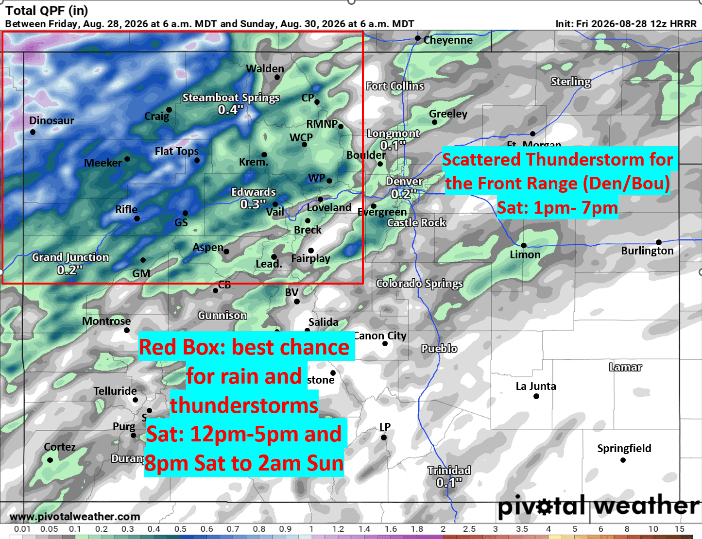
For the north-central mountains and parts of northwest CO, likely two rounds of storms on Sat: ahead of the main front some thunderstorms from 12pm-5pm. Then as the cold-front moves in another good chance for thunderstorms and rain from 8pm Sat to 2am Sun.
Heads up there could be a dusting of snow above 13k ft by Sun am across some of the high peaks!
For Den/Bou and the front-range also a better chance for some stronger storms on Sat (mostly ahead of the front) from 1pm-7pm Sat, a few stronger storms in spots.
Then as I mentioned yesterday, continued good afternoon thunderstorm chances for Sun, Mon and Tue, favoring the mountains: 1pm-10pm each day. But the front-range should get some as well.
Have a great weekend!
First image loop shows forecast radar over the next 48hrs (6am this morning to 6am Sun) from latest HRRR model. Second image shows forecast total liquid precip from now through 6am Sun from latest HRRR, take with grain of salt but shows where best chances for rain will be (in the red box, etc).

Like what you read?
Receive daily weather reports straight to your inbox with Seth's Daily Newsletter. Sign up below.
