Strong wind and high fire danger on Wed. Moisture returns to the mountains Thu-Sat.
Apr 21, 2026
04/21/26 8:15am: The weather story for the next couple days will be the strong wind and high fire danger conditions, especially on Wed:
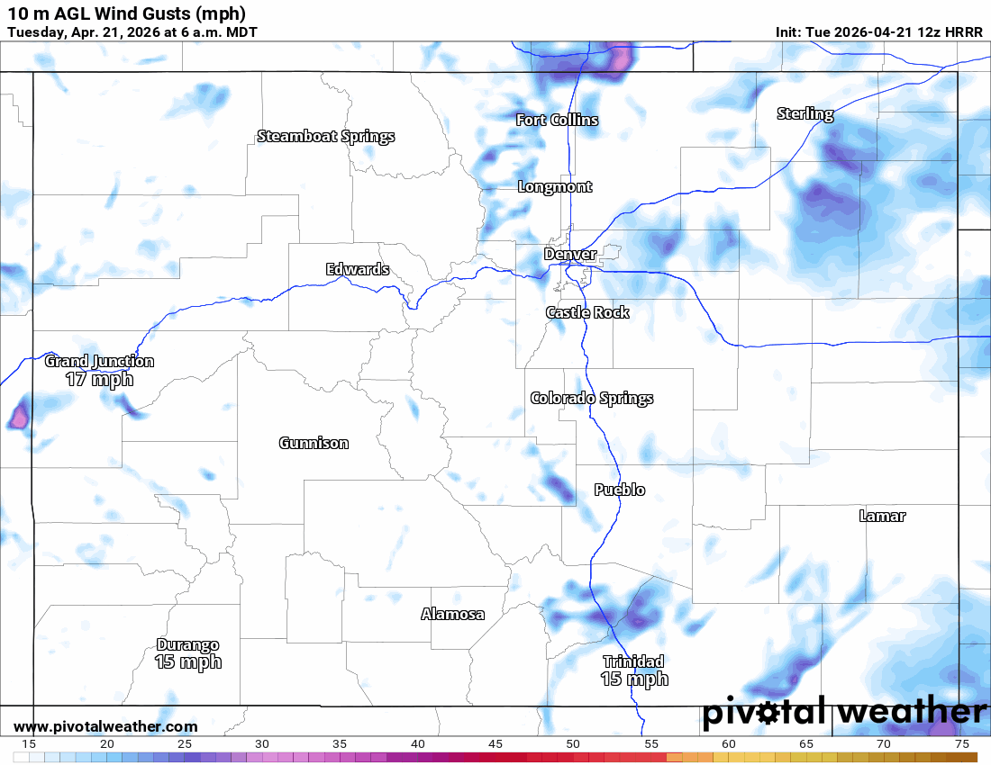
Models show strong wind, especially for the mountain and foothills (but also including the front-range: Den/Bou) between 9am tomorrow through 4am Thu, strongest winds will be 2pm-6pm on Wed: southwester wind-gusts of 30-70 mph.
Strongest in the mountains near/east of the Cont. Divide (gusts > 70 at times above 8f ft).
For Den/Bou, wind-gusts likely staying below 60 mph on Wed but still strong.
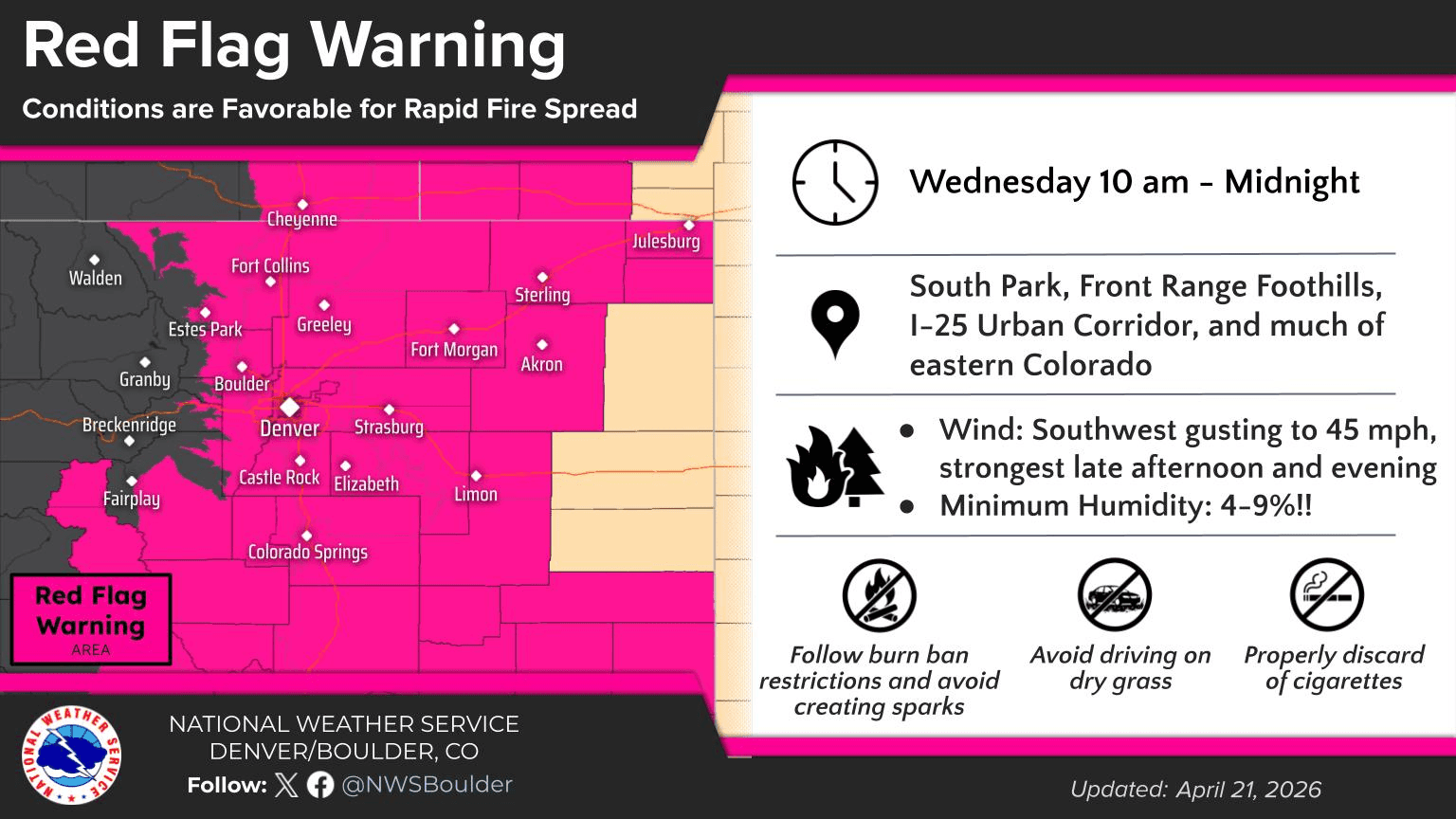
There is a Red Flag Warning in place for most of northern CO (mountains, front-range, plains) from 10am Wed to 12am Thu.
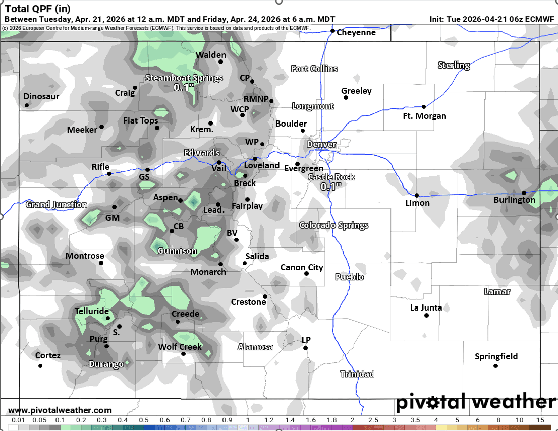
A bit of moisture returns on Wed evening into Thu afternoon. But the initial short-wave for Wed night into Thu am is looking weak.
So just a few rain/snow showers over parts of the mountains on Wed afternoon / evening. Best chances over northern CO (closer to Park Range).
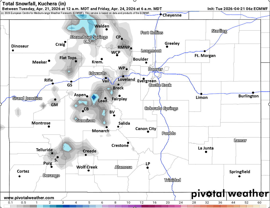
But then some rain/snow showers (snow mostly above 9k ft) move into the mountains during the day Thu, best chances from 12pm-11pm Thu. Models show a chance for 1/2" to 2" of snow in a few spots near the Cont. Divide by Fri am.
A continuation of lighter, on/off snow showers in the mountains on Fri afternoon into Sat but nothing too major.
Maybe a few sprinkles for Den/Bou on Fri afternoon and Sat afternoon.
But it appears the main, bigger storm system with more meaningful rain/snow will hold off until Sun into Mon, with biggest impacts from 12am Sun through 12pm Mon: Snow for the mountains.
Rain/snow for Den/Bou on Sun into Mon, could be all wet snow by Sun evening into Mon am but uncertainty is high.
First image loop shows forecast wind-gusts over the next 48hrs (6am this morning through 6am Thu) from latest HRRR. Second image is forecast slide from NWS, showing the Red Flag Warning. Images 3 and 4 show forecast total liquid precip and snowfall through just 6am Fri (for the Wed/Thu wave) from latest ECMWF, take amounts with grain of salt.

Like what you read?
Receive daily weather reports straight to your inbox with Seth's Daily Newsletter. Sign up below.