Strong thunderstorms for parts of eastern CO tonight. High Fire Danger in the mountains. Better rain chances return to mountains Wed-Fri
Jun 23, 2026
06/23/26 8:50am: Busy weather day on tap especially tonight into tomorrow for parts of the front-range and eastern plains as a stronger cold-front pushes in from the northeast.
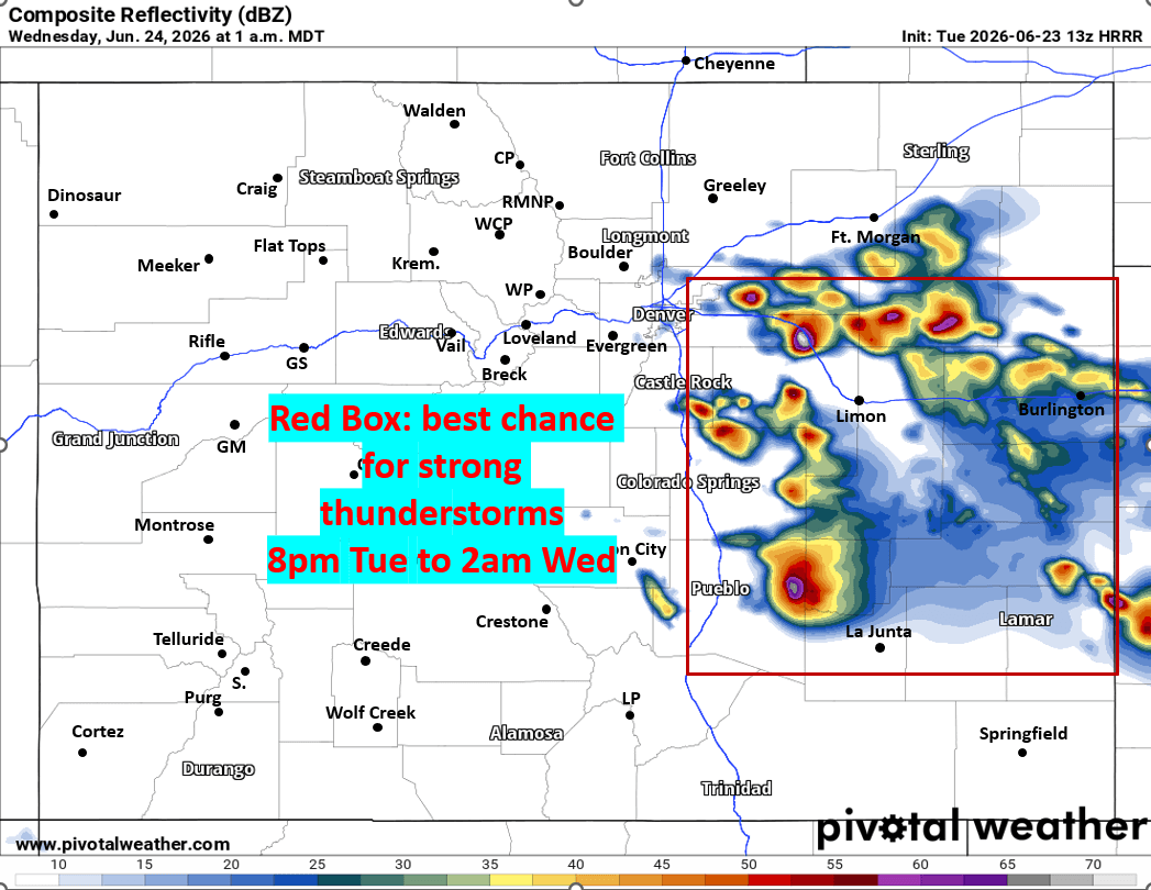
Parts of the front-range and eastern plains from Ft. Collins to Longmont to DIA to Castle Rock to Springs an east (along/east of I-25) is under a more Enhanced Risk for strong to severe thunderstorms especially in the 8pm Tue to 2am Wed timeframe. Prior to this some more isolated storms in spots.
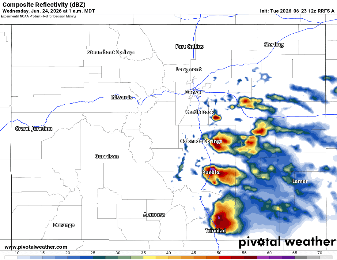
Going to be interesting to see where the heaviest storms setup tonight. Latest high-res models show the strongest thunderstorms developing just south / east of Denver (Palmer Divide to Springs to Pueblo and east). But Denver proper may get some of these strong storms, its a bit conditional on where the boundary sets up.
In the mountains west of the Cont. Divide: High Fire Danger again with a Red Flag Warning from 12pm-10pm today, westerly wind-gusts of 20-40mph, dry and fairly hot.
Better rain chances return to the mountain on Wed, especially Wed night into Thu (could be rain in the morning on Thu) and again Thu into Fri. I'll have more on that later.
First image shows forecast radar at 1am Wed from latest HRRR and I made a box around area that has best chances for strong storms. Second image is equivalent from the RRFS model. Images 3 and 4 are from Den/Bou NWS office showing the severe weather threat and high fire danger.


Like what you read?
Receive daily weather reports straight to your inbox with Seth's Daily Newsletter. Sign up below.