Some unexpected heavier snow in the mountains this morning. More cold and snow coming this week
Nov 25, 2025
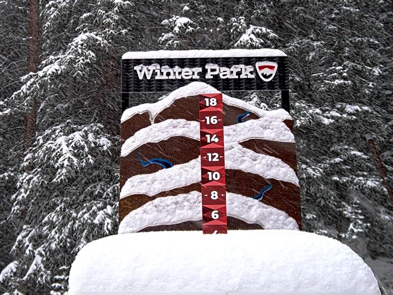
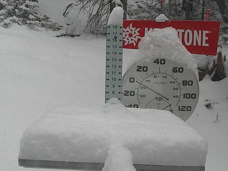
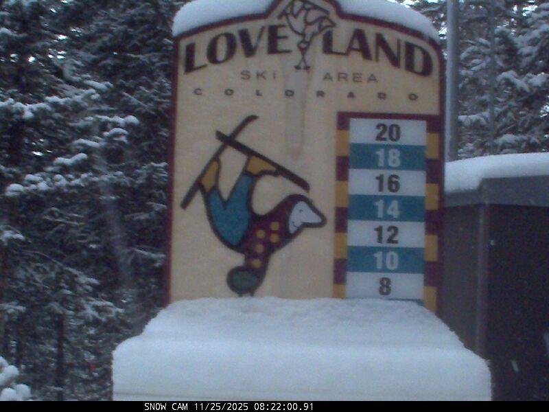
11/25/25 8:40am: Wow, great to see some higher than expected snow totals in parts of the north-central mountains this morning as the cold westerly flow moves in. I thought maybe 1-2" going into it yesterday but was not expecting 4-5" for some of the ski areas near Keystone, Loveland and Winter Park. Its finally happening, finally some cold northwest flow and an overproducing snow event.
Here are some estimated totals looking at the snow-stake cams:
Keystone: 5"
Winter Park: 4"
A-Basin: 3"
Loveland: 3"
Eldora: 2"
Breck: 1"
Vail: 1"
Copper: 1"
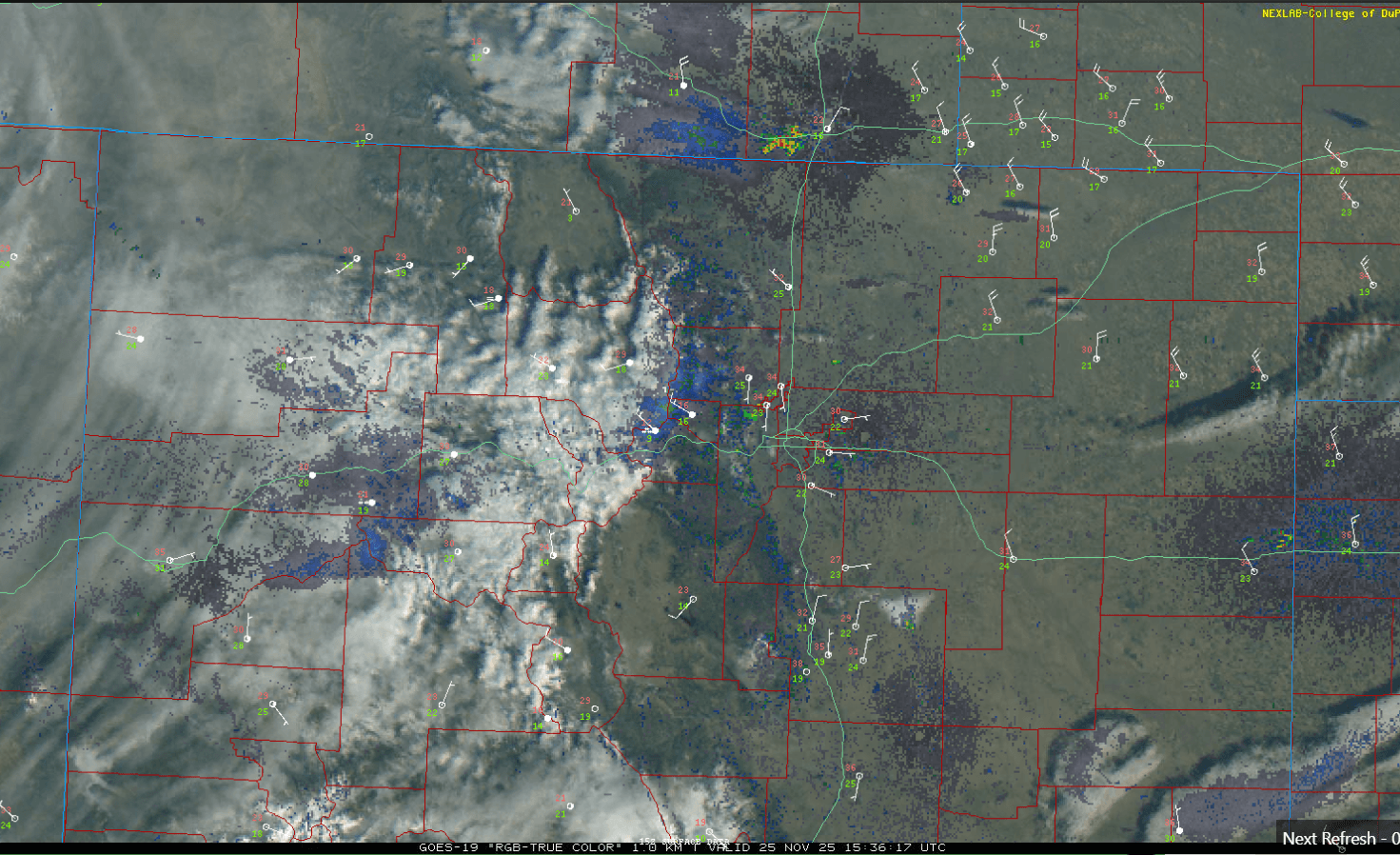
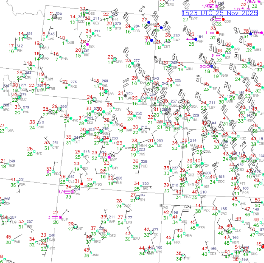
On the front-range finally, seasonable cold this morning behind the initial cold-front with temps in the 30s and some cold wind over the northeast plains (not too windy in Den/Bou but chilly and sunny).
Snow / snow-showers will continue in the mountains through 12pm, with 1-3" of additional accumulation in spots, favoring areas near the Cont. Divide (for the ski areas mentioned above).
There will also be strong wind over parts of the mountains today, especially the Front Range mountains with northwest wind-gusts of 30-60mph (strongest near the Cont. Divide).
More light snow for the north-central mountains mostly from 2pm Wed to 2am Thu, with and additional 1-4", favoring same areas: parts of Gore, upper / eastern parts of Summit Co, western ClearCreek areas near Berthoud and IPW.
Then look increasingly likely that Den/Bou will get its first snowfall of the season on Friday night into Saturday. Models show a strong, arctic cold-front moving down the front-range after 9pm Friday, with snow developing in Den/Bou after 11pm Fri, with a shot of snow from 11pm Fri through 2pm Sat (likely 1-4" for the metro areas and 3-6"+ for the foothills and PD).
More snow for the mountains as well on Fri night into Sat: additional 2-6" seems likely. Then more snow Sun into Mon.
First 3 images show current snow-stake views from Winter Park, Keystone and Loveland. Image 4 is current, local satellite/radar overlay showing the snow in the mountains. Fifth image is latest surface map showing current temps, dewpt, wind-speed and precip.

Like what you read?
Receive daily weather reports straight to your inbox with Seth's Daily Newsletter. Sign up below.