Some rain reports from Mon and look at decent thunderstorm chances for eastern CO today
Sep 8, 2026
09/08/26 8:15am: Morning, its Tuesday lol. Some rain reports first, then a look at the thunderstorm chances for the front-range and eastern plain today.
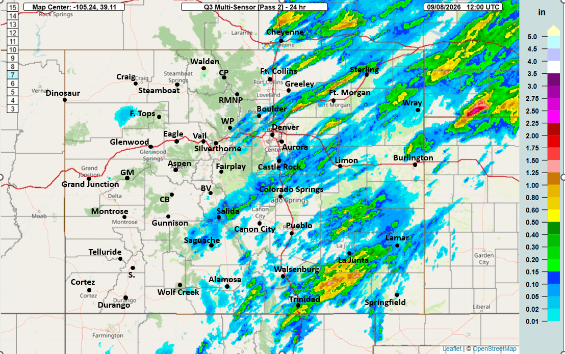
Good to see some rain in spots across the metro area yesterday, mostly closer to Broomfield, Westminster and Boulder locally under some bands of storms yesterday evening. At my house I measured 0.07" (from 3 different showers).
Also some heavier rain of > 0.50" across southeast CO yesterday.
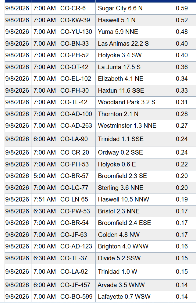
Here are some notable 24hr rain reports from CoCoRaHS:
Haswell 5.1 N: 0.52"
Yuma 5.9 NNE: 0.48"
La Junta 17.5 S: 0.36"
Trinidad 1.1 SSE: 0.24"
Sterling 3.6 NNE: 0.20"
Elizabeth 4.1 NE: 0.34"
Woodland Park 3.2 S: 0.31"
Thornton 2.1 N: 0.28"
Westminster 1.3 NNE: 0.27"
Broomfield 2.3 SE: 0.20"
Golden 4.8 NW: 0.17"
Boulder 1.7 N: 0.09"
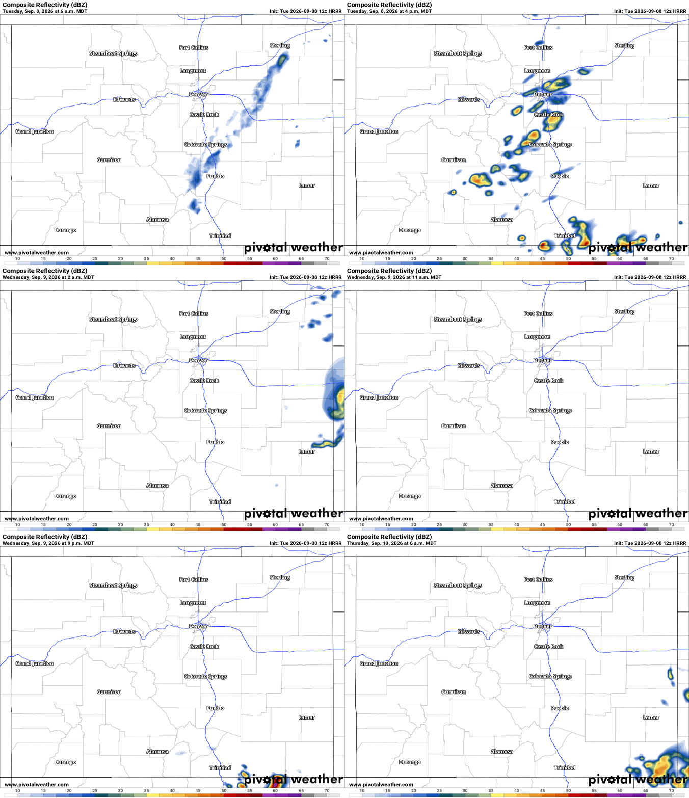
Anyway for today another decent chance for some thunderstorms for the front-range (Den/Bou area) and eastern plains from 2pm-8pm today
Best chances today will be from Denver south and east, near/along the Palmer Divide and over parts of the eastern plains after 3pm. Also closer to Springs and Pueblo. There could be some stronger storms in spots.
In the mountains today, most of the thunderstorm action will be confined to areas further east: East of a line from Evergreen to Bailey to Fairplay to BV/Salida to Monarch east....towards parts of the southeast plains. 2pm-9pm.
Looking ahead, back to mostly dry weather over the state from Wed-Fri
Aside from a few storms over extreme southeast CO on Wed night into early Thu am.
Thunderstorm chances return to the mountains by Saturday.
First image shows 24hr observed rainfall from MRMS. Second image shows top 24hr reports from CoCoRaHS. Third image shows forecast radar over the next 48hrs (6am this morning through 6am Thu) from latest HRRR model.

Like what you read?
Receive daily weather reports straight to your inbox with Seth's Daily Newsletter. Sign up below.
