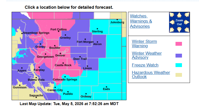
Some initial rain and snow reports as the storm ramps up this morning. Winter Storm Warning for Den/Bou tonight
May 5, 2026
05/05/26 8am: LFG! Stoked on the snow and rain! I have snow flying at my house right now as latest radar shows the storm really taking shape over northern CO with rain changing to snow along the northern front-range (from north to south) as we speak.
Already some snow accumulation for lower elevations and last night a bunch of snow in parts of the mountains on the front-end of the storm (you may have seen my post about it late last night in the group).
At my house I have already measured 0.24" of rain / melted snow! And we are just getting started.
Forecast is certainly on track as Den/Bou and all of the front-range urban corridor is under a Winter Storm Warning from 8pm this evening through 3pm tomorrow afternoon.
Lets take a look at some notable rain and snow totals this morning (just the very beginning of the storm).
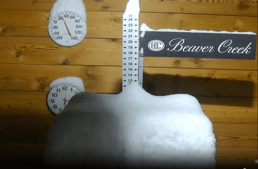
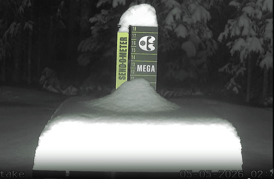
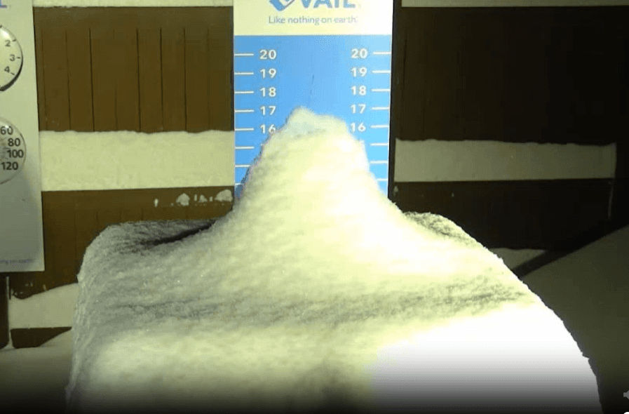
Some estimated snow-totals from the ski area snow-stake cams this morning:
Beaver Creek: 9”
Vail: 9”
Copper: 6”
Loveland: 4”
A-Basin: 4”
Winter Park: 2”
Here are some town snow-totals from CoCoRaHS (reported by 7/8am):
Estes Park 1.8 S 5.7
Loveland 12.4 WSW 4.4
Lyons 8.9 WNW 4.0
Livermore 20.3 NW 3.5
Allenspark 2.3 N 3.0
Estes Park 10.5 SE 3.0
Four Corners 3.0 SSE 3.0
Drake 4.3 WSW 2.5
Horsetooth Mountain 3.2 NNW 2.0
Vail 0.9 WNW 1.2
Golden 12.5 NW 1.1
Jamestown 2.5 SSE 1.1
Lyons 1.8 N 1.0
Red Feather Lakes 3.8 ENE 1.0
Nederland 3.7 ENE 0.9
Rollinsville 1.1 SSW 0.8
Pinecliffe 2.5 WNW 0.6
Lyons 5.9 NW 0.5
Loveland 2.7 E 0.5
Berthoud 4.4 WSW 0.5
Lyons 0.3 NNE 0.3
Fort Collins 3.0 WNW 0.3
Here are some notable rain / liquid totals from CoCoRaHS:
Vail 0.9 WNW 0.96
Drake 4.3 WSW 0.93
Carbondale 5.9 ENE 0.80
El Jebel 0.8 W 0.79
Edwards 0.5 E 0.70
Horsetooth Mountain 3.2 NNW 0.65
Estes Park 1.7 SW 0.63
Lyons 8.9 WNW 0.62
Jamestown 2.5 SSE 0.62
Erie 1.7 WNW 0.60
Loveland 2.7 E 0.59
Fort Collins 0.9 N 0.55
Loveland 3.0 NNE 0.52
Milliken 1.3 WSW 0.51
Boulder 1.8 NW 0.51
Gypsum 1.0 SW 0.51
Greeley 2.4 WSW 0.51
Erie 1.5 NNE 0.51
Niwot 2.3 W 0.50
Longmont 3.3 SW 0.50
Rifle 8.9 NE 0.50
Denver 0.2 NNW (Botanic G.) 0.30
Wheat Ridge 2.2 ESE 0.26
Westminster 1.1 SW (my house) 0.24
That is all for now, I'll have much more later. Stoked the storm is on track. Going to be a doozy tonight.
How much rain or snow at your house so far?
First image is latest KFTG (Denver) radar showing the rain changing to snow now. Second image shows the Winter Storm Warning for Den/Bou and the foothills. Images 2-5 are early morning snow-stake views for Beaver Creek, Copper and Vail.

Like what you read?
Receive daily weather reports straight to your inbox with Seth's Daily Newsletter. Sign up below.