Some impressive rain and snow total since the end of March
May 24, 2026
05/24/26 11am Hi, I hope you are having a great Memorial Day weekend and enjoying the nice weather! After all the recent rain and snow lately thought it would be a good time to look at some of the much need precip total since March 24th (the end of the really hot and dry spell).
Although we are still in drought and the snowpack is low we have picked up some much need precip in the last 40 days and its helped turn things around a bit (in terms of drough and just water in the ground).
Here are some take away numbers I put together and also from some other meteorologists on Facebook:
Impressive to see 2-5" of additional liquid precip along the front-range since the end of March!
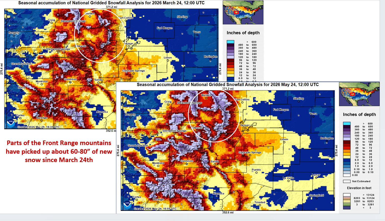
More importantly: Upper Parts of the Front Range Mountains (from near Loveland ski areas to Jones/Berthoud Passes, near Winter Park, IPW, RMNP, Cameron Pass areas) have picked up a whopping 60-80” of new snow since March 24th!
Part of the front-range foothills also picked up 30-50" of new snow since March 24th as well!
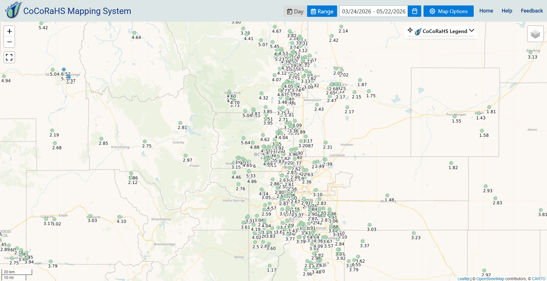
Here are some notable rain / liquid totals since March 24th:
Ward 4.6 NE 5.64”
Bellvue 8.1 WNW (west of Ft. Collins) 5.07”
Boulder 3.0 SSW: 4.69”
Estes Park 1.7 WNW 4.60”
Fort Collins 1.1 WNW 4.19”
Vail 0.9 WNW 4.10
Longmont 3.0 SW: 4.04”
Kittredge 2.5 SSE (Evergreen) 4.04”
Highlands Ranch 0.6 SSE 3.17”
Denver 6.1 WSW (Lakewood) 3.15”
Tabernash 2.7 NW 2.97"
Denver 1.3 NE 2.91”
Broomfield 1.2 NE 2.87”
Aurora 3.3 S 2.87"
Here are some facts about the precip lately:
At my house I went from only 2.12” of liquid precip on 04/17 to 4.19” by 05/20. My seasonal snowfall total since Oct 1st is now 31.9” of snow....which is still barely the lowest seasonal total I have measured in the last 20 years (previous lowest was 32.3 in 2011), but better than being at the very bottom.
From Bouldercast Weather: As of May 22nd, Boulder has picked up 3.53” of rain (May 5th to 21st, which was more than the previous 7 months combined: 3.23”!
From Meteorologist Chris Bianchi: As of May 19th, Fort Collins has more precip in the last two weeks (3.42”) than the previous 7+ months combined (2.31”). Downtown Denver's picked up more precip in the last 13 days (1.48") than the last 151 days combined (1.43", Dec. 4th to May 4)!
How much rain and snow did you get in the last 40 days?
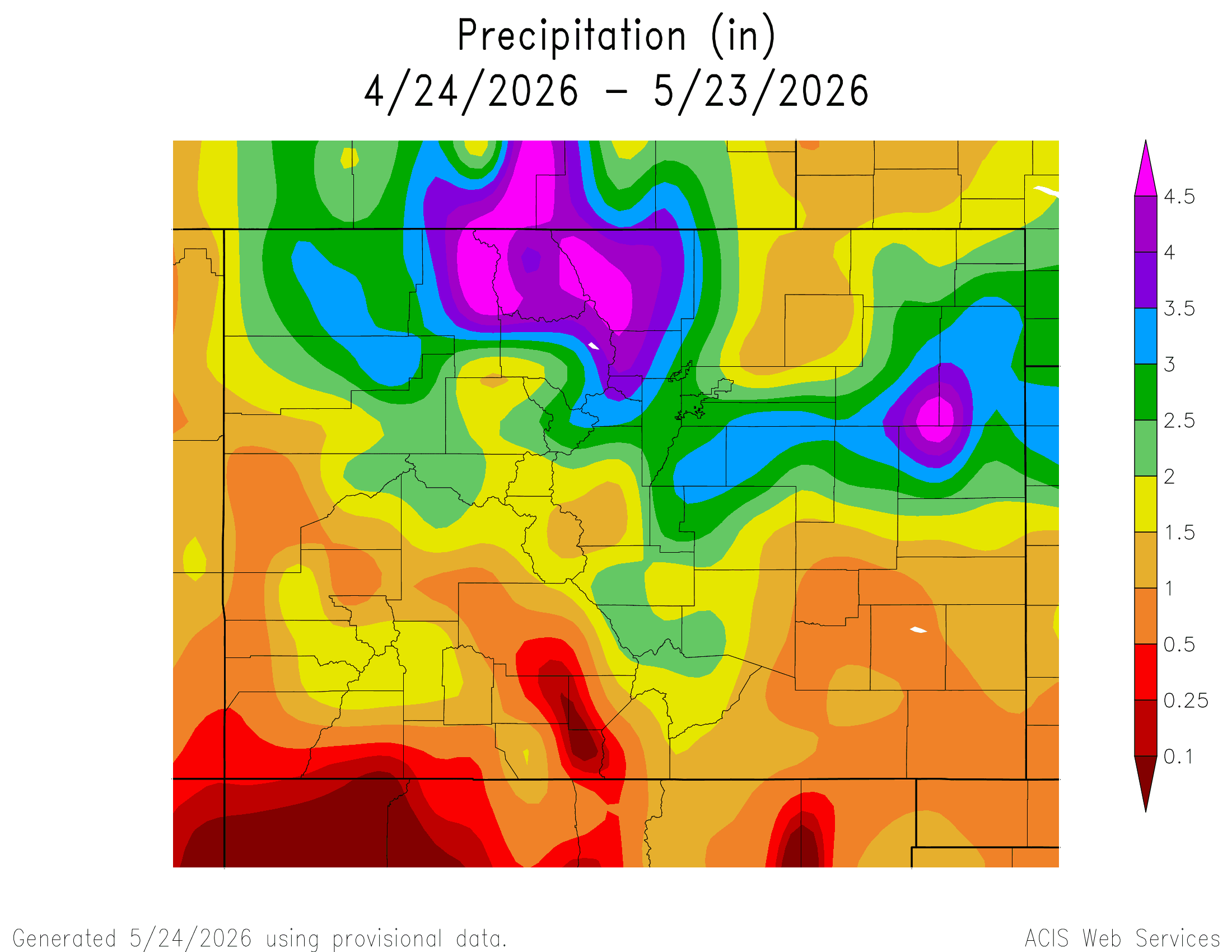
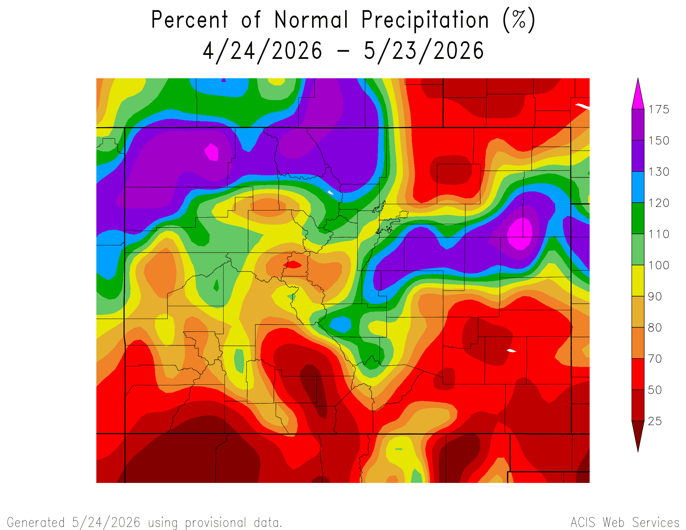
First image below shows total liquid precip since April 24th from ACIS. Second image is Percent Normal Precip since April 24th. Image 3 shows the change in total snowfall since March 24th via NOHRSC. Image 4 shows reported liquid total since March 24th from CoCoRaHS.

Like what you read?
Receive daily weather reports straight to your inbox with Seth's Daily Newsletter. Sign up below.