Some healthy snow-totals from this last storm system.
Dec 1, 2025
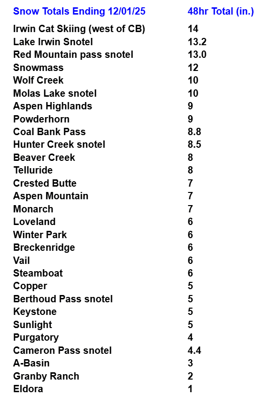
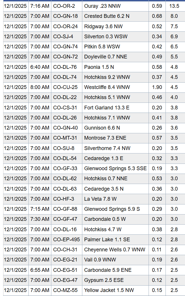
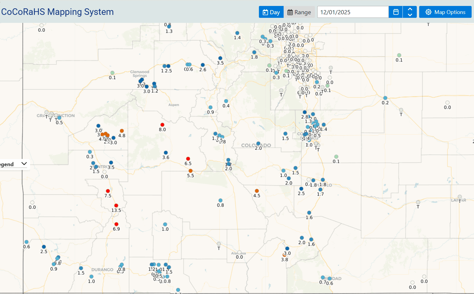
12/01/25 8:20am: Happy first day of meteorological winter! Great to see the snow come through in the mountains with some heavy totals in spots! Overall I'm pleased with the forecast given the uncertainty. First image below shows 48-hr totals from the ski areas and SNOTEL sites (via CAIC). Second image shows top town snow reports from CoCoRaHS.
Great to see see the expected 8-14" for much of the Elks and San Juans. With 5-10" for much of the rest of the north-central mountains and local ski areas (Good to see 6" at Winter Park since yesterday for example).
In terms of town snow totals. Ouray (north of Silverton) picked up a whopping 13.5" of new snow. Also some heavier snow of 4-8" near Hotchkiss, Paonia, Montrose and the Gunnison area. For areas near towns of Vail to Frisco To Silverthorne: 2-5" generally.
On the front-range, parts of Springs picked up 1.5" to 2.5" (closer t Woodland Park).
And here in the donut hole, nothing for most of Denver/Boulder (no snow here at my house in Westminster).
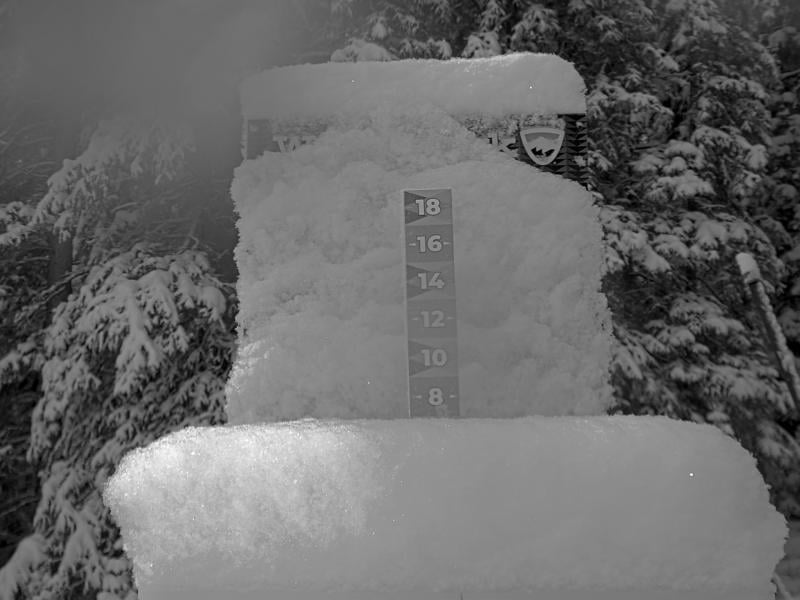
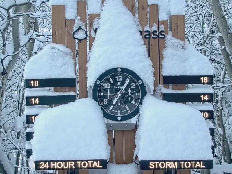
I have also included latest snow-stake views from Winter Park, Snowmass, Irwin Cat Skiing, Powderhorn, Telluride and Vail. Image 5 shows a map of 24hr CoCoRaHS reports.
How much snow did you get?

Like what you read?
Receive daily weather reports straight to your inbox with Seth's Daily Newsletter. Sign up below.