Some forecast details for the Thu/Fri storm
Dec 29, 2025
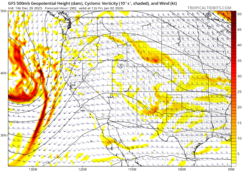
12/29/25 8:25pm: Lets take a quick look at the next storm system. Models show a disorganized short-wave trough / decaying upper-level low moving into CO from the southwest on Thu into Fri. Its a fairly warm system overall and the setup doesn't get me that excited (at least for the heart of the north-central mountains, I-70 corridor). On the other hand, could be a decent snow-event for parts of western and southwestern CO (mostly above 9k ft).
Snow moves back into the San Juans by 5am Thu.
Light snow-showers will move into the north-central mountains after 11am Thu
Most of the accumulating snow will be from 11am Thu to 5pm Fri, heaviest snow Fri morning
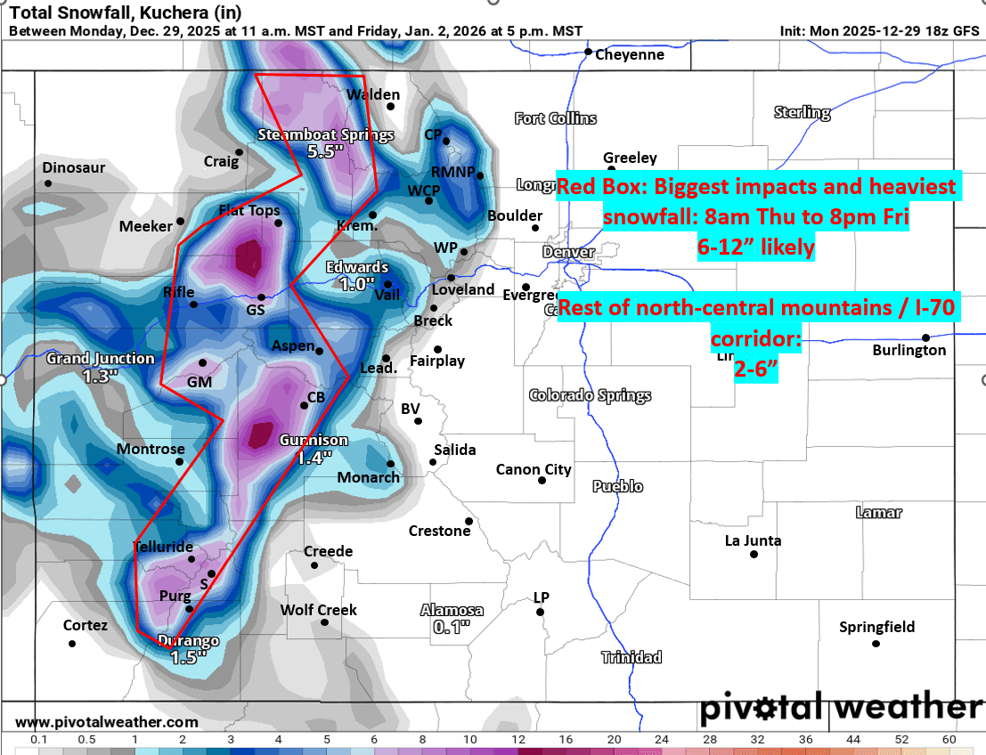
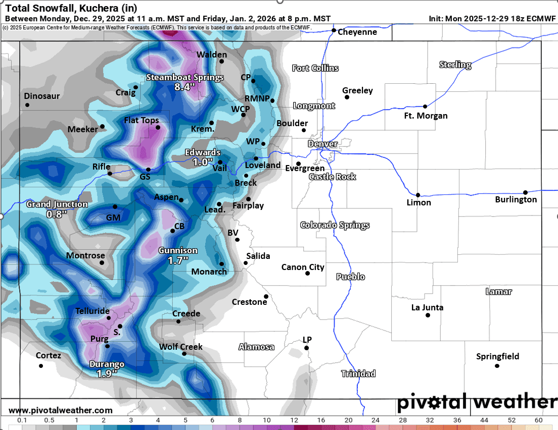
Areas like Park Range (near Steamboat), Flat Tops, Grand Mesa, Elk Range (Aspen/CB) and Western San Juans (Telluride, Silverton, etc) will be favored for 6-12" of new snow
Rest of the north-central mountains (Vail, Summit, ClearCreek, Grand, etc), I-70 mountain corridor can expect 2-6" favoring areas west of Vail Pass
Most of the snow in the mountains will be above 9k ft (warmer storm)
For Den/Bou and the front-range likely minimal impacts (westerly flow and moisture is too far west), but maybe a few rain showers as the trough moves through late Thu night into Fri morning (12am-12pm Fri will be best chances), likely not much and will remain warm
Winds don't look to be too strong with this storm system. Some stronger wind over the Front Range mountain (along/east of the Cont. Divide) on Fri during the day: westerly wind-gusts of 30-50 mph (less wind west of the Tunnels)
Looking ahead, I am seeing signs of a more active and colder pattern for the western U.S. around Jan 10th-17th, fingers crossed.
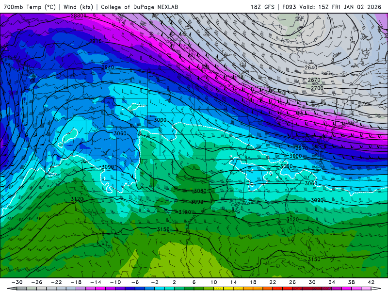
First two images show forecast total snowfall from now through 5pm Fri from latest GFS and ECMWF models. Third image shows the disorganized wave on Fri morning via 500mb vorticity/wind from GFS and third image shows 700mb temps Fri am, showing the relatively warm air aloft (you can see the colder air over the eastern U.S.).

Like what you read?
Receive daily weather reports straight to your inbox with Seth's Daily Newsletter. Sign up below.