Some forecast details for the Fri to Sun storm: looking like a potent winter storm for the mountains
Jan 21, 2026
01/21/26 8:15am: I'm getting excited, its looking like a potent winter storm for the mountains this weekend with heavy snow there, and very cold, arctic air with light to moderate snow for the front-range (Den/Bou).
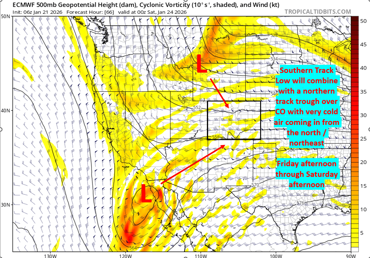
Forecast is on track as models show a southern track upper-level low combining with a northern track trough that will bring in a bunch of cold-air and moisture, these features will combine over CO and bring some heavy snow in spots, especially over southwest CO.
Timing: 8am Fri to 8pm Sat initially. Then more snow likely for the mountains from 2am-2pm Sun.
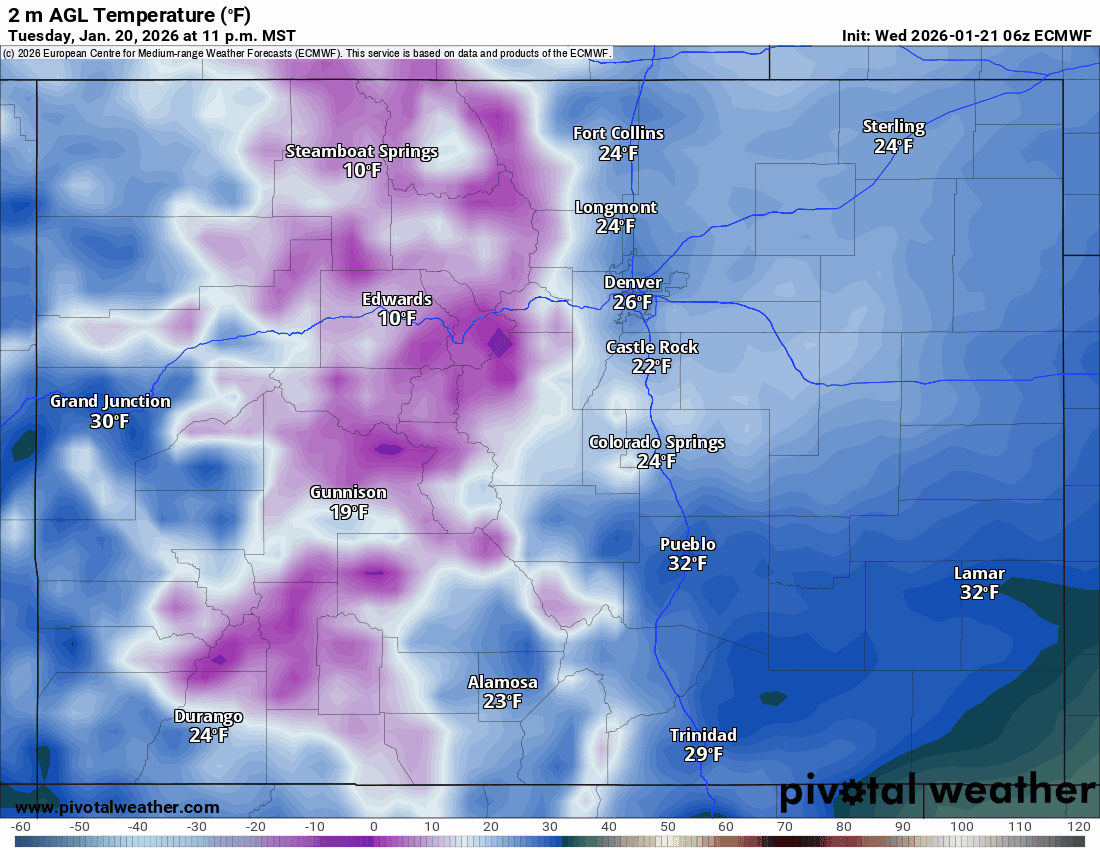
As I mentioned yesterday going to be turning very cold across the region on Friday, Saturday and Sunday. Coldest air Sat into Sun.....looks like a classic arctic air mass, with high temps only around 10-15 degs for Den/Bou on Sat and likely colder in the mountains (with high temps between 5-10 degs). Low well below zero expected on Sun morning for both mountains and plains.
Much colder air will move into the front-range after 9pm Thu and especially by Fri morning with some light snow developing along the front-range (Den/Bou) by Fri morning.
Snow moves into southwest CO (San Juans) by 2am Fri and will spread across the rest of the mountains by 8am Fri. Snow will get going in earnest Fri evening.
I'm slowly working on my snowfall map, which I'll put out tonight or tomorrow.
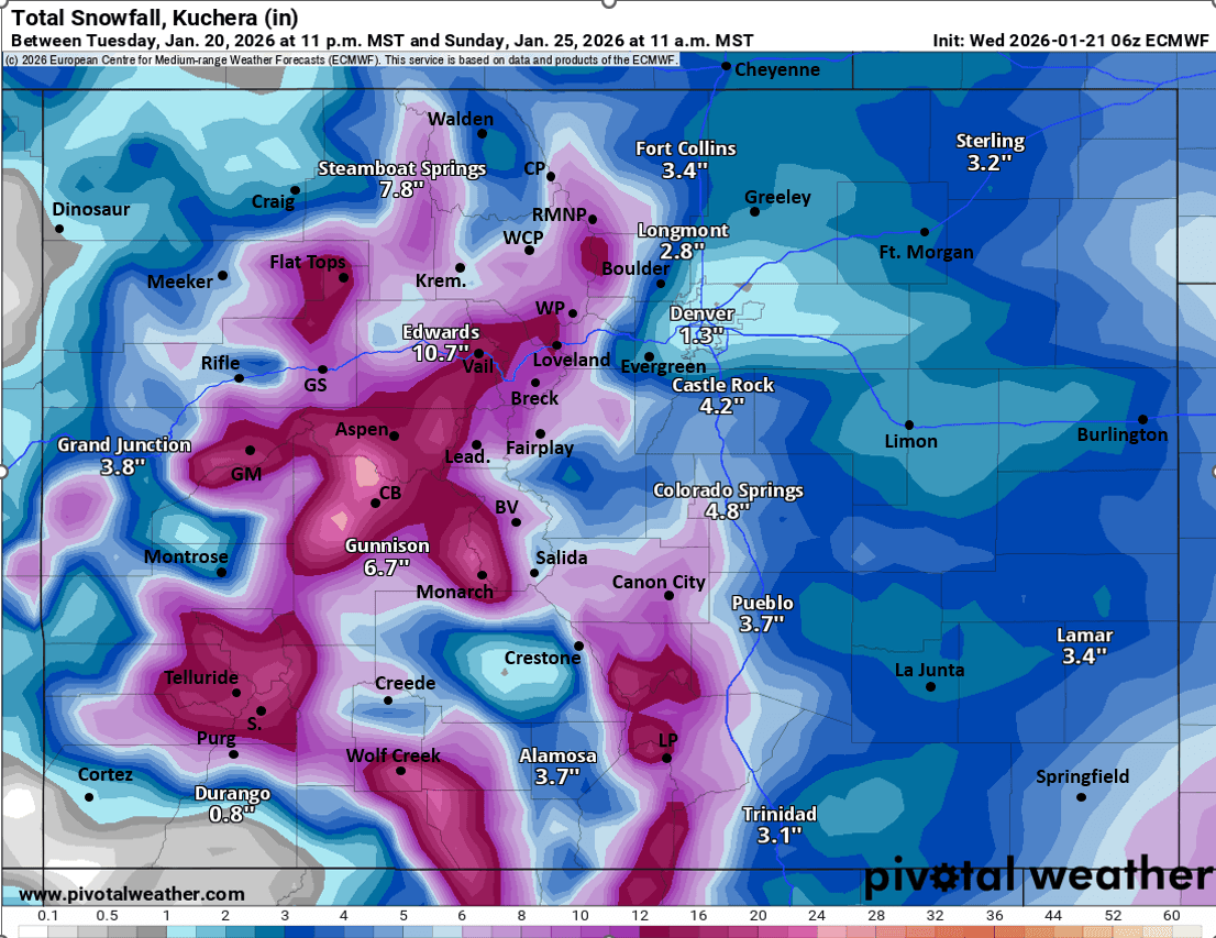
Here are some preliminary forecast totals through Sun morning (there could be even more than this by Sun evening)
Front Range areas:
Denver, Aurora, Erie, DIA, areas along/east of I-25: 1-4"
Boulder, Golden, Littleton, areas along/west of I-25, western and southern suburbs: 2-5"
Ft. Collins, Longmont, Loveland, Greeley: 1-5"
Foothills and Palmer Divide: 3-8"
Colorado Springs area: 3-8"
Pueblo and southeast CO: 2-5"
Mountain areas
Front Range mountains, including Winter Park, Loveland ski area, Berthoud Pass, IPW, RMNP: 6-12"
Cameron Pass area: 5-10"
Summit ski areas (Copper, Breck, Keystone, A-Basin, etc): 7-13"
Vail, Beaver Creek, Gore Range: 8-14"
Steamboat, Flat Tops, Park Range: 5-10"
Monarch, Collegiate Range: 9-15"
Aspen ski areas: 10-16"
Crested Butte / Irwin areas: 12-18"
Grand Mesa area: 8-14"
Western San Juans including Telluride ski area, Silverton, Purgatory: 8-14"
Eastern San Juans including Wolf Creek: 12-18"
northern mountain valley (Silverthorne, Fraser, town of Vail, etc): 3-8"
southern Valleys (South Park to SLV): 1-6"
That is all for now. Later we will look at the big impacts coming to parts of the southeast and eastern / mid-Atlantic region over the weekend with a major snow-storm and ice-storm in the forecast for parts of the southeast.
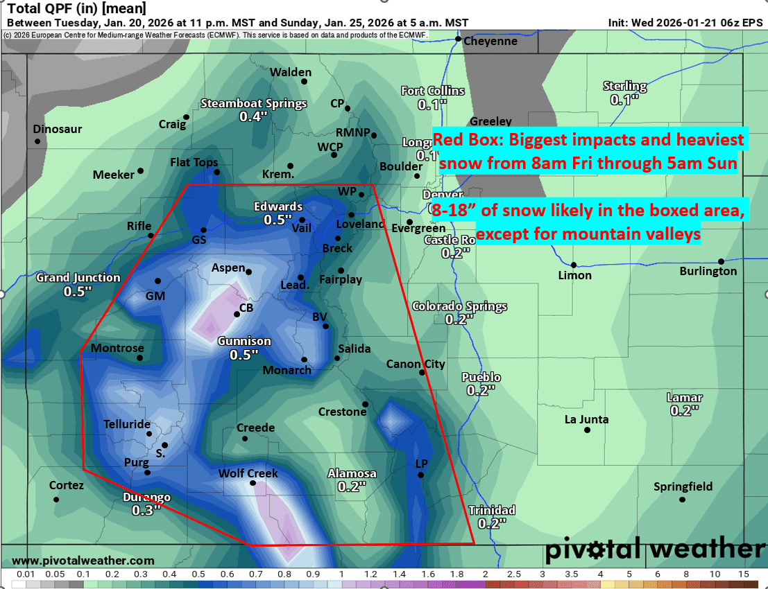
First image shows the upper-level setup via forecast 500mb vorticity and wind valid 5pm Fri from latest ECMWF. Second image shows biggest impacts via forecast total liquid precipitation from now through 5am Sun from latest ECMWF-Ensemble (EPS). Third image shows forecast total snowfall from now through 5am Sun from latest ECMWF model. Fourth image loop shows forecast temperatures over the next 5 days, including the very cold air over the weekend from latest ECMWF. I'll post GFS snowfall in the comments.

Like what you read?
Receive daily weather reports straight to your inbox with Seth's Daily Newsletter. Sign up below.