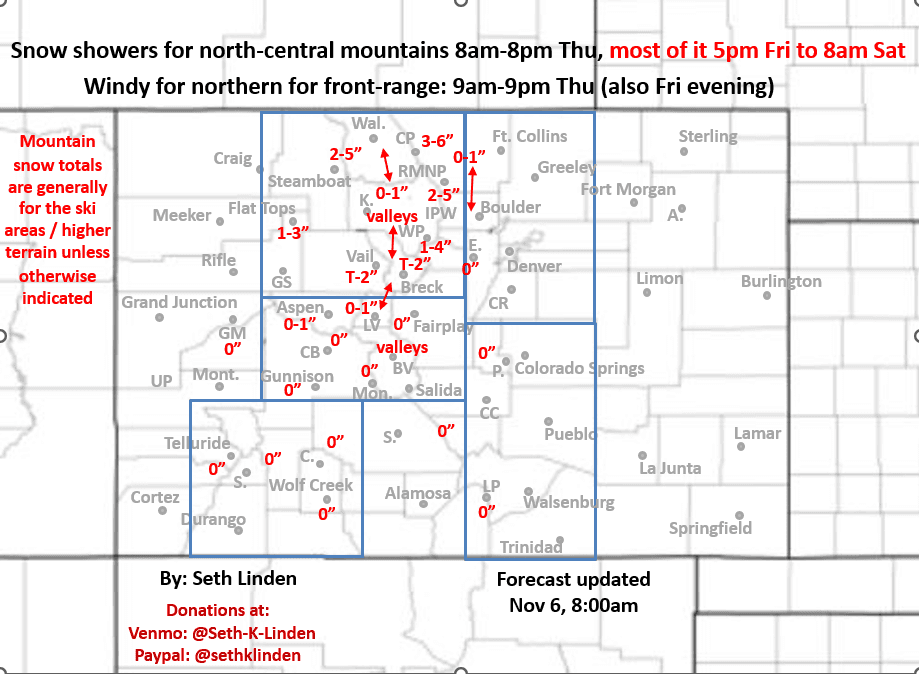
Snowfall map through Sat am (two waves of snow for northern mountains). Windy on the front-range
Nov 6, 2025
1/06/25 8:30am: Morning, I made a little snowfall map for the approaching storm system, really two different short-waves: one weak wave today and another wave tomorrow night into Sat morning that will just bring some light snow to the northern mountains and some wind to the front-range (and mountains).
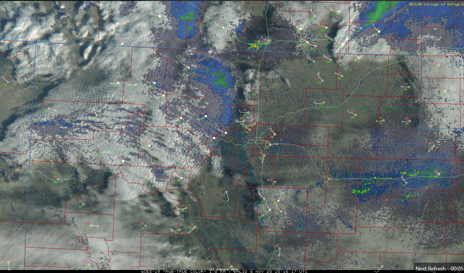
Latest satellite/radar overlay (image 2) shows some snow-showers already moving into the northern mountains closer to Cameron Pass and RMNP now. Also some strong wind already developing in the front-range foothills and western urban corridor (getting windy at my house).
For the north-central mountains including Routt, Eagle, Summit, ClearCreek, Grand, Gilpin, western Boulder/Larimer counties:
Some snow showers today mostly from 8am-8pm (already ongoing)
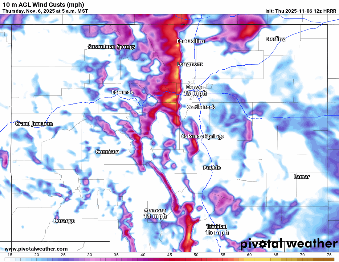
Windy over the Front Range mountains with northwest wind gusts of 40-60mph
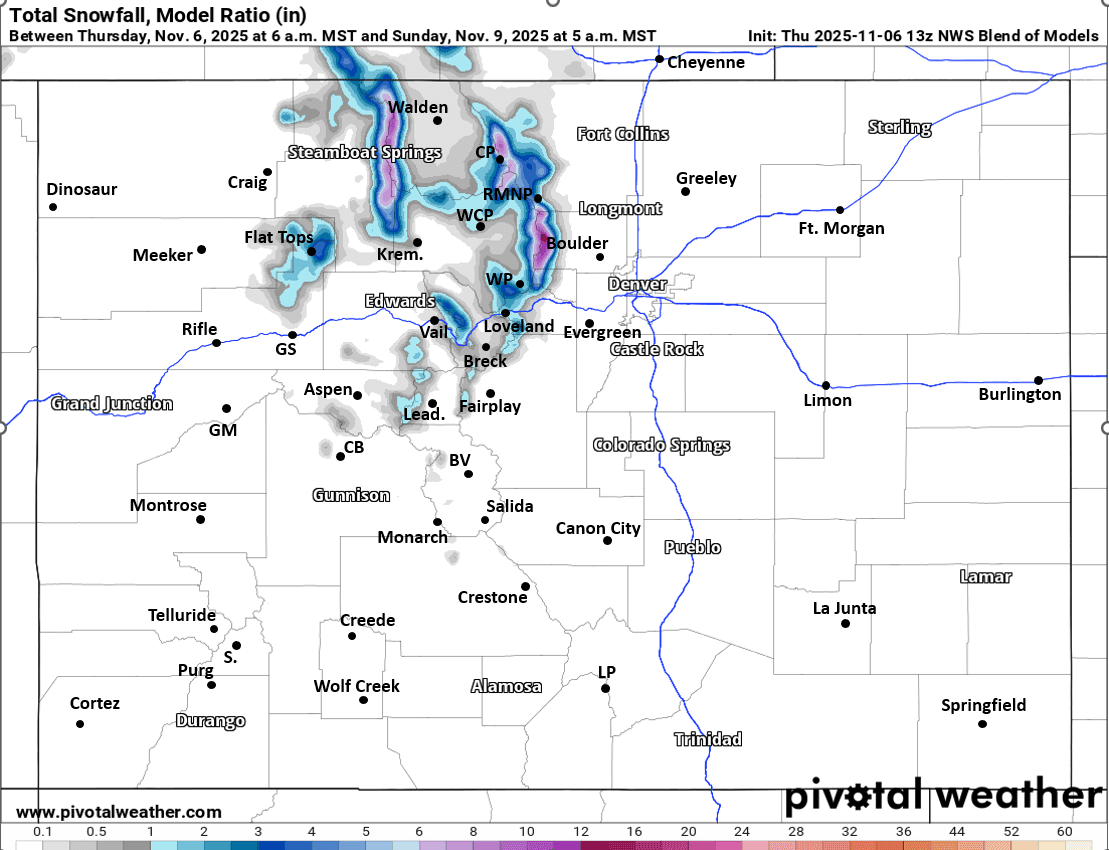
Then a better chance for light snow from 5pm Fri to 8am Sat (a few snow shower may linger in spots through 11am Sat): Generally Trace-4" of snow for some of the ski areas, favoring areas closer to Berthoud Pass, WP, IPW, RMNP and Cameron Pass (secondarily the Park Range)
Also windy Fri night into Sat mid-day with northwest wind-gusts of 20-50mph, strongest along/east of the Cont. Divide (Front Range mountains)
For Den/Bou and the front-range
Windy today from 9am-9pm, west / northwest wind-gusts of 20-50mph
No precip expected due to the westerly downslope flow
Then windy again on Fri night into Sat am ahead of a cold-front
A dry cold-front will move into the front-range on Sat, dropping temps into the 50s, breezy on Sat...
Then even colder air moves in by Sat night into Sun am (but will remain dry). Sun high temps maybe only in the upper 40s for Den/Bou and the urban corridor
Only the slightest chance for a snow-shower in the northern foothills mostly Fri night into Sat am (otherwise dry)
That is all for now. First image is my preliminary snowfall map through Sat mid-morning. Second image is current, local satellite/radar/surface overlay. Image 3 shows forecast wind-gusts over the next 48hrs (5am this morning to 5am Sat) from latest HRRR. Fourth image is forecast total snowfall from now through 5am Sun from latest NWS Blend of Models, take amounts with grain of salt.

Like what you read?
Receive daily weather reports straight to your inbox with Seth's Daily Newsletter. Sign up below.