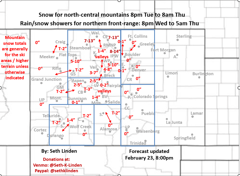
Snowfall map for the Tue pm to Thu am storm system
Feb 23, 2026
02/23/26 8:30pm: Alright, snowfall map for the Tue night to Thu am storm and a heads up about two active weather days: very strong wind expected tomorrow across the mountains and parts of the front-range and then some decent snowfall for the north-central mountains from Tue night to Thu am.
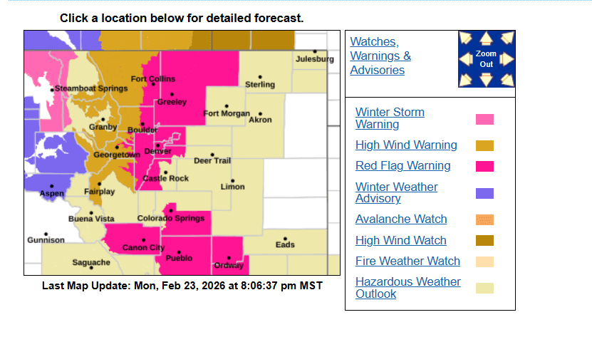
Another very active hazard map for parts of CO this evening (image 2 below).
Most of the north-central mountains and under a High Wind Warning from 8am-6pm Tue: westerly wind-gust of 60-80 mph, strongest near/east of the Cont Divide and over the Front Range mountains and foothills above 8k ft.
The north-central mountains including Pitkin, Eagle, Summit, Grand, Clear Creek counties, local ski areas and the I-70 mountain corridor are also under a Winter Weather Advisory from 8pm Tue to 12am Thu: generally 4-10" of new snow favoring areas from Summit Co east and near the Cont. Divide (near A-Basin to Loveland to Berthoud Pass to WP).
The Park Range including Steamboat ski area, Rabbit Ears Pass, Buff Pass, etc is under a Winter Storm Warning from 6pm Tue to 9pm Wed. Areas near northern IPW, RMNP and Cameron Pass should be included in that warning but just an advisories for now, regardless these favored areas can expect 7-15" of new snow (remember this is for the ski areas and higher terrain, less for the valleys), refer to map.
Much of the CO front-range including: Den/Bou, Ft.Collins, foothills, Colorado Springs, Pueblo to Trinidad is under a Red Flag Warning from 10am-5pm tomorrow: westerly wind-gusts of 30-60 mph, strongest from Ft. Collin to WY border (locally). Low RH and hot temps: High temps of 70-75 tomorrow for Den/Bou area with the chinook winds. No burning.
Strong wind will continue in the mountains on Wed as the short-wave and cold-front move through (cold front moves through between 2pm-11pm Wed). Strong winds expected from 10am Wed through 2am Thu: north to northwest wind-gusts of 30-60 mph, strongest above 10k ft.
The storm clears out after 8am Thu. Then a big warm up / dry out again from Thu afternoon through Sun.
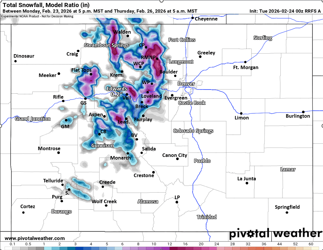
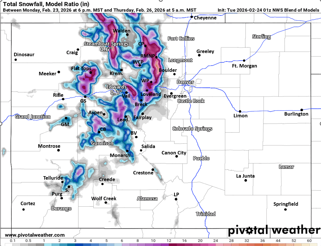
First image is my total snowfall map through 8am Thu. Image 2 shows all the current advisories from NWS. Images 3 and 4 compare forecast total snowfall from now through 8am Thu from latest RRFS model and NWS Blend of Models, take modeled snow amounts with a grain of salt, it just shows where the heaviest totals are possible (refer to my map for expected amounts).

Like what you read?
Receive daily weather reports straight to your inbox with Seth's Daily Newsletter. Sign up below.