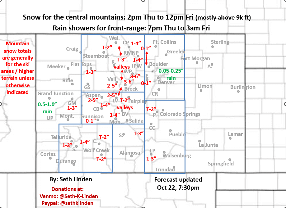
Snowfall map for the Thu/Fri storm valid through 6pm Fri
Oct 22, 2025
0/22/25 8:15pm: Snowfall map time!... But the confidence in this one is not high at all lol! I don't think I can remember a storm where the models differ so wildly in terms of precip, snowfall and where the bullseye will be. Even at this hour all over the place, hard to make sense really. The main issue is that they are unclear on the exact track of this meandering upper-level low and the low starts to fall apart Thu night into Fri as it moves through (and they can't resolve the strength and where the better lift will be).
I'll let the map mostly speak for itself but realize there may be some areas where I indicated snow that don't get any at all and other areas where the total will be well above the range.
Bottom line: biggest impacts from 12pm Thu to 12pm Fri with precip lingering in spots through 6pm Fri.
Overall biggest impacts in terms of slick roads in the mountains (Berthoud Pass, Eisenhower Tunnels, Vail Pass, Hoosier Pass, etc) will be from 6pm Thu to 6am Fri (with bad driving condition in spots)
Still looks like snow-line falls to about 8500ft on Thu night, most of the accumulation will be above 9kft: generally 2-6" for the local ski areas favoring higher terrain in Summit, ClearCreek, southern Grand counties, maybe Eagle County, closer to Beaver Creek as well but that is more of an unknown. Refer to the map.
For Den/Bou a chance for rain showers from 7pm Thu through 3am Fri, best chances after 10pm Thu, spotty rain amounts, best coverage from Denver south and in/near the foothills. Snow-level > 9k ft maybe a dusting in the upper foothills.
The storm will move into southern / southeast CO by Fri afternoon / evening with some rain and snow down there .
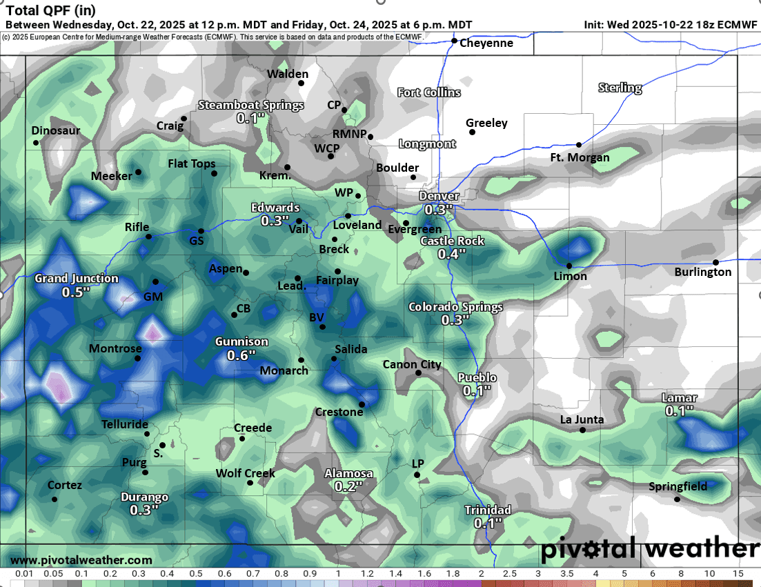
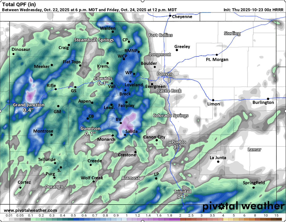
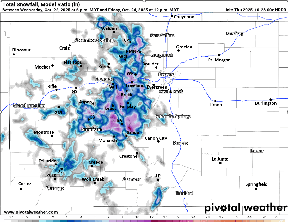
First image is my preliminary snowfall map from now through 6pm Fri (may have to update it tomorrow). Images 2 and 3 show the stark differences in total liquid precip from latest 18z ECMWF and 00z HRRR (fresh off the press). Image 4 shows forecast total snowfall from latest HRRR through 12pm Fri, take modeled rain and snow amounts with a huge grain of salt. I'll post some more recent model runs in the comments (they are so wildly different lol).
Who else is stoked that snowfall map season is back! Its a busy time of year 🙂

Like what you read?
Receive daily weather reports straight to your inbox with Seth's Daily Newsletter. Sign up below.