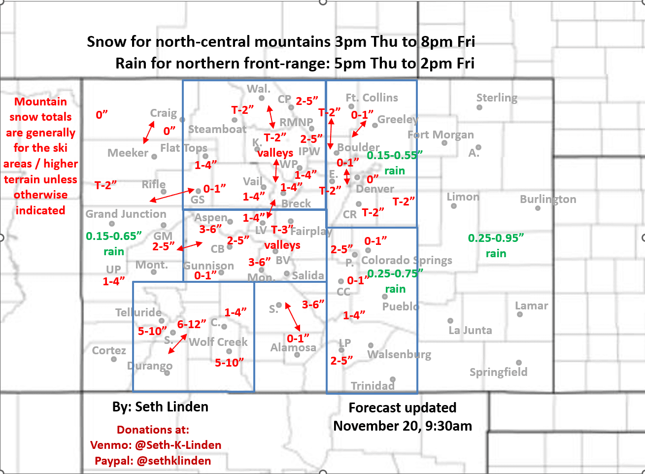
Snowfall map for the Thu/Fri storm (its looking weaker for northern CO)
Nov 20, 2025
into tomorrow and hence models have decreased rain and snow amounts for northern CO including the front-range (Den/Bou).
Below is my updated total snowfall map through 8pm Fri and a mention about rain amounts. Still not feeling very confident in these numbers given the uncertainty in the models, but its my best guess this morning.
Rain and snow showers over southern CO this morning.
Then the main rain/snow event for much of CO will be from 5pm this evening through 2pm tomorrow with some snow showers lingering in the mountains.
Now it looks like Den/Bou may only get 0.15" to 0.55" of rain, even that is a bit in doubt.
Foothills and Palmer Divide Trace-2".
North-central mountains / local ski areas: 1-4", favoring areas along/east of the Cont. Divide and south of Hoosier Pass.
Elks / Collegiates: 2-6"
San Juans: 5-12" (including what fell this morning)
More rain / snow expected on Sunday into Monday favoring southern CO (but Den/Bou and the front-range will get some as well), more on that later.
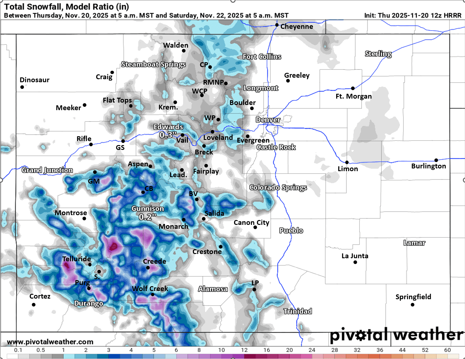
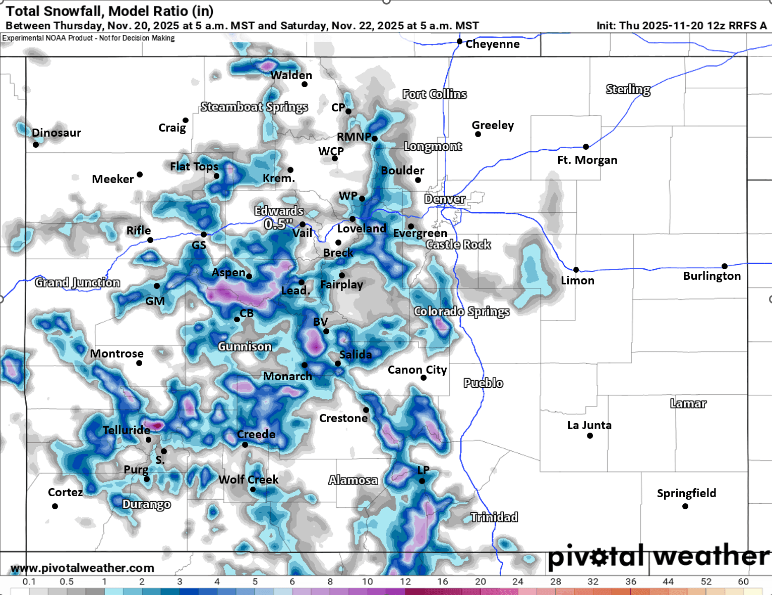
Latest snowfall map and also forecast snowfall from latest HRRR and RRFS (high-res models) from now through 5am Sat, take with grain of salt.

Like what you read?
Receive daily weather reports straight to your inbox with Seth's Daily Newsletter. Sign up below.