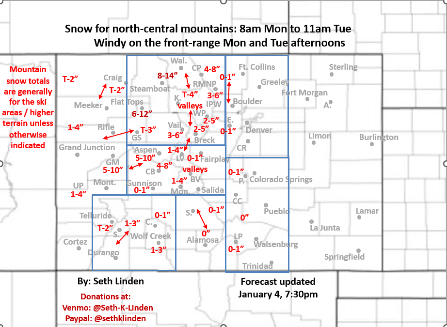
Snowfall map for the Mon/Tue storm system
Jan 4, 2026
01/04/25 8pm: Hi, I made a snowfall map for you, for the approaching storm system that will bring snow to the north-central mountains primarily from 8am Mon to 11am Tue, heaviest Mon night. I'll let the map mostly speak for itself.
Still some uncertainty in how far north or south the main wave moves through, so numbers may change a bit tomorrow. But generally 2-6" for the local ski areas and mountains passes, I-70 corridor, heaviest west of Vail Pass.
Highest amounts expected in the Park Range north of Steamboat and in the Flat Tops: 6-14" there.
Also likely some decent snow for the Elk Range (between CB and Aspen): 5-10". Not much south of there.
For Den/Bou just some wind, especially tomorrow afternoon: 11am-5pm: westerly wind-gusts of 30-50mph (stronger in the foothills)
More snow expected for the mountains from 5am Thu through 5am Fri.
Maybe some snow for Den/Bou on Thu night into Fri.
That is all for now.
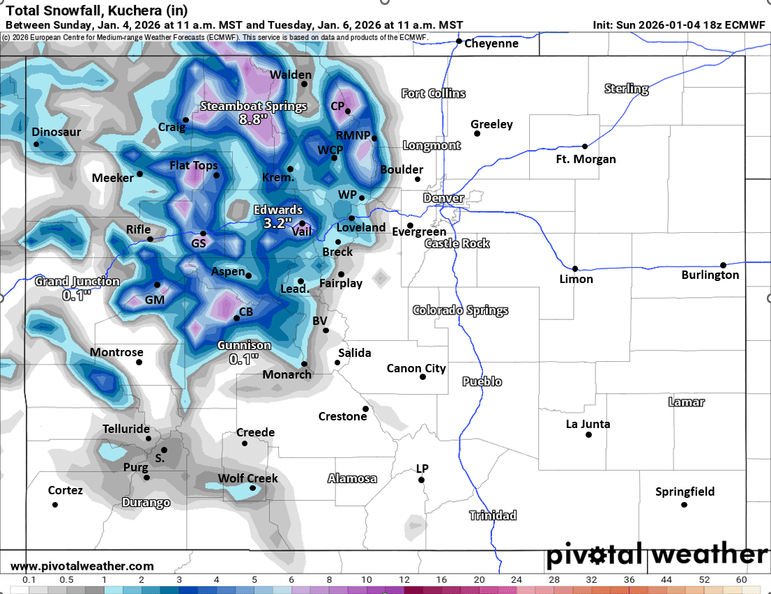
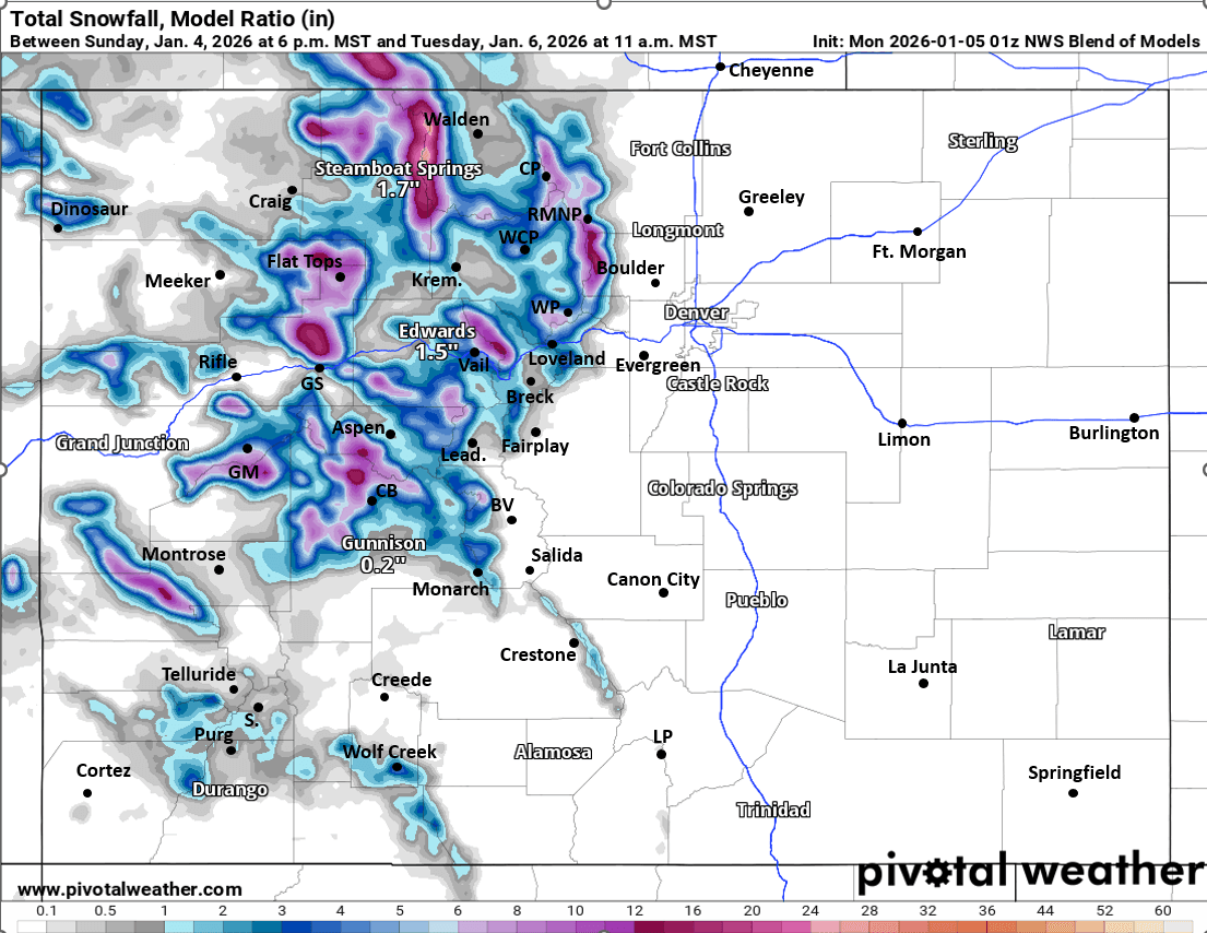
First image is my preliminary snowfall map from now through 11am Tue. Images 2 and 3 compare forecast total snowfall from now through 11am Tue from latest ECMWF and latest NWS Blend of Models, take amounts with grain of salt.

Like what you read?
Receive daily weather reports straight to your inbox with Seth's Daily Newsletter. Sign up below.