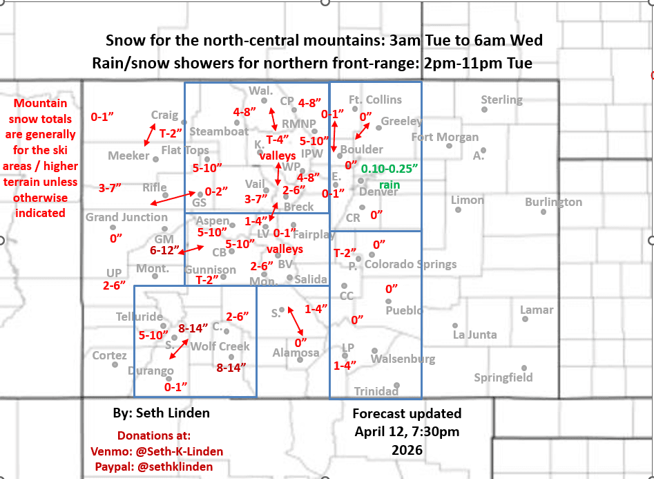
Snowfall map for the Mon pm to Wed am storm system. Colder storm for Fri/Sat.
Apr 12, 2026
04/12/26 8:25pm: Hi, hope you are having a good Sunday evening. I was able to put together a snowfall map for the Mon night through Wed am storm system. We also have another, colder storm system on tap for Fri/Sat (04/17-04/18) and that storm looks like it may bring some snow to Den/Bou (and the mountains as well).
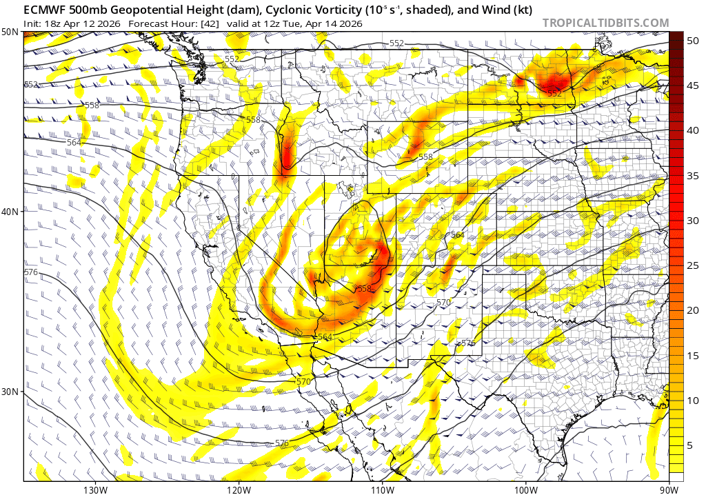
Anyway, for this first storm system, model show a disorganized upper-level low moving across the state on Tue evening with some moderate / heavy snow for the mountains and some rain for the front-range (but not much given the more northerly storm track and more downslope flow).
The storm system initially comes in with strong southwest flow aloft and fairly warm air, so snow levels will be above 9500ft initially through Tue am. Then colder westerly flow comes in Tue night into Wed am, with the snow-level dropping to 8k ft by Wed am.
For the north-central mountains a few rain/snow showers tomorrow afternoon / evening (after 2pm) but then the main event will really be from 3am Tue to 6am Wed, heaviest snow Tue night.
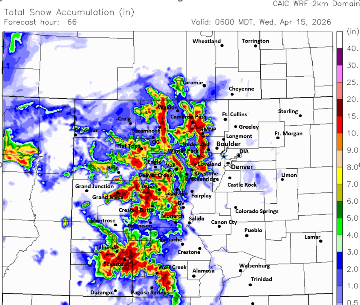
For the local ski areas, mountain passes and higher terrain, I-70 mountain corridor etc: 2-8", favoring the Front Range mountains (Loveland to Berthoud Passes, IPW, RMNP, Cameron Pass etc).
Overall heaviest snowfall will be in the San Juans from areas above Silverton to Wolf Creek: 8-14"+ for those areas (some models have 20" near Wolf Creek pass). Also 5-12" for Grand Mesa and the Elks.
For Den/Bou and the front-range looks like a shot of rain (snow above 9k ft) mostly from 2pm-11pm Tue, mostly from Denver north, hopefully 0.10"-0.25" of rain in spots. Foothills maybe a Trace-1" of snow but likely very little.
As I mentioned, tracking a colder storm system, larger upper-level low that is currently looking quite potent (per both ECMWF and GFS), slated to impact the state from about 6am Fri through 6am Sat.
Den/Bou and lower elevations may get a nice shot of snow on Fri am or Fri night: 1-4"+ possible (more for the foothills).
North-central mountains will get an additional 5-12" Fri into Sat,
April powder is back on the menu. Looking like Wed and Sat could be pow day, hallelujah!
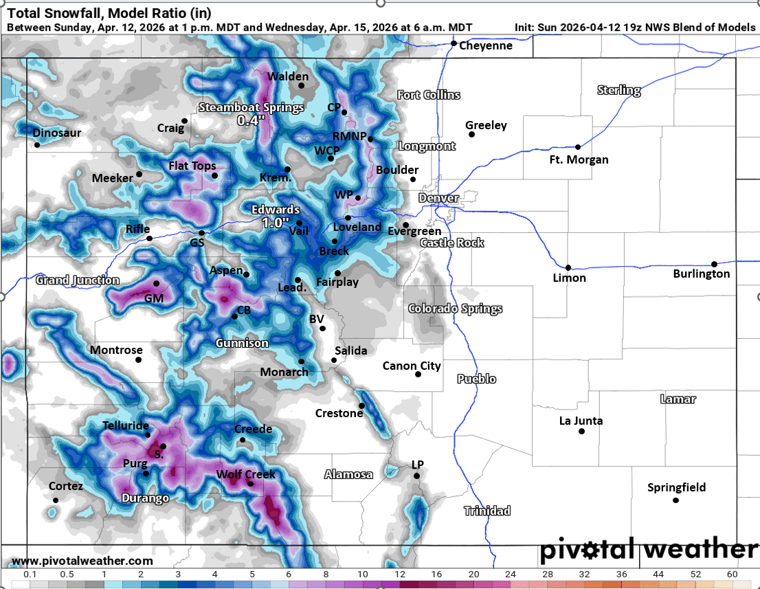
First image shows forecast total snowfall through 6am Wed. Second image shows the upper-level low at 6am Wed via 500mb vorticity / wind from latest ECMWF model. Images 3 and 4 compare forecast total snowfall from CAIC WRF 2km model and NWS Blend of Models, take modeled snow amounts with grain of salt but you get the picture.

Like what you read?
Receive daily weather reports straight to your inbox with Seth's Daily Newsletter. Sign up below.