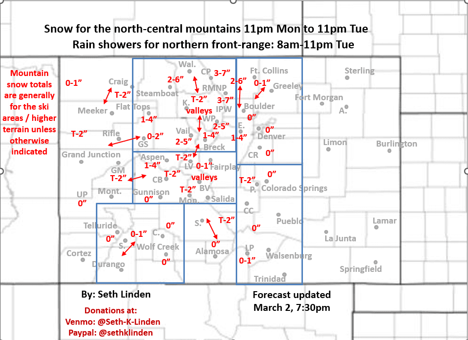
Snowfall map for the Mon night to Tue storm system
Mar 2, 2026
03/02/26 8pm: Alright, snowfall map for the approaching storm system which is already bringing some rain/snow to western CO. Models show a fairly warm disorganized upper-level low that will move across central CO on Tue. Wind flow will go from northwest to northerly to northeasterly by Tue afternoon / evening (so a decent shot of upslope). A few inches of snow in the mountains. I'll let the map mostly speak for itself.
For the north-central mountains snow / snow showers from 11pm tonight through 11pm Tue, most of it Tue am. Generally 1-5" for the local ski areas favoring the Front Range mountains along/east of the Cont. Divide (IPW, RMNP, Cameron Pass areas), secondarily maybe near Vail/BC on the front-end of the storm.
For Den/Bou/Ft.Collins and the northern front-range looks like a few rain showers in the morning, but then a better chance for some more consistent light rain / rain showers from 11am-11pm Tue (as colder upslope flow develops) favoring areas from Denver north to WY border (snow for Cheyenne, WY). Hopefully 0.10-0.25" of rain in spots.
The northern foothills west of Den/Bou/Ft.Collins can expect some snow, mostly above 7500ft from 10am Tue to 2am Wed (best chances Tue evening). 1-6" in spots favoring more northern foothills areas: Boulder to Larimer counties up higher.
In terms of wind, not that bad with this system (with westerly flow turning to northeast upslope flow).
Some wind for the front-range (Den/Bou) tomorrow as the cold-front pushes in from the north: northeast wind-gusts of 15-30 mph.
The storm system clears out by early Wed am.
Monitoring the next storm system for Fri am through Sat pm, I'll have more on that later.
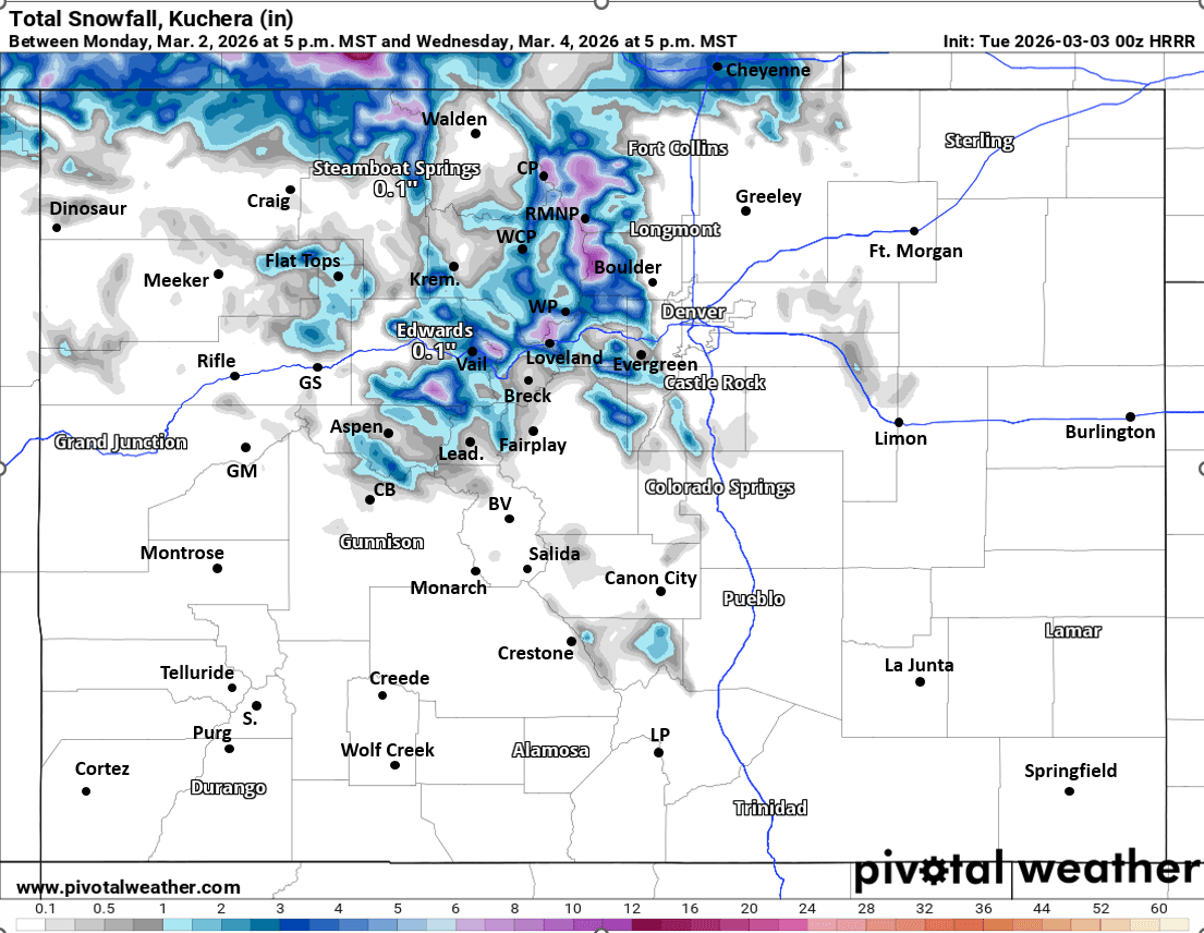
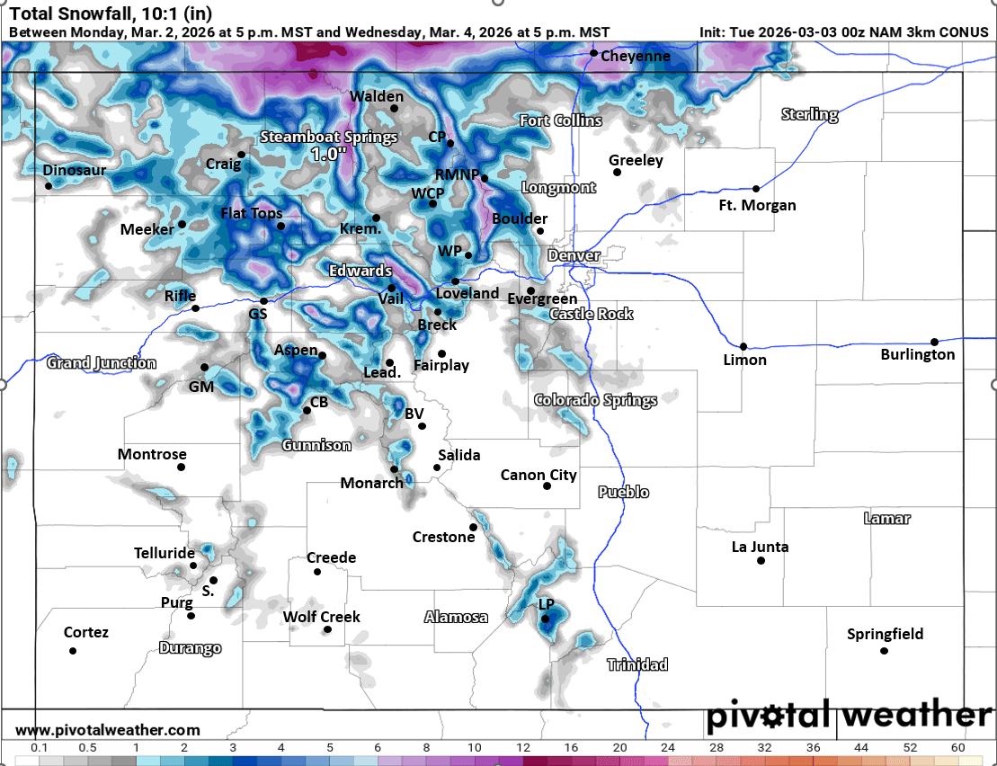
First image is my snowfall map from now through 5am Wed. Images 2 and 3 compare forecast total snowfall from now through 5pm Wed from very latest 00z HRRR and NAM-3km models, take modeled snowfall amounts with a grain of salt.

Like what you read?
Receive daily weather reports straight to your inbox with Seth's Daily Newsletter. Sign up below.