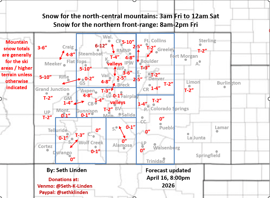
Snowfall map for the Fri storm system
Apr 16, 2026
04/16/26 8:30pm: I made a little snowfall map for the approaching storm system. Forecast remains on track per this morning. A quick shot of snow and return to winter for much of northern CO but it will be brief. I'll let the map mostly speak for itself.
The cold-front is moving into the UT/CO border now and will move into the mountains overnight. Very strong westerly winds will continue over western CO until the front moves through this evening after 11pm.
The main snow event for the north-central mountains will be from 3am Fri to 12pm Sat. Generally 3-8" for the local ski areas, I-70 mountain corridor higher terrain, locally favoring areas closer to Cameron Pass / RMNP, secondarily near Vail and Beaver Creek. Similar amounts near Aspen as well, less south of there.
Heaviest snowfall likely in the Park Range near/north of Steamboat ski area to Buff Pass, etc: 6-12", above 9k ft there.
For Den/Bou and the front-range still looks like a quick shot of upslope and snowfall, mostly between 8am-2pm Fri., likely a quick 1/2" to 3" on grassy surfaces. Favoring the upslope notch: southwest of a line from Boulder to Parker, in/near the foothillls. Similar amounts near Ft. Collins / Loveland areas.
For the foothills west of the urban corridor, likely 2-5" above 6500ft, favoring areas closer to Evergreen, Idaho Springs, Georgetown, etc.
Just a little snow down towards Springs as well but not much south of there. Refer to map.
For the front-range: temps dropping into the low 30s by Fri afternoon, then low temps of 22-28 by Sat am. With lows of 10-20 for the mountains.
In terms of wind: windy over western CO this evening.
Then turning windy over the front-range (including Den/Bou) from 2pm Fri to 2am Sat (westerly wind-gusts of 25-50 mph).
Front Range mountains (along/east of the Cont. Divide) wil have strong wind on Fri afternoon / evening and also on Sat afternoon/ evening: westerly wind-gusts of 30-60mph.
That's all for now. Hoping for a high-end bust in terms on snowfall at my house! Lets go (probably won't happen, given the season lol).
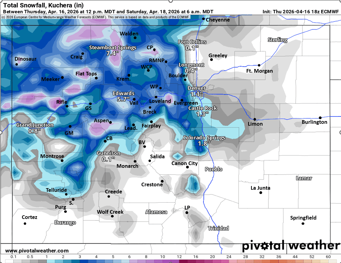
First image is my total snowfall map through 6am Sat. Images 2 and 3 compare forecast total snowfall from now through 6pm Sat from latest HRRR and ECMWF models (sometimes the global models resolve these a bit better, take amounts with grain of salt).


Like what you read?
Receive daily weather reports straight to your inbox with Seth's Daily Newsletter. Sign up below.