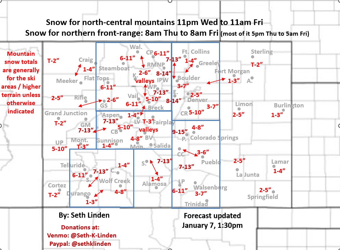
Snowfall map for approaching storm from Wed pm through Fri am
Jan 7, 2026
01/07/26 2pm: Here you go, my initial snowfall forecast map for the approaching storm system which will bring most of the impacts from about 8am Thu through 8am Fri. Refer to map for all the details.
For the north-central mountains, snow from generally 11pm tonight to 11am Fri, heaviest snow Thu night into early Fri am. Generally 6-12" of snow for the local ski areas with highest amount expected along/east of the Cont. Divide (Front Range mountains).
For rest of mountains like Park range, Elks to San Juan range also a good 6-12" in many areas (higher terrain) refer to map.
For Den/Bou and the front-range, light snow likely between 8am-5pm. Then the main event, with most of the snow accumulation from 5pm Thu through 8am Fri. Generally 2-6" of new snow for Den/Bou with highest amounts near the foothills.
For the foothills west of Den/Bou, generally 7-14" with higheast amounts from Nederland south (including near Georgetown, Idaho Springs, Evergreen/Conifer, Bailey and west of Pikes Peak)
For Longmont, Loveland, Ft. Collins, Greeley: 1-4" of snow
For Palmer Divide to Springs likely 4-10" of snow favoring upper PD.
Rest of southern front-range (Pueblo, etc): 3-7"
In terms of wind, not very windy with this storm through early Fri am. Then some stronger northwest winds over parts of the north-central mountains and especially Front Range mountains on Fri during the day: westerly wind-gusts of 20-50mph (strongest along/east of the Cont. Divide).
The storm clears out by 12pm Fri.
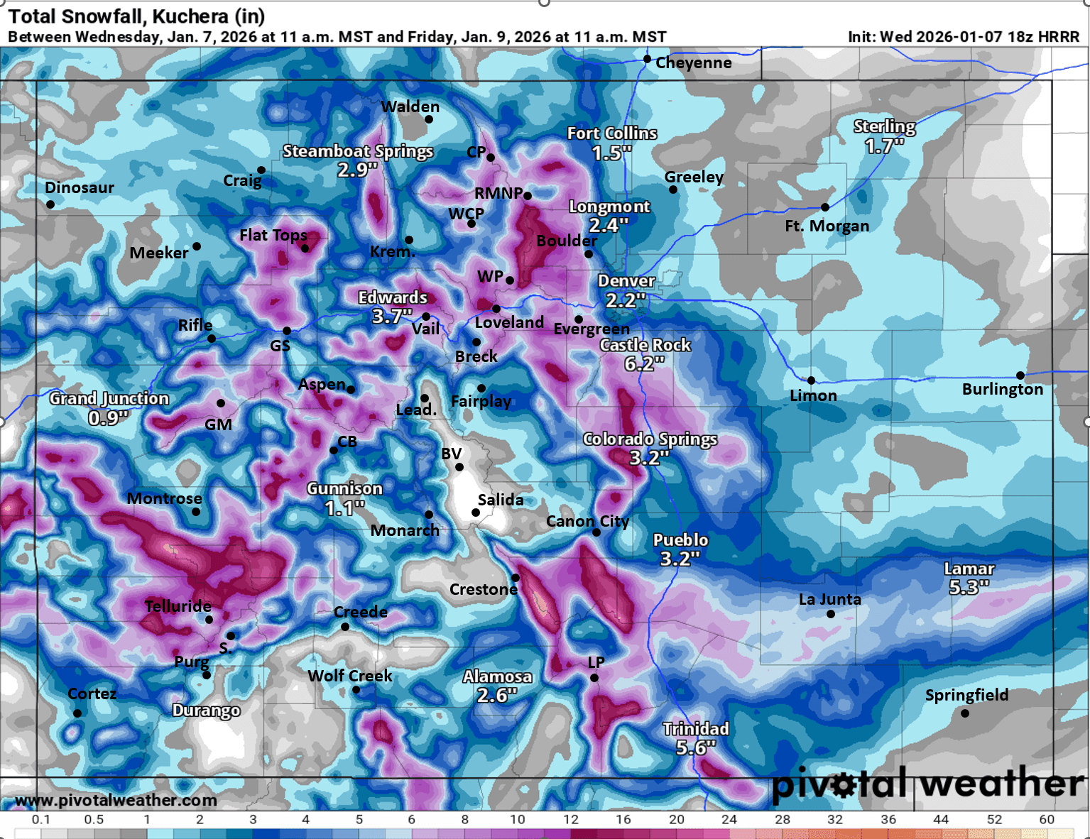
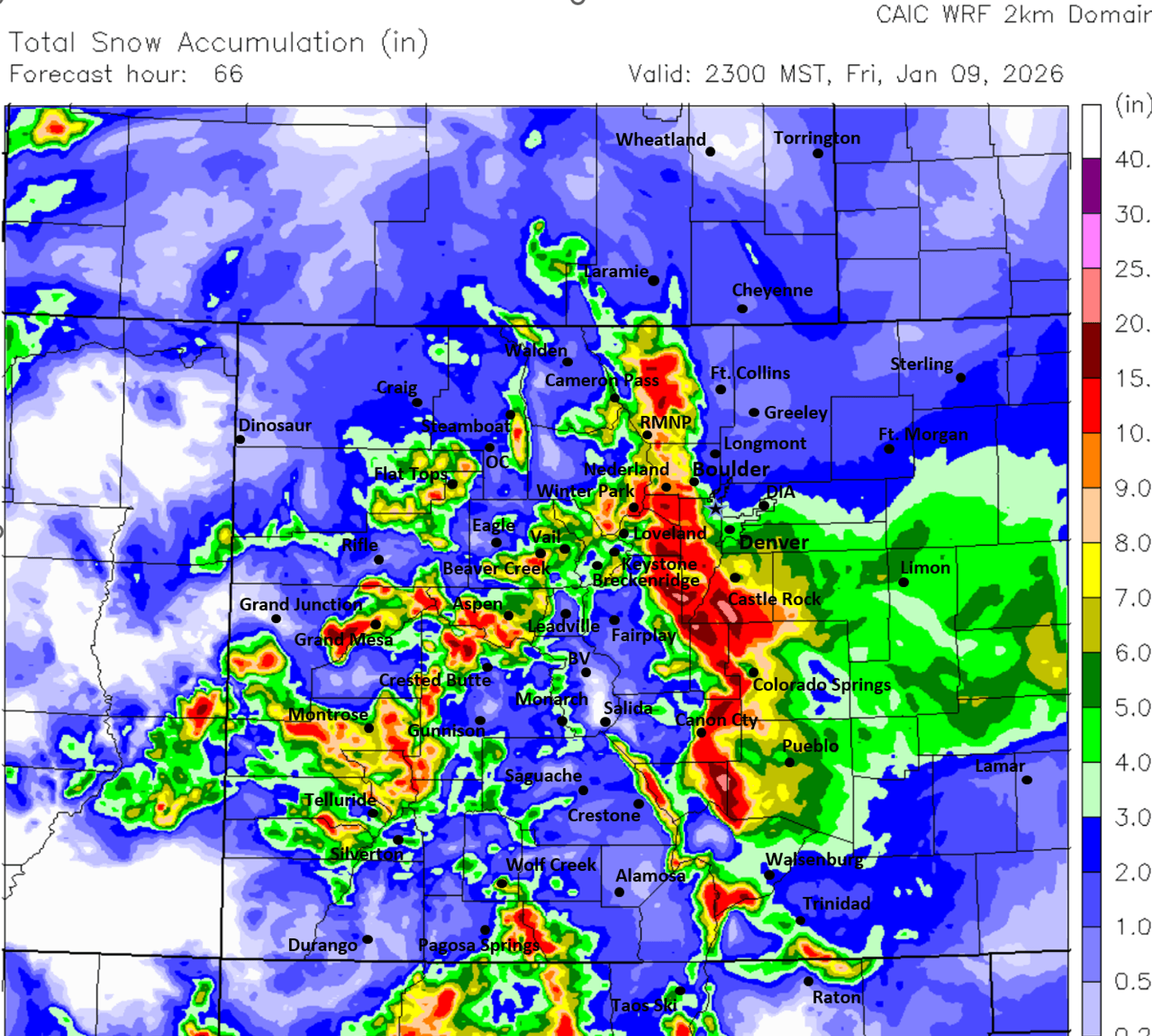
First image is my preliminary total snowfall forecast map through 11am Fri (may need some adjustment tomorrow). Images 2 and 3 compare forecast total snowfall from now through 11am Fri from very latest (18z) HRRR and latest CAIC WRF 2km model, take modeled amounts with grain of salt.

Like what you read?
Receive daily weather reports straight to your inbox with Seth's Daily Newsletter. Sign up below.