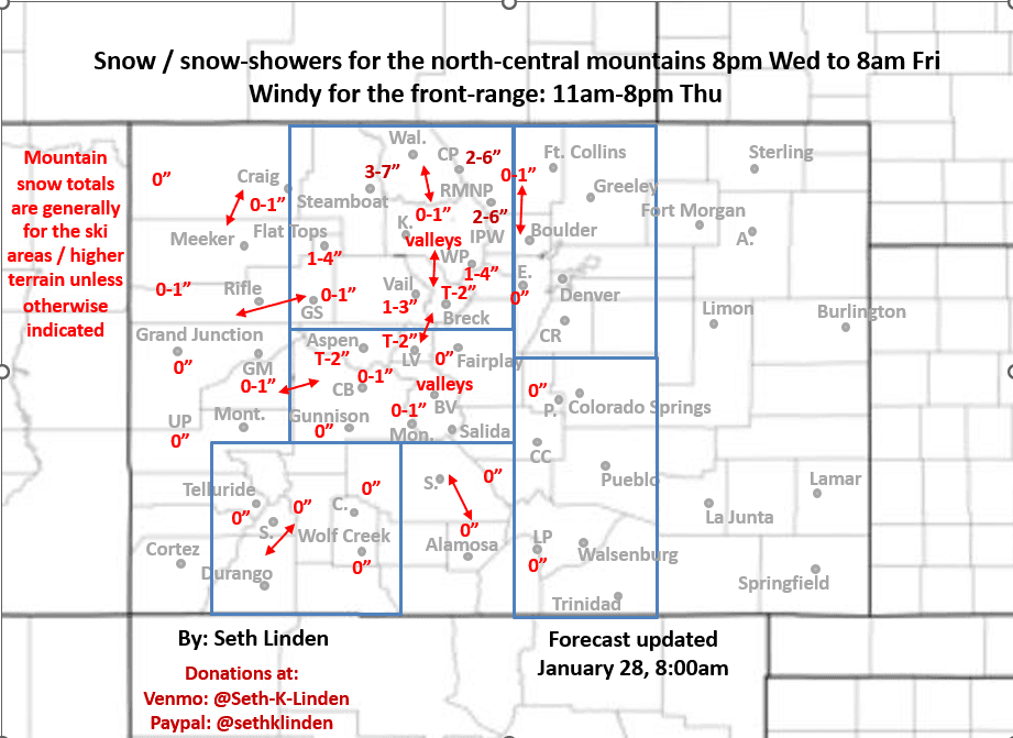
Snowfall forecast map for the Wed night through Fri am storm
Jan 28, 2026
01/28/26 8:10am: Morning. I put together a little snowfall forecast map for the approaching short-wave which will bring a round of mostly light snow / snow-showers to the north-central mountains form 8pm Wed through 8am Fri and some windy conditions to parts of the mountains and front-range (Den/Bou), especially on Thu.
For the north-central mountains including Routt, Eagle, Summit, ClearCreek, Grand, western Boulder/Larimer counties: light snow / snow-showers from about 8pm Wed through 8am Fri (most of it by 5pm Thu, with lingering showers into Fri am). Generally 1-6" of new snow for the ski areas and high terrain favoring areas in the Park Range near Steamboat and Medicine Bow Range near Cameron Pass, RMNP, and northern IPW.... Refer to map below for details.
It will be windy in the mountains from 2pm Wed through 5pm Thu: westerly wind-gusts of 30-60mph. Windiest along the Front Range mountains Thu afternoon.
For Den/Bou and the front-range just some wind with this wave (too much northwest downslope flow). Turning a bit windy overnight tonight (Wed night into Thu am) but the strongest wind will be from 11am-8pm Thu: northwest wind-gusts of 20-50 mph, strongest in/near the foothills and from Boulder north to the WY border.
Looking ahead, GFS was trying to show a little snow for the front-range (Den/Bou) on Fri, behind a sneaky backdoor cold-front, but given the westerly winds aloft, that seems doubtful (other model aren't showing it).
Then back to warm and dry weather Sat to Tue.
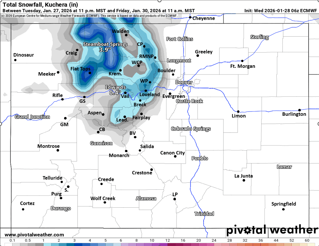
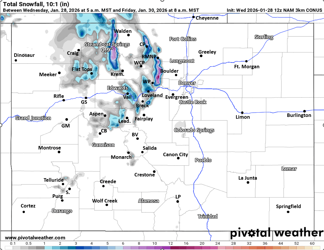
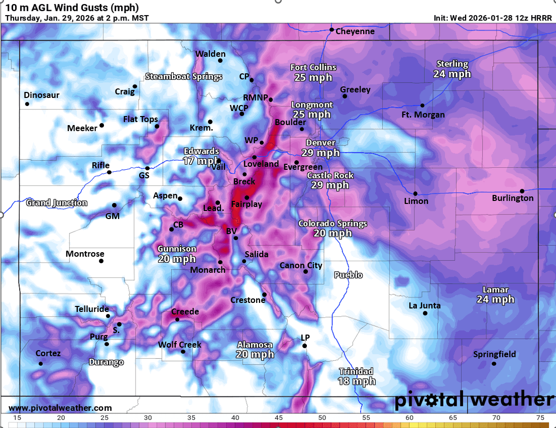
First image is my total snowfall map from now through 8am Fri. Images 2 and 3 compare forecast total snowfall from now through 8am Fri from latest ECMWF and NAM-3km models, take modeled snowfall with a grain of salt. Fourth image shows forecast wind-gusts at 2pm Thu (windy for the front-range).

Like what you read?
Receive daily weather reports straight to your inbox with Seth's Daily Newsletter. Sign up below.