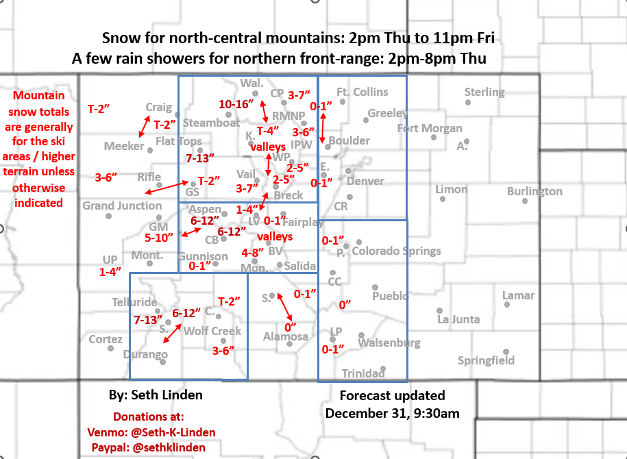
Snowfall forecast map for the Thu/Fri storm
Dec 31, 2025
12/31/25 10am: Morning, happy New Year's Eve. We are getting ready to head to the mountain house in Silverthorne soon but I made a snowfall map for the Thu/Fri storm system. I'll let the map mostly speak for itself. Some main points
Snow showers move back into southwest CO / San Juans by 8am Thu
Snow showers move into parts of the north-central mountains after 12pm Thu
The main snow event for the north-central and south-central mountains will be from 2pm Thu through 11pm Fri (heaviest early Fri am). Colder orographic flow expected Fri evening.
For much of the local ski areas / I-70 mountain corridor expecting 2-6" of new snow
For parts of western CO including near Steamboat, Aspen, CB, Telluride, Silverton: 6-15" of new snow, refer to map
Some good pow in spots likely Fri am and Sat am
Snow level will start out above 9k ft on Thu evening, dropping to near/below 8k ft by Fri (a fairly warm storm)
Some wind but not that bad, strongest wind expected over the Front Range mountains along/east of the Cont. Divide on Fri: westerly wind-gusts of 30-50 mph. Less wind west of the Tunnels
For Den/Bou and the front-range minimal impacts expected: A chance for some rain showers form 2pm-8pm on Thu. It will remain warm with high temps near 60 for the weekend
Storm clears out early Sat am
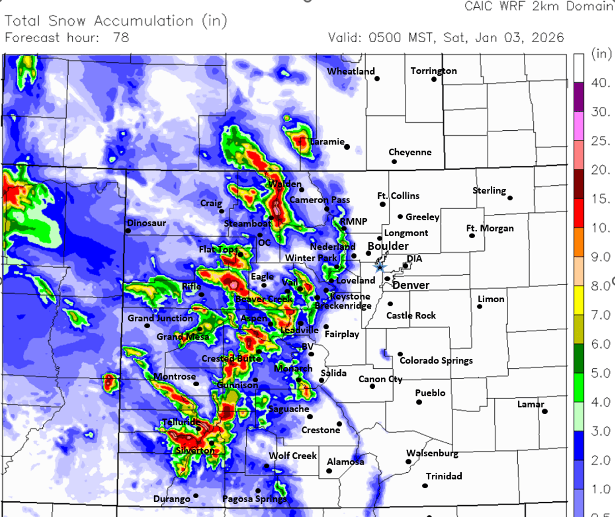
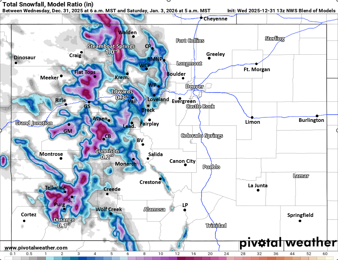
First image is my preliminary snowfall forecast map from now through Sat am. Images 2 and 3 compare forecast total snowfall form now through 5am Sat from latest CAIC WRF 2km model and NWS Blend of Models, take modeled snowfall with a grain of salt.

Like what you read?
Receive daily weather reports straight to your inbox with Seth's Daily Newsletter. Sign up below.