Snow reports (already 5" at Vail, 0.5" to 3" at the other ski areas)
Jan 29, 2026
01/29/26 8:30am: Great to see the expected snowfall come through with a few higher totals in spots (for example already 5" at Vail). Rest of the ski areas were in the 0.5" to 3" range. On / off snow will continue in the mountains through today and into tomorrow with moist northwest flow in place (as we discussed last night).
Here are some snow totals from the ski areas this morning (with some of them combining morning reports with what is currently on the snow-stakes):
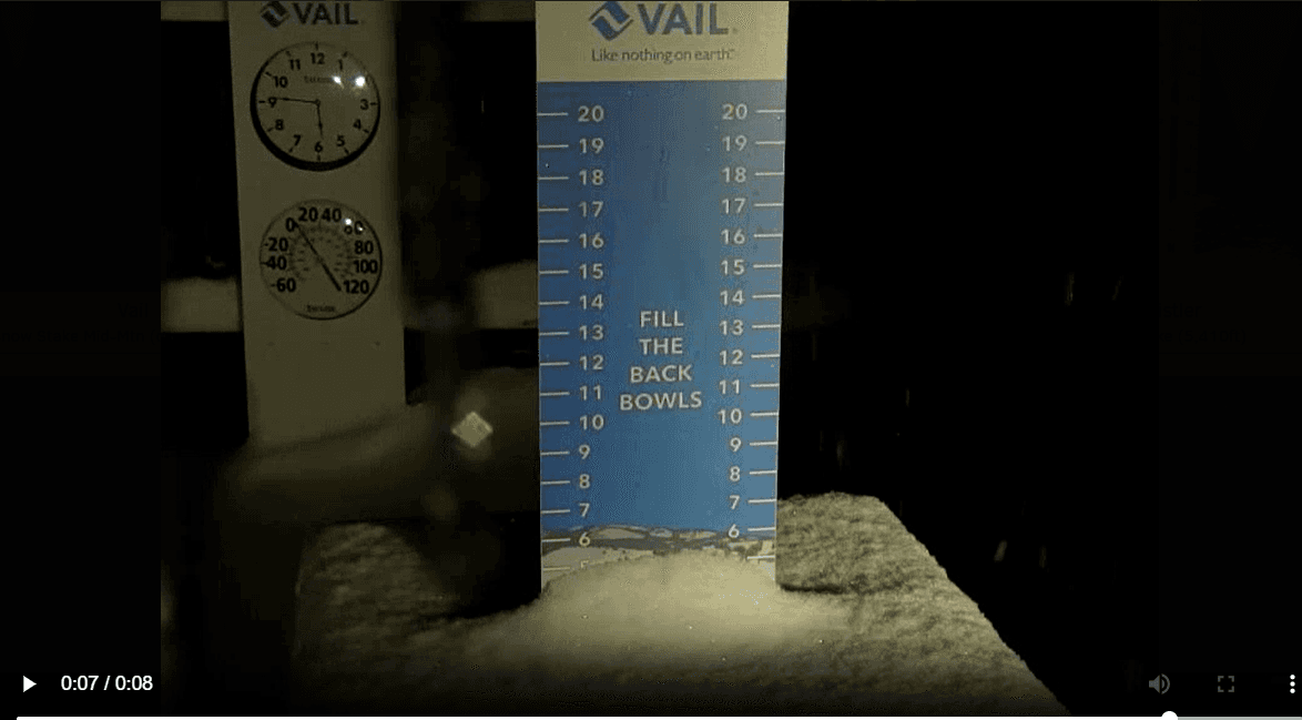
Vail: 3" (+2, 5")
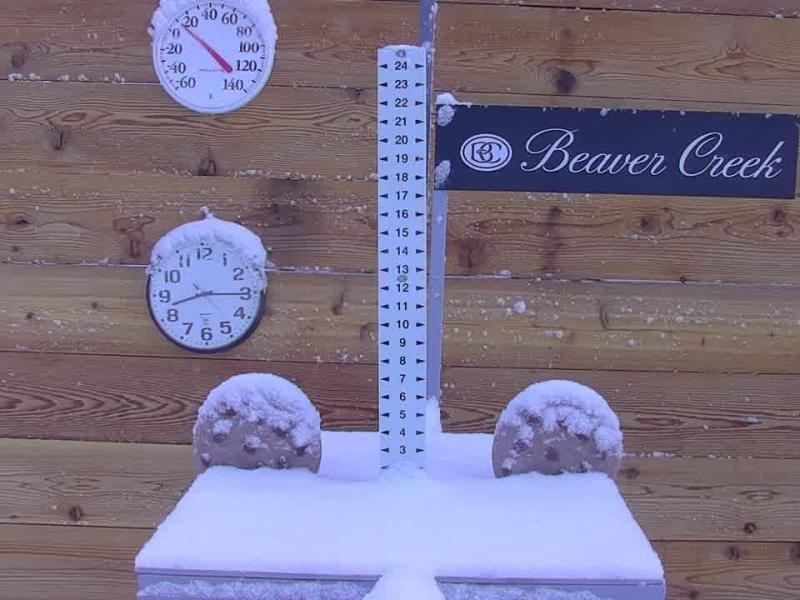
Beaver Creek: 2" (+1, 3")
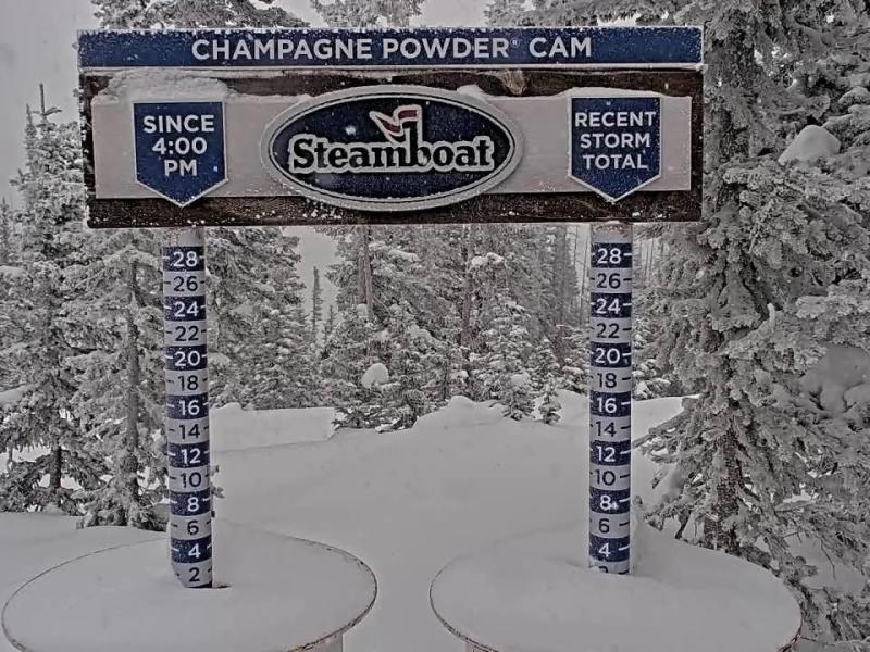
Steamboat: 2" (+1, 3")
Eldora: 1" (+2, 3")
Breck: 1" (+1, 2")
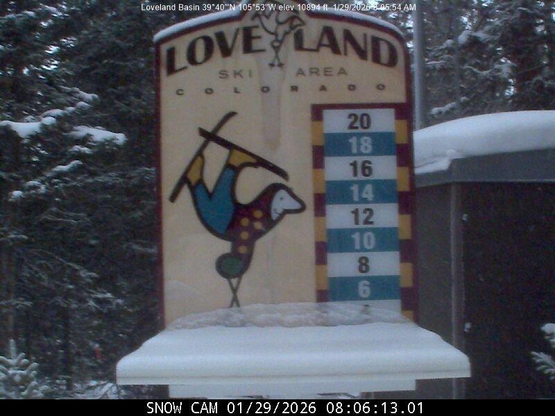
Loveland: 1" (+0.5, 1.5")
Copper: 1"
Keystone: 1"
A-Basin: 1"
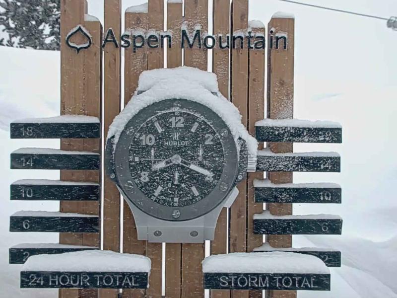
Aspen Mtn: 0" (+2, 2")
Winter Park: 0.5"
Here are a few SNOTEL reports from CAIC
Buffalo Park (Park Range): 6"
Tower (Park Range): 3"
Arapahoe Ridge (IPW): 2"
Bear Lake (RMNP): 1"
As mentioned on/off snow will continue in the mountains through 12pm Fri, with 1/2" to 3" of additional accumulation favoring areas near the higher terrain, mountain passes and especially near the Cont. Divide (closer to Loveland to Berthoud). More light snow showers expected Fri night into Sat with minimal accumulation.
It will be windy on the front-range (Den/Bou) from 10am-5pm today: northwest wind-gusts of 20-50mph. For the foothills and front-range mountains west / northwest wind-gusts of 30-60mph. Less wind west of the Tunnels.
A bit less wind tomorrow (windy over Front Range mountains, east of the Divide), less wind west.
Below I show early morning snow-stakes, or current snow-stakes from Vail, Steamboat, Aspen Mtn, Loveland and Beaver Creek.

Like what you read?
Receive daily weather reports straight to your inbox with Seth's Daily Newsletter. Sign up below.