Smoky conditions over parts of the state, especially behind tonight's cold-front
Aug 3, 2026
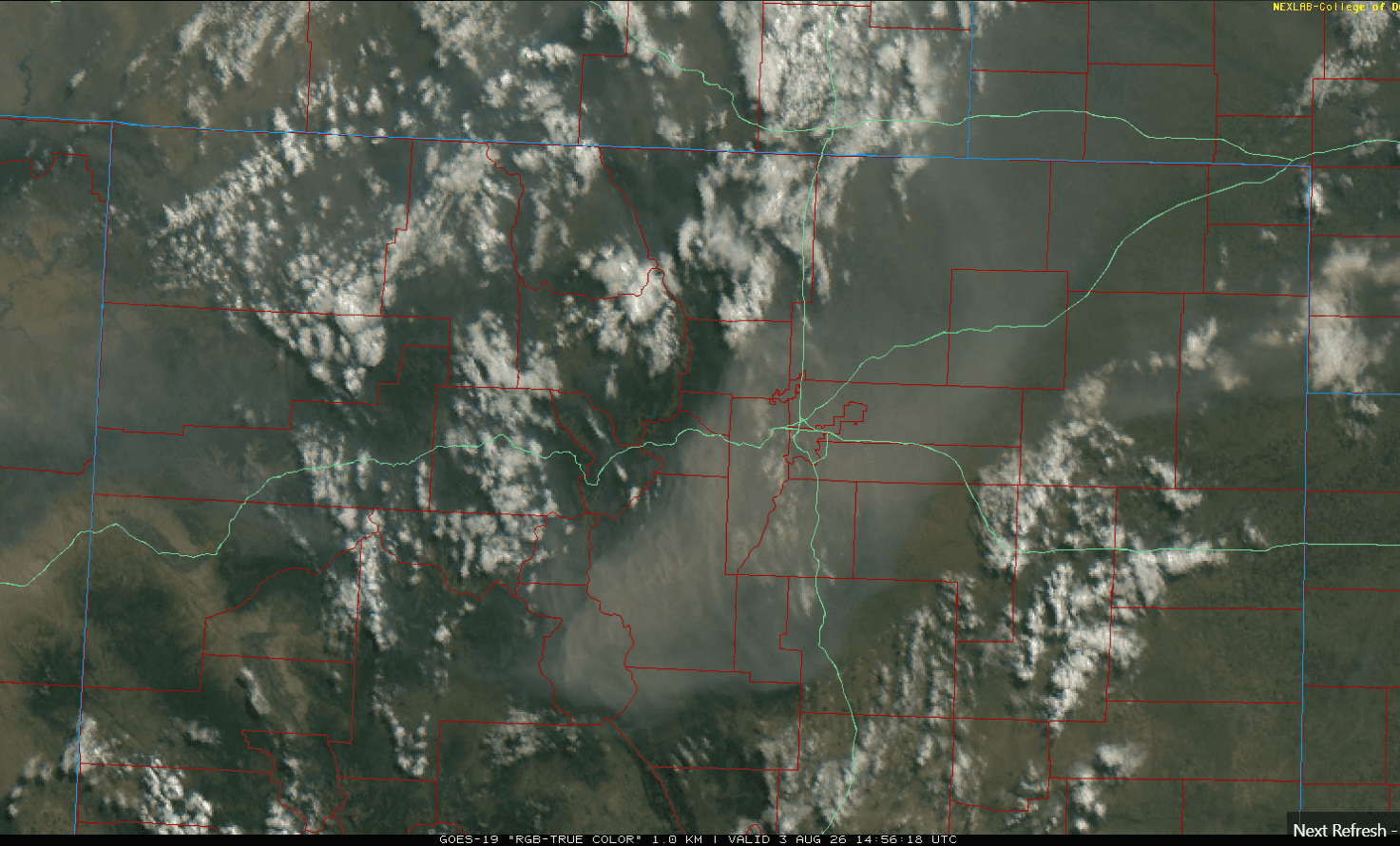
08/03/26 9:05am: Morning, its Monday. Already smoky out there over parts of the northeast plains, front-range (Den/Bou) and into parts of the central mountains. You can see the brown smoke on the visible satellite image below (image 2).
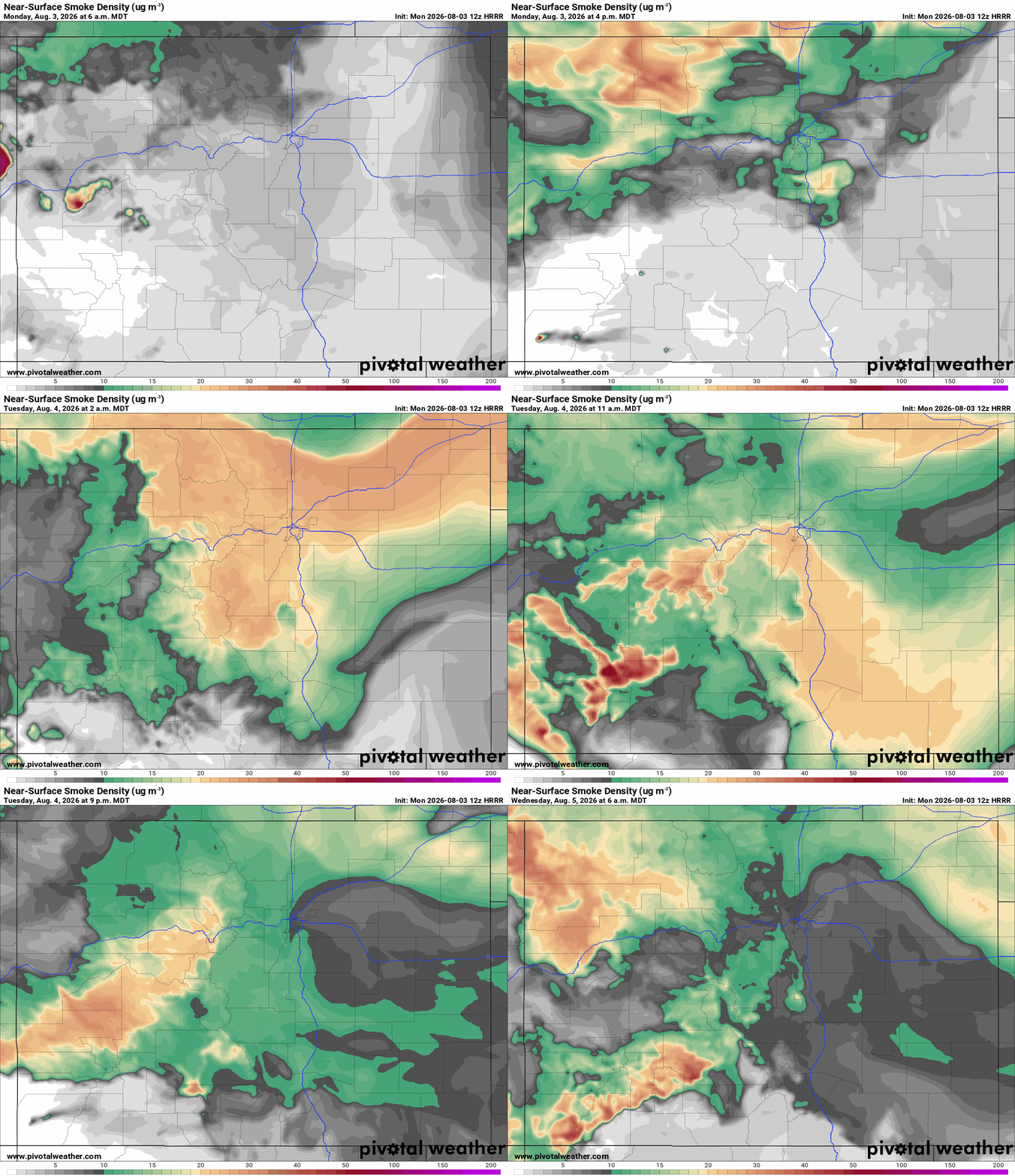
Unfortunately the smoke is going to get worse, especially for the front-range (and areas east of the Cont. Divide) behind tonight's cold-front: which will bring in a surge of northeast upslope flow and trap the smoke up against the foothills. First image loop shows forecast near-surface smoke over the next 48hrs (6am this morning to 6am Wed).
The smoke loop shows at least shows us when the main cold-front moves in this evening: mostly between 8pm-10pm from north to south. Going to be quite smoky, but cooler tonight. Smoky tomorrow morning, improving conditions again by Tue night into Wed.
Some smoke in the mountains as well but not as concentrated.
Prior to this a chance for some isolated, high-based thunderstorms for parts of the front-range (including Den/Bou) this afternoon between 2pm-8pm. Probably won't amount to much but the cloud-cover will help tamp down the temps (already cloudy / smoky so likely not as hot today, but still hot).
Best chances for storms will be east of a line from Ft. Collins to Alamosa (front-range and east, parts of southern CO and east).
Little to no impact from the cold-front (and showers, etc) west of the Cont. Divide.
For tomorrow it will be cooler over the eastern half of the state (low 80s for Den/Bou).
A chance for more isolated to scattered thunderstorms for Den/Bou and parts of the front-range tomorrow (Tue) 1pm-6pm, best chances will be from Denver south, especially from Palmer Divide south and in the foothills west/southwest of Denver.
It will remain cool on the front-range / eastern plains on Wed, a continued chance for a few isolated thunderstorms and showers.
It will remain hot over western CO and much of the mountains.
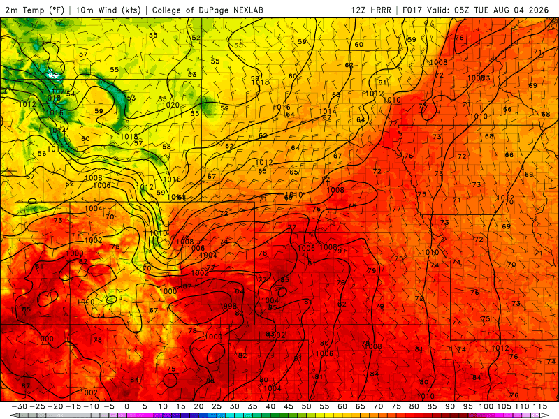
Third image shows forecast (virtual) radar at 3pm today from latest HRRR showing a few showers. Fourth image shows the stronger cold-front pushing down the front-range at 11pm tonight from latest HRRR.


Like what you read?
Receive daily weather reports straight to your inbox with Seth's Daily Newsletter. Sign up below.
