Severe weather threat for Den/Bou and the eastern plains today after 3pm
Aug 26, 2026
08/26/26 7:50am: Nice and cool out there this morning, with upper 50s on the front-range (and some 40s in the mountains).
But with a post-frontal environment on the front-range and some upslope (east to west wind-flow) in place this afternoon, this will set the stage for some stronger thunderstorms in spots over parts of eastern CO, including the front-range and Den/Bou.
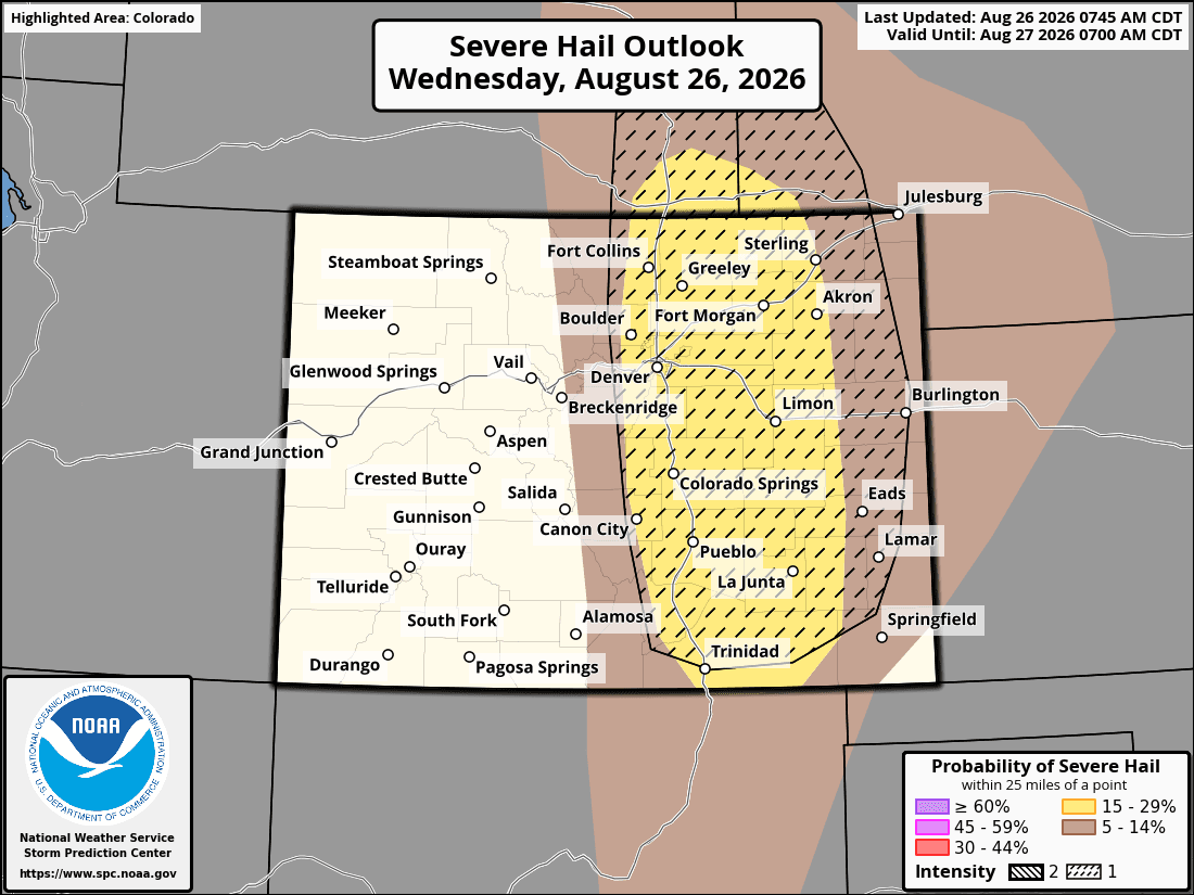
Heads up Den/Bou is under a risk for severe storms and large hail today mostly from 3pm-9pm. Strongest storms expected along/east of I-25, there could be storms with > 1" hail in spots and strong wind (best chances will be around the edges of Den/Bou, especially east / southeast towards the Palmer Divide after 5pm).
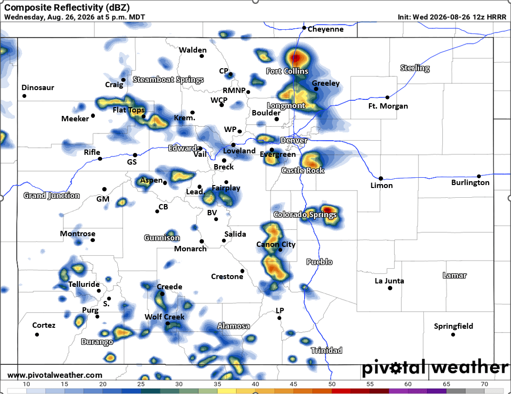
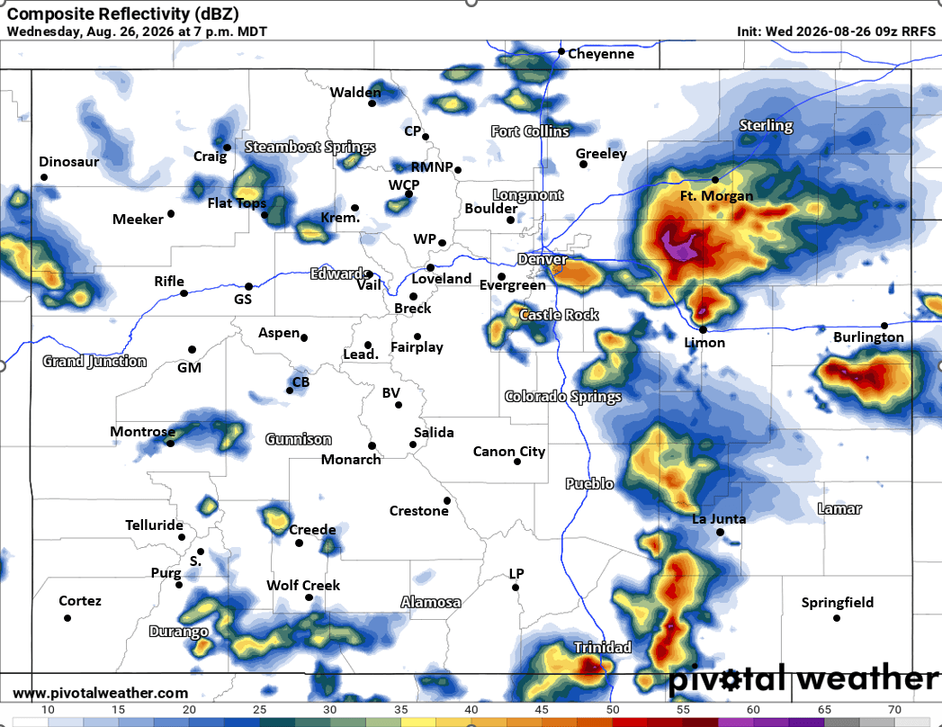
After 5pm, strongest / severe storms will be over the eastern plains (with some larger hail).
The north-central ands south-central mountains will have isolated to scattered thunderstorms today from 2pm-8pm, with a few stronger storm in spots. Best coverage after 3pm will be along/east of the Cont. Divide.
For tomorrow, less coverage of storms overall and warming up some. But still some thunderstorms for the front-range on Thu: 3pm-9pm again, favoring south-central to southeast CO, but also on the front-range from Denver south (this is for Thu). Less coverage in the mountains.
First image shows Severe Weather Outlook for today from SPC, second image shows where the best chances are for larger hail (along/east of I-25). Image 3 shows forecast radar at 5pm from latest HRRR, image 4 shows forecast radar at 7pm from latest RRFS model, take with grain of salt but you get the idea.


Like what you read?
Receive daily weather reports straight to your inbox with Seth's Daily Newsletter. Sign up below.
