Severe weather over the eastern plains today / tonight as a short-wave moves through
May 21, 2026
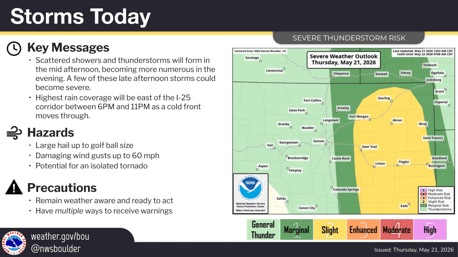
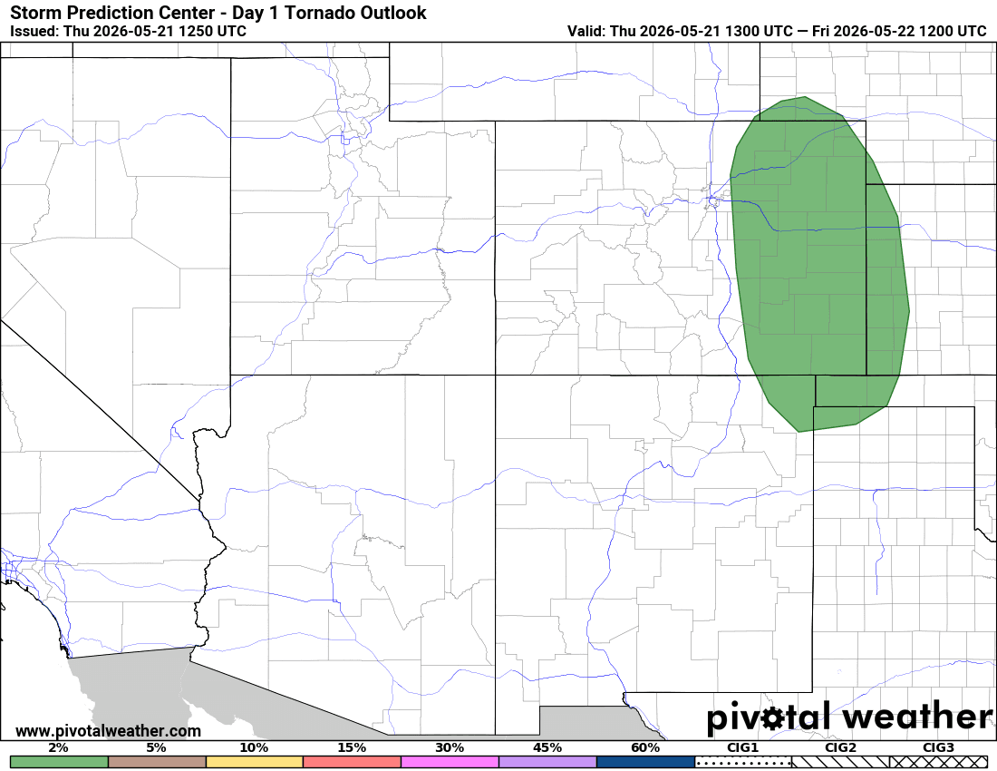
05/21/26 8:35am: First order of business today is the severe weather threat across parts of eastern CO today: mostly east of a Greeley to DIA line (closer to Limon and east) from 3pm today through 2am tomorrow morning. Large hail, heavy rain, gusty winds and brief tornado are possible (especially in the areas color-coded green on the tornado probability map, thid image).
For Den/Bou and the front-range not as big of impacts: some isolated to scattered weaker storms from 2pm-10pm (maybe one round on the front-end of the trough, another on the backend closer to 9-10pm). Won't be much actual rain hitting the ground.
For the north-central mountains limited impacts as the models show the storm system tracking north (with best moisture well east of the Cont. Divide). So just a few rain/snow showers from 2pm-12am Fri. Just a little bit of snow accum for the very northern mountains: near RMNP, Cameron Pass, parts of Park Range: 1-4" in spots, otherwise: Trace-2" for a few spots near the Cont. Divide (further south, near tunnels).
We will have another chance for rain and thunderstorm across the region tomorrow afternoon, mostly after 2pm again.
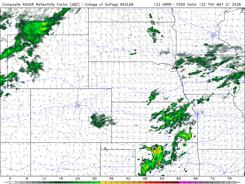
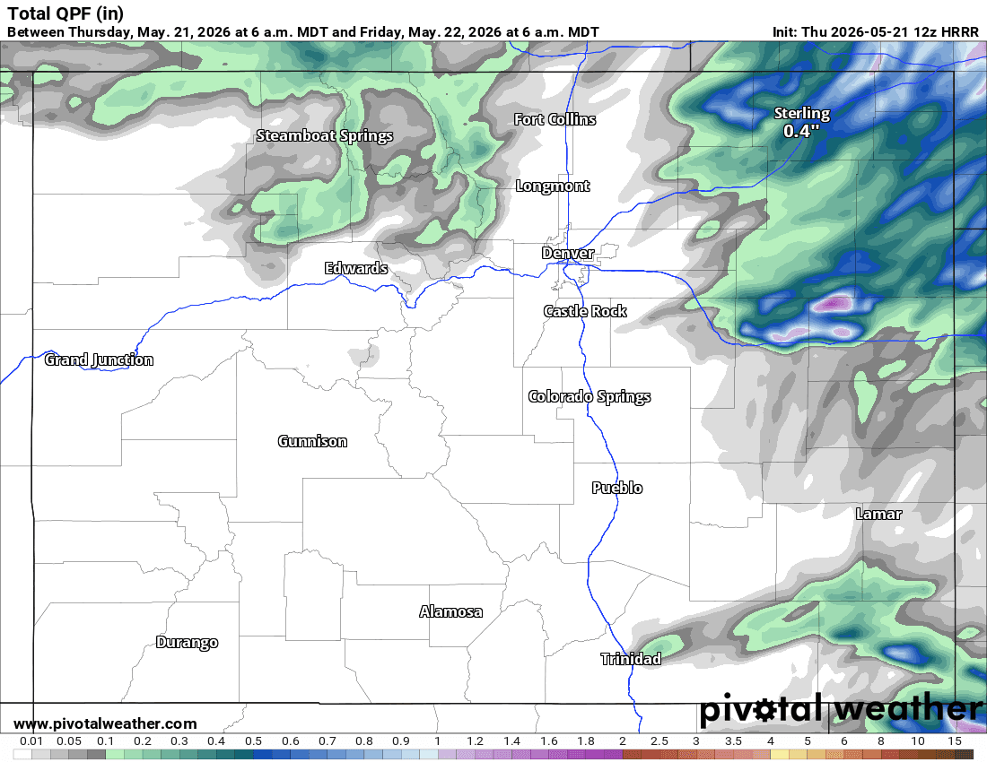
First image loop shows forecast radar over the next 48hrs (6am this morning through 6am Sat). Image 2 shows the severe weather threat from Den/Bou NWS office. Third image shows where the tornado threat is today. Fourth image shows forecast total liquid precip over the next 24hrs only, won't be much for much of CO.

Like what you read?
Receive daily weather reports straight to your inbox with Seth's Daily Newsletter. Sign up below.