Severe thunderstorms expected today from Denver east, especially over the eastern plains
Jun 8, 2026
06/08/26 8:40am: Morning, its Monday, but we have some weather to talk about! I may have to storm chase later today as its looking like a pretty strong setup for severe thunderstorms over the eastern plains / northeast CO this afternoon and evening.
Even Den/Bou may get in on some strong storms later today behind this morning's cold front, which has brought in some cooler temps initially but also some much higher humidity. This will combine with a little short-wave later.
In the mountains, less impacts, but some storms along/east of the Cont. Divide, Front Range mountains between 12pm-6pm, but more garden variety storms, not that strong. Not much rain or thunderstorms west of the Cont. Divide today.
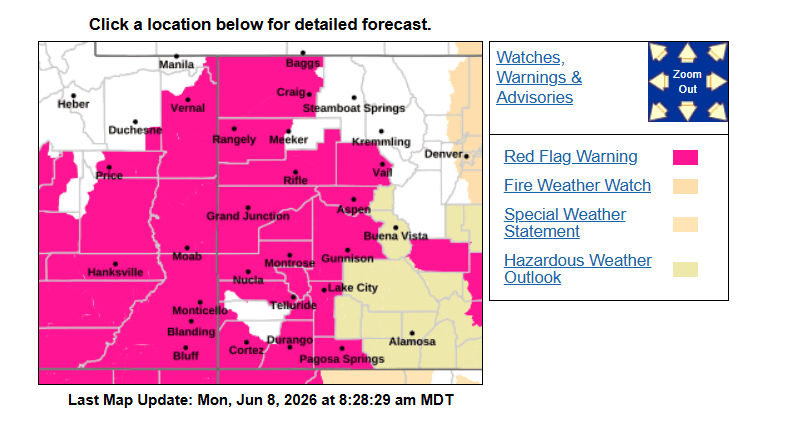
Over western CO, just windy, hot with high fire danger. In fact much of western CO (including areas from Grand Junction to Aspen and the San Juans) are basically under either a Red Flag Warning or Fire Weather Watch from 10am-10pm each day: today, tomorrow and Wed. Westerly winds of 20-30 mph, wind-gust of 40-60mph.
Some thunderstorm details:
For Den/Bou and the front-range a chance for some stronger isolated to scattered thunderstorms between 1pm-6pm (best chances 2pm-5pm). Some severe storms possible in spots with hail being the main threat, best chances along/east of I-25 after 3pm today. I would watch the radar.
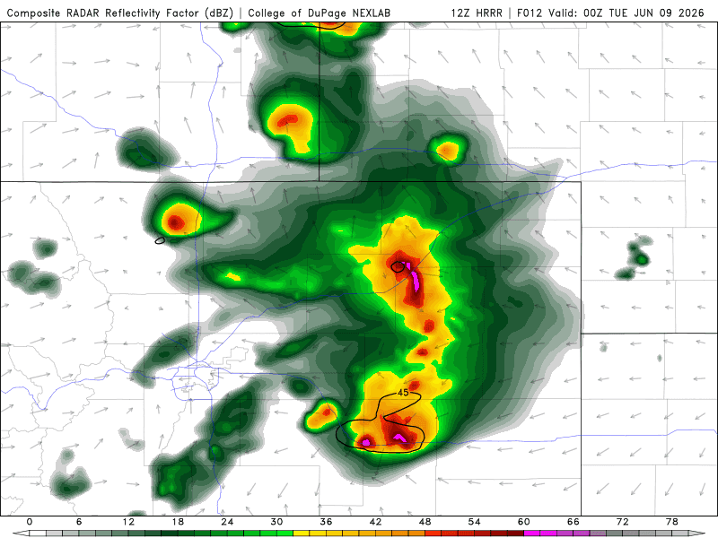
On the eastern plains the best chance for severe weather will be generally along/east of a line from Greeley to DIA, and especially along the I-70 corridor near Limon and extending north towards the I-76 corridor going up to Sterling: 3pm-9pm will be the main window. Some severe storms in spots with 1-2" hail, heavy rain, strong wind and an isolated tornado...
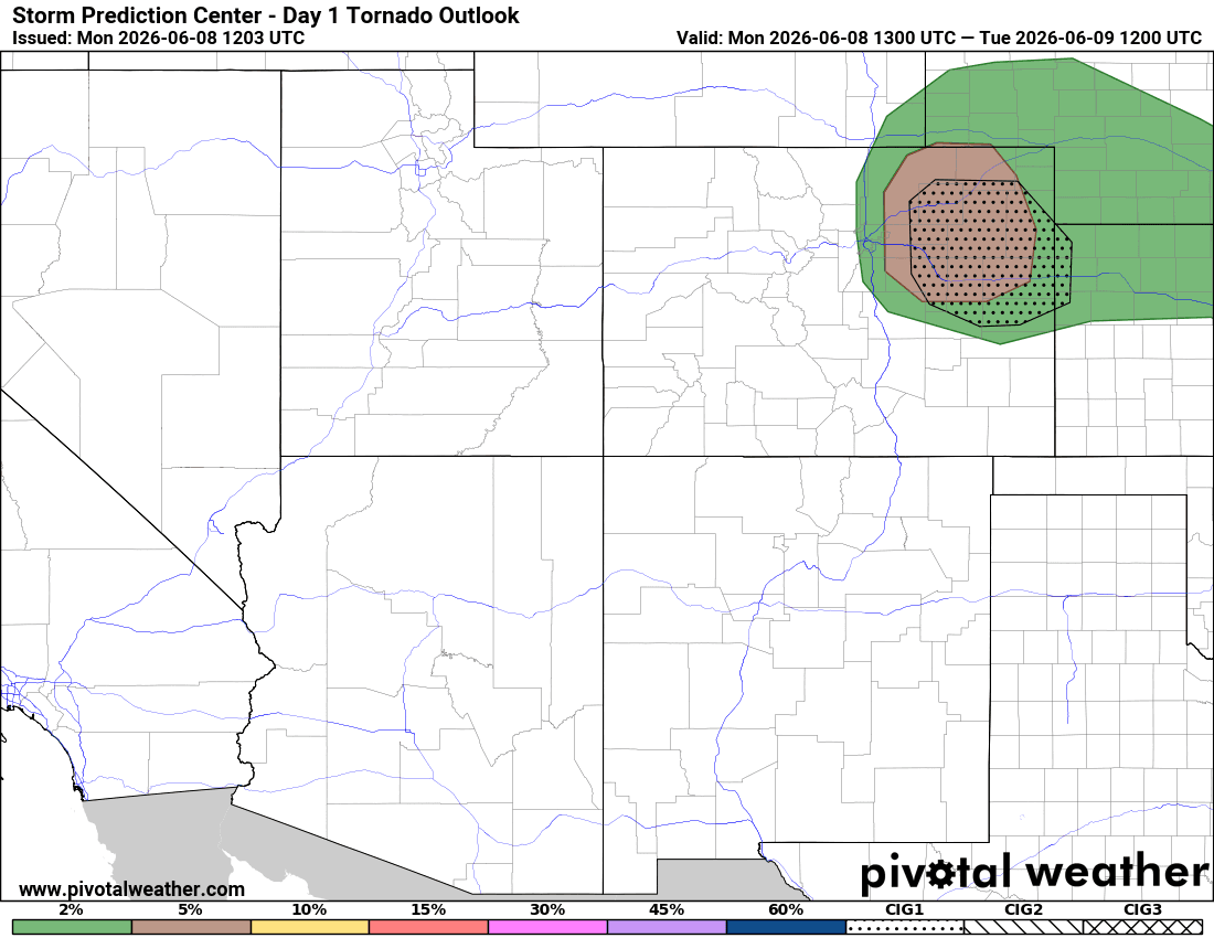
In fact first day of the season with a 5% hatched area in terms of tornado chances over northeast CO (between Limon to Sterling areas), that is pretty high relatively speaking. So maybe a tornado after 4pm on the eastern plains.
I will likely be storm chasing later today (my first storm chase in quite some time), hoping to catch the strong storms maybe a tornado, we shall see.
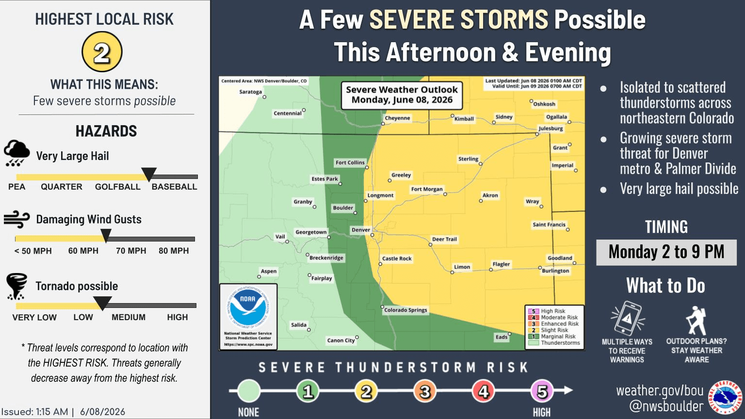
First image is forecast radar over the next 48hrs (6am this morning through 6am Wed) from latest HRRR model. Second image is zoomed in view of forecast radar over northeast CO at 6pm today with some severe storms near Limon. Third image is forecast slide from Den/Bou NWS showing the severe weather threat. Fourth image shows where the main tornado threat will be for today. Fifth image shows all the Red Flag Warnings in place across western / southern CO today (and tomorrow).

Like what you read?
Receive daily weather reports straight to your inbox with Seth's Daily Newsletter. Sign up below.