Rain reports from Thu. More thunderstorms for the front-range and plains this afternoon
May 29, 2026
05/29/26 8:45am: Great to see more rain for parts of Denver and the foothills, with 0.25" to 0.75" in spots. First some 24hr rain reports below.
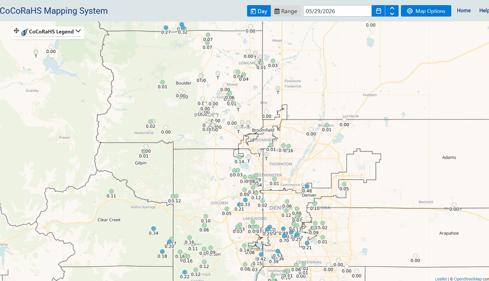
Here are some notable 24hr reports from CoCoRaHS:
Englewood 1.3 ENE 0.70
Littleton 1.5 NE 0.53
Denver 3.5 S 0.49
Wray 5.7 SSW 0.40
Idaho Springs 4.7 SSE 0.34
Wheat Ridge 1.4 WSW 0.33
Lyons 5.9 NW 0.32
Holyoke 5.7 NW 0.29
Vernon 7.1 S 0.28
Cherry Hills Village 2.1 N 0.24
Conifer 3.5 NW 0.22
Greenwood Village 2.1 NE 0.21
Golden 3.9 E 0.21
Evergreen 5 W 0.20
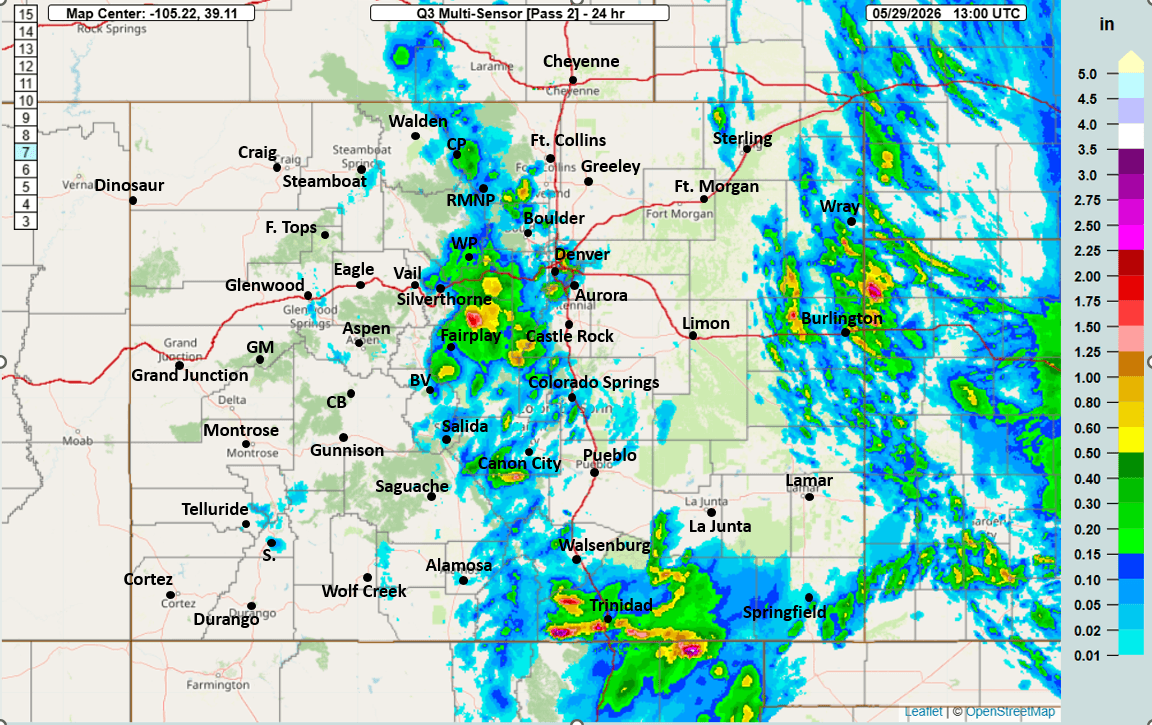
First image is a map showing 24hr observed rainfall from MRMS. Also some big totals near Fairplay of 0.50" to 1.00" in spots.
Second image shows a map of 24hr reports from CoCoRaHS over Den/Bou and the foothills.
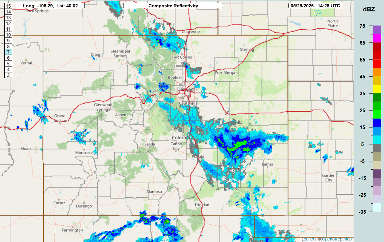
Anyway, we still have quite a bit of moisture streaming up from the south, focused on the front-range. Actually still a few lingering rain showers over parts of southeast CO this morning (third image is current composite radar).
With the lingering moisture, another good chance for rain showers and thunderstorms this afternoon, focused on the front-range and eastern plains but also in the mountains from Summit Co east, favoring the front-range mountains primarily from 1pm-8pm
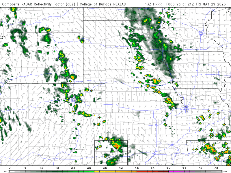
Best chances for Den/Bou: 3pm-7pm, and best coverage around the edges, looks like some convergence just east of DEN again (DCVZ setup near DIA). And the foothills wil be favored again.
Fourth image shows the forecast radar at 3pm today from latest HRRR, I'll have more on that later and an update on the drought after all the rain lately.

Like what you read?
Receive daily weather reports straight to your inbox with Seth's Daily Newsletter. Sign up below.
