Rain reports from Monday and look at an increasingly active weather forecast this week
Aug 11, 2026
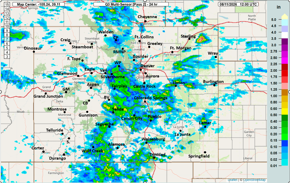
08/11/26 9am: First, great to see some meaningful rain across parts of the mountains yesterday especially for parts of eastern Summit Co, near Eisenhower Tunnels / Loveland ski area and extending down towards Fairplay (a sold 0.25" to 0.50" for the higher terrain in those areas as you can see in the first image below).
Also some good rain over southwest CO near Pagosa Springs and Durango.
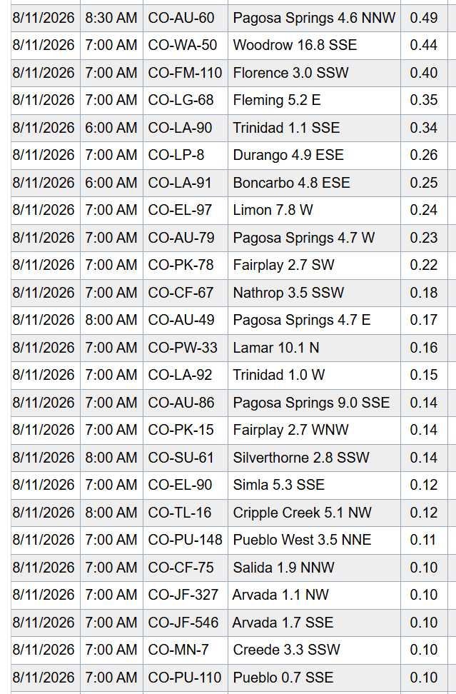
Here are some notable 24hr reports from CoCoRaHS:
Pagosa Springs 4.6 NNW: 0.49"
Florence 3.0 SSW: 0.40"
Trinidad 1.1 SSE: 0.34"
Durango 4.9 ESE: 0.26"
Limon 7.8 W: 0.24"
Fairplay 2.7 WNW: 0.14"
Silverthorne 2.8 SSW: 0.14"
Arvada 1.1 NW: 0.10"
Westminster 1.1 SW (my house): 0.05"
Anyway, a bit of a repeat today before the weather gets even more active tomorrow.
For today, for the front-range (including Den/Bou): isolated to scattered thunderstorms from 2pm-8pm...initially areas closer to Longmont / Ft. Collins maybe favored, later this evening areas from Denver south and east will be favored (southeast plains).
For the mountains today, best coverage will be along/south of I-70 and east of the Cont. Divide (north and south central mountains and east) from 2pm-10pm (scattered storms)
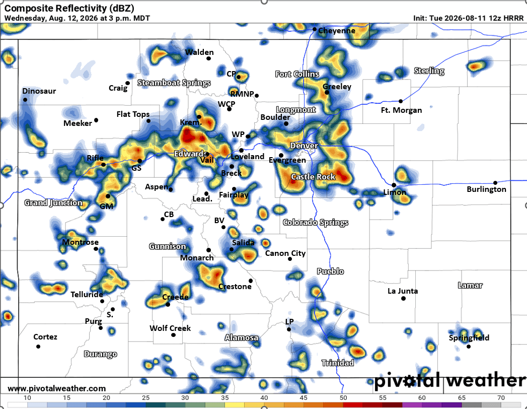
Monsoon moisture starts to ramp up tomorrow ahead of a cold-front. Heads up Wed afternoon looks like good thunderstorm coverage for both the mountains and front-range.
For both the north-central and south-central mountains tomorrow, rounds of scattered thunderstorms from 12pm-11pm (best chances 2pm-8pm, turning wet in spots, heaviest action east of the Cont. Divide again).
For Den/Bou and the front-range tomorrow (Wed): scattered thunderstorms from 1pm-8pm, best chances 2pm-6pm, best coverage from the Palmer Divide north (Denver north to the WY border)
Then much more rain on Thu, Fri and Sat afternoon (12pm-9pm each day), I'll have more on that later.
First image shows 24hr observed rainfall from MRMS. Second image shows top 24hr rain reports from CoCoRaHS. Third image loop shows forecast radar over the next 48hrs (6am this morning to 6am Thu) from latest HRRR. Fourth image is a static view of forecast radar at 3pm tomorrow (Wed) with some strong storms in spots.


Like what you read?
Receive daily weather reports straight to your inbox with Seth's Daily Newsletter. Sign up below.
