Rain reports and the thunderstorm forecast: Wed and Thu will be active weather days
Jul 21, 2026
07/21/26 9am: Morning: A bit hazy and cooler along the front-range behind and initial cool-front that is bringing some smoke into the front-range (from the north and west, with some upslope flow).
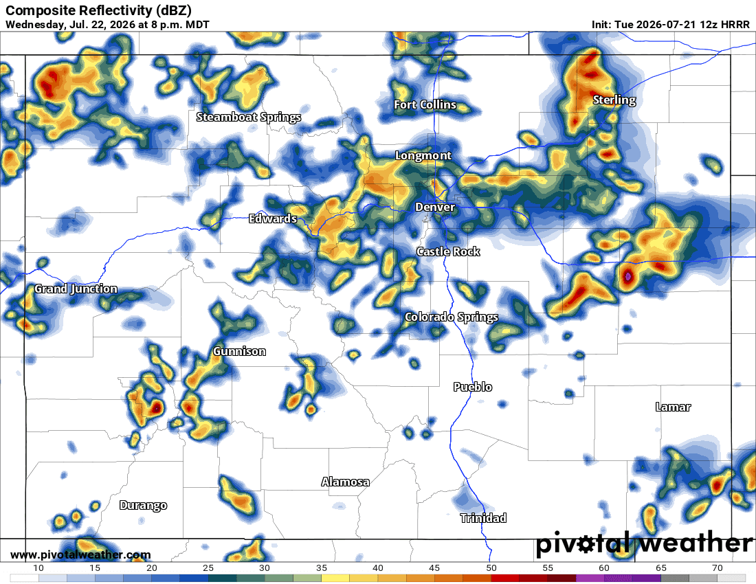
Heads up tomorrow (Wed) looks like an active weather day for the front-range (Den/Bou, foothills, etc) with good storm coverage.
Prior to this some more storms for the mountains, southern and western CO again today, maybe a few will spill onto the front-range.
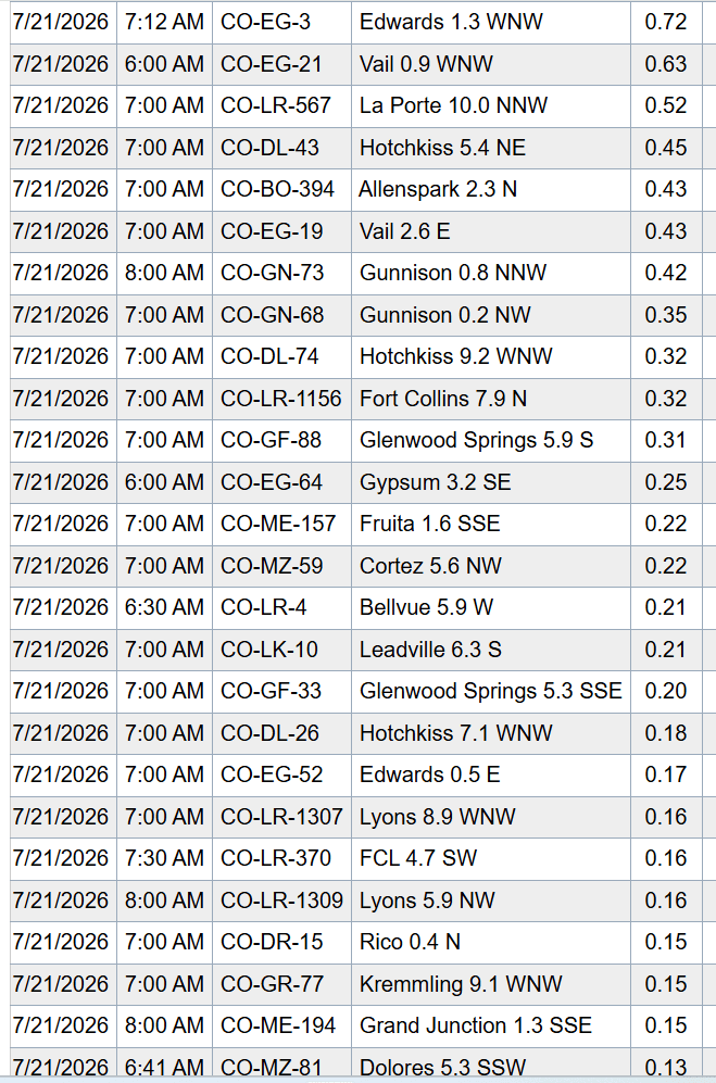
But first I include some top rain reports from CoCoRaHS:
Edwards 1.3 WNW: 0.72"
Vail 0.9 WNW: 0.63"
La Porte 10.0 NNW (north of Ft. Collins): 0.52"
Hotchkiss 5.4 NE: 0.45"
Allenspark 2.3 N: 0.43"
Gunnison 0.8 NNW: 0.42"
Fort Collins 7.9 N: 0.32"
Glenwood Springs 5.9 S: 0.31"
Fruita 1.6 SSE: 0.22"
Leadville 6.3 S: 0.21"
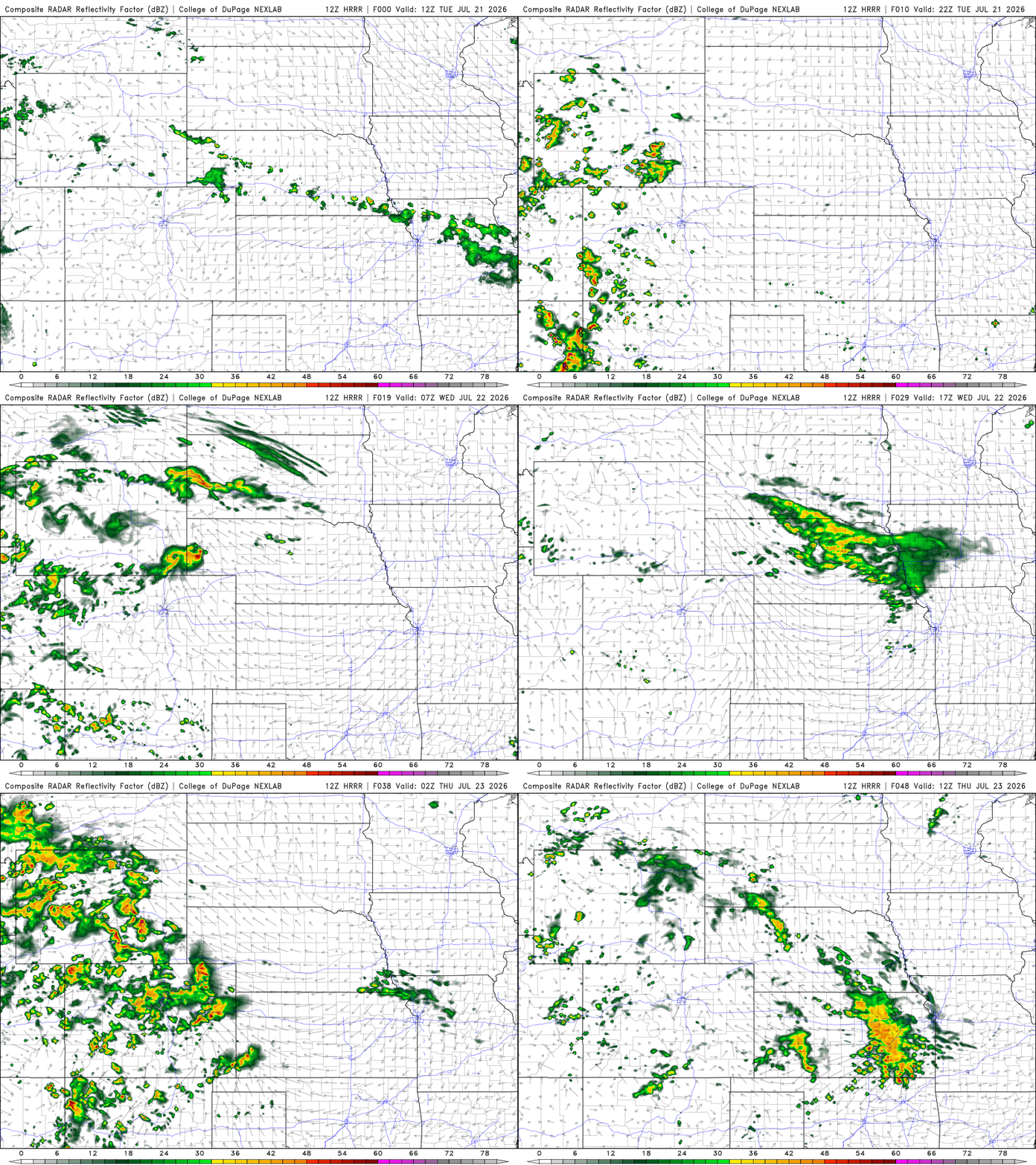
For today storms will first form in southwest CO / San Juans after 1pm, with good storm coverage there 1pm-10pm
Storms will develop over parts of the north-central mountains, northwest CO and the northern front-range mountains a bit later today: 3pm-10pm
For Den/Bou/Ft.Collins and the front-range, maybe a few late afternon / evening storms from near Boulder to Ft. Collins to the WY border: 8pm-11pm likely not much.
But the big weather days are coming up Wed and Thu (cooler with much better rain chances across much of the state).
Wednesday looks active: numerous storms in the mountains from 12pm Wed through 3am Thu.
For Den/Bou and the front-range on Wed: scattered to numerous storms from 1pm Wed through 2am Thu, heaviest, best rain chances in the 3pm-9pm timeframe, turning wet in spots. Cooler.
On Thu another good chance for storms across the mountains and front-range: 1pm-9pm again, I'll have more on that later.
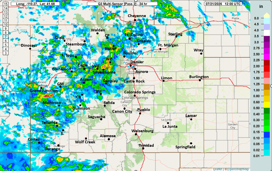
First image loop shows forecast radar over the next 48hrs (6am this morning to 6am Thu) from latest HRRR model. Second image shows top 24hr rain reports from CoCoRaHS (for the rain that fell yesterday). Third image shows 24hr observed rainfall from MRMS (from yesterday's rain). Fourth image shows forecast radar at 8pm tomorrow evening from HRRR, showing an active setup.

Like what you read?
Receive daily weather reports straight to your inbox with Seth's Daily Newsletter. Sign up below.
