Nice Memorial Day Weekend on tap, better storm chances Mon-Fri this week.
May 23, 2026
05/23/26 9:40am: Happy Memorial Day Weekend! Going to be a pretty nice weekend weather wise with lots of sun and warm temps with limited storm chances at least through mid-day Monday.
Looking ahead, a return to a more active and wetter pattern potentially from Mon evening through Fri as we come under the influence of an upper-level low to our west (and a preceding short-wave coming up from the southwest on Mon night into Tue).
For today mostly sunny and pleasant across much of the state (highs in the 70s for Den/Bou and will remain mostly dry).
Best chances for a few weaker storms today will be over south-central to southeast CO (San Juans to SLV to Sangres to southeast plains): 2pm-9pm. Much of the rest of the state stays dry.
For tomorrow a slightly better chance for storms over parts of the north-central mountains and front-range mountains and foothills between 1pm-8pm, but again fairly isolated activity.
For Den/Bou and the front-range some isolated, high-based storms late tomorrow 4pm-9pm, won't be much.
Then models show a short-wave moving up from the southwest on Mon into Tue with deeper moisture.
More numerous to scattered storms return the mountains, favoring southwest CO starting at 12pm.
For all the mountains scattered storms on Mon afternoon 1pm-10pm.
For Den/Bou and the front-range on Mon, starts out nice for the Bolder Boulder, good conditions, sunny with seasonable warm temps (should be about perfect). But then a chance for isolated to scattered storms from 3pm-10pm, favoring the foothills.
Looking ahead, we will stick with good thunderstorm chances in the mountains on Tue, less chances on the front-range.
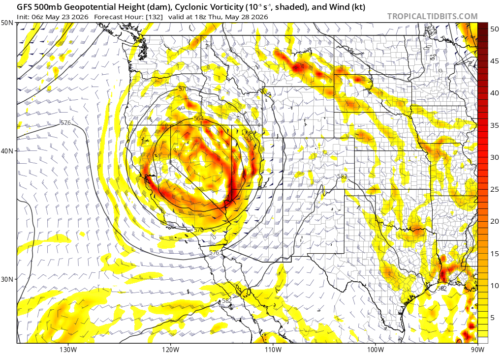
But then the big question for the later part of next week is: where will the big upper-level low track from Wed-Sat: will it stay further west (like ECMWF shows), or track further east, with bigger impacts to CO, like GFS shows to some degree.
Better rain chances for Den/Bou and the front-range starting Wed afternoon into Thu. Then likely the best rain chances with maybe a shot of colder upslope flow for Fri/Sat next week (05/29-05/30), looks unsettled next weekend, so stay tuned.
Maybe even more snow for the mountains at times Thu-Sat next week but details are very uncertain.
Overall I continue to see an active weather pattern into early to mid-June!
That is all for now. Enjoy the great weather this Memorial Day weekend!
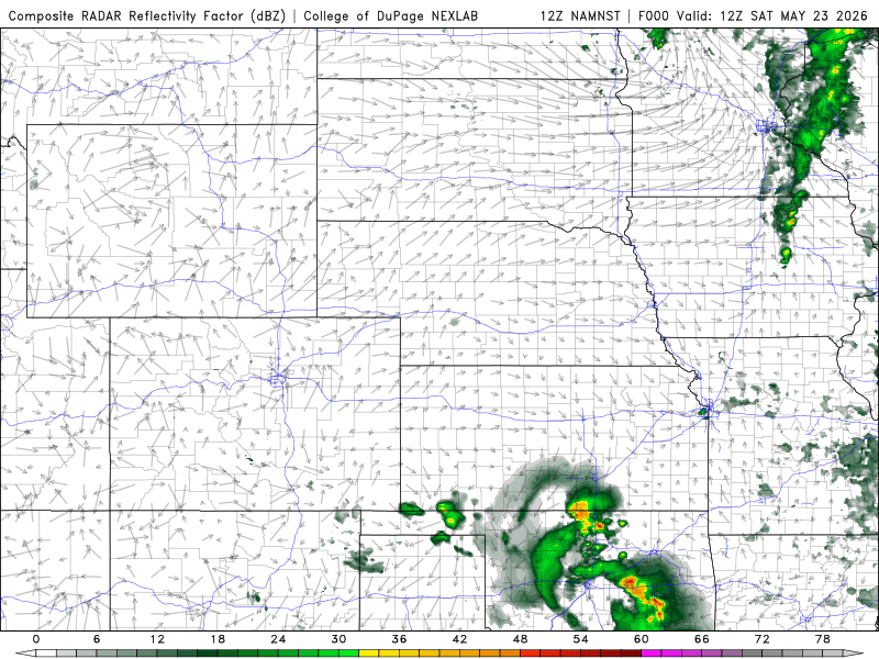
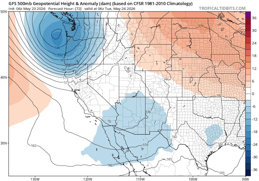
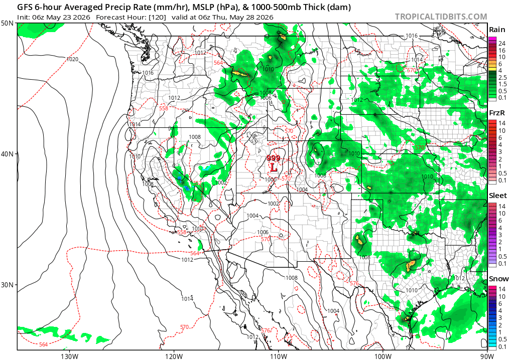
First image loop shows forecast radar over the next 60 hours (6am this morning to 6pm Mon) from latest NAM-3km model, take with grain of salt. Second image shows the next disturbance coming up from the southwest on Tue am, with the bigger upper-level low waiting in the wings. Fourth image shows forecast precip-type-rate on late Wed into Thu, showing potential upslope rain on the front-range. Fourth image shows the big upper-level low on Thu...our weather will depend on where this tracks.

Like what you read?
Receive daily weather reports straight to your inbox with Seth's Daily Newsletter. Sign up below.