Much cooler over eastern CO this morning (down from 105 to 55). A look at the forecast for the next few days
Aug 4, 2026
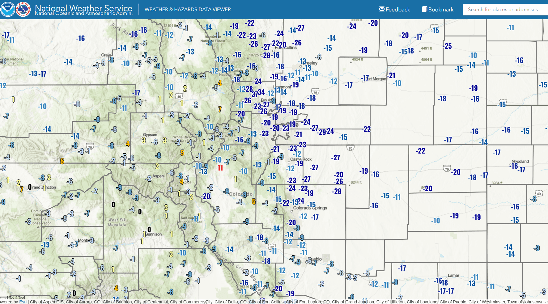
08/04/26 8:15am: This cold air is delightful! Currently only 55 degs at my house this morning (and over a good portion of Den/Bou). From nearly 105 yesterday to 55 right now, feels so good. And compared to yesterday morning, down 20-25 degs (it was 78 at this time yesterday).
You can see the big change in temperatures on the first image (showing 24hr temperature change). And Second image shows low temps this morning.
Denver had a low of 52 this morning! Berthoud Pass (top) had a low of 37! Winter is coming lol...just kidding back to death heat next weekend. But this is a nice break.
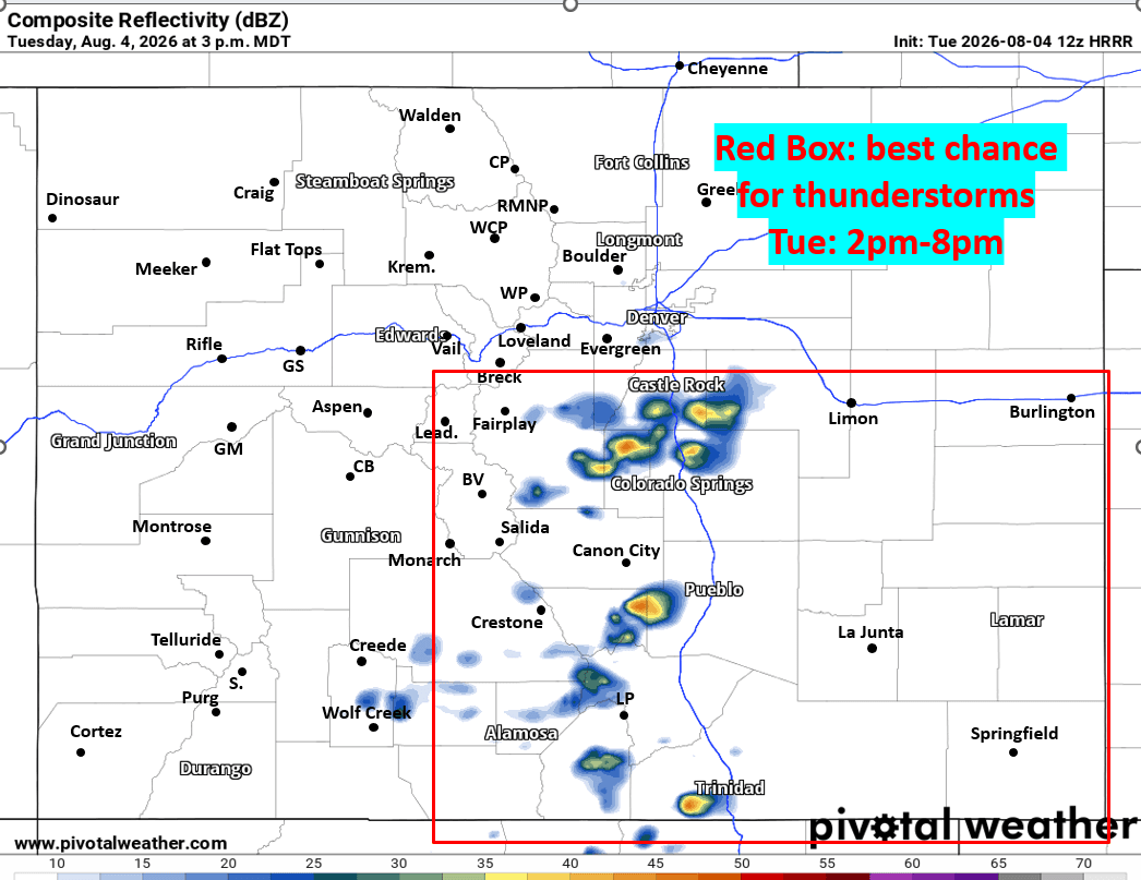
For today: best chances for thunderstorms will be over southeast CO mostly from the Palmer Divide south and east of the Cont. Divide (favoring areas from Springs to Pueblo east) between 2pm-8pm. I indicate this on the third image showing forecast radar at 3pm today from HRRR.
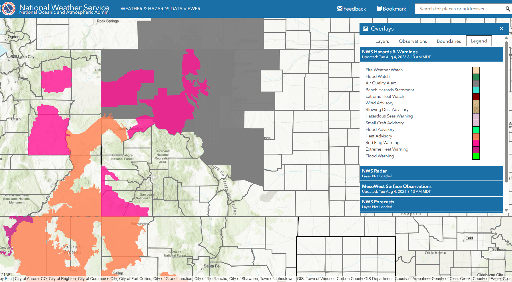
The other weather stories. Much of western CO including areas near Meeker, Craig, Kremmling, Steamboat, Vail, Beaver Creek, and Aspen areas are under a Red Flag Warning from 1pm-7pm today for hot and dry conditions with westerly winds of 15-30 mph. So heads up there.
For much of the north-central mountains including Summit, ClearCreek, Grand, western Boulder/Larimer counties a preemptive Fire Weather Watch for tomorrow (Wed) between 12pm-7pm: hot, dry with westerly winds of 15-30 mph.
For Den/Bou and the front-range (north and south) an Air Quality Alert through 6pm today for smoky skies...
But at least it will be nice and cool, high temps only in the upper 70s for Den/Bou today, 80s tomorrow, back to 90s on Thu. Near 100 for Fri-Sun.
Fourth image shows the hazards for the next two days.
How are conditions in your neck of the woods this morning? Enjoying the cool air?


Like what you read?
Receive daily weather reports straight to your inbox with Seth's Daily Newsletter. Sign up below.
