Monsoon surge Wed pm through Fri pm, favoring southwest CO
Sep 21, 2026
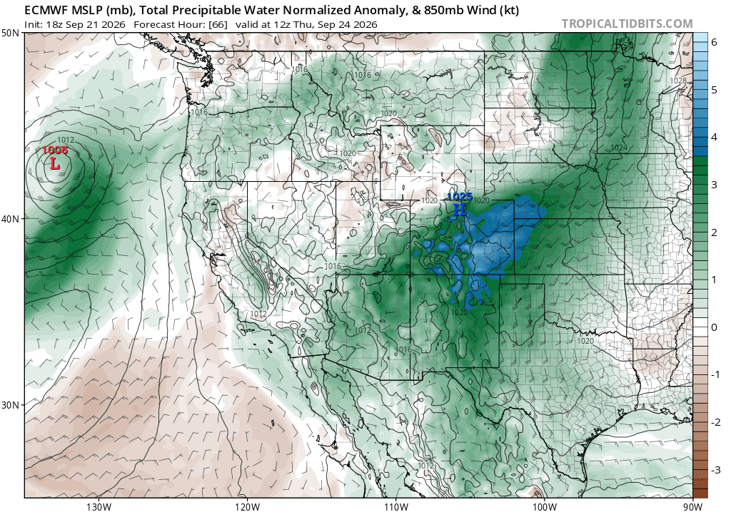
09/21/26 8:20pm: Hi. The weather is looking rather interesting from Wed pm through Fri pm as models show another big surge of monsoon moisture combined with a short-wave that will move up across the state from the southwest on Thu.
This type of setup favors very heavy rain for southwest CO / San Juans and parts of the central mountains but on the flipside it is not a good rain producer for Den/Bou and the northern front-range....
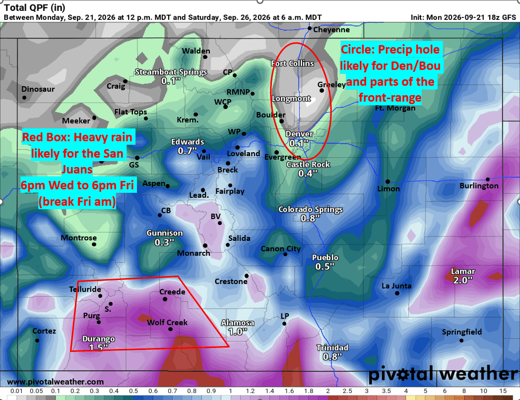
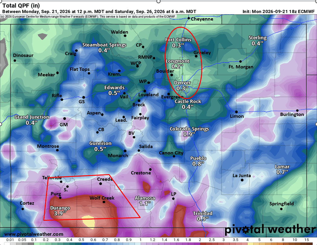
Hence when you look at model total precip maps from now through 6am Sat (images 1 and 2 below) you can see a precip hole over Den/Bou.
It also shows the potential for 2-4" of additional rainfall for the San Juans! With 0.50" to 1.50" generally for the rest of the central mountains (including the I-70 mountain corridor).
Biggest impacts expected from 6pm Wed to 6pm Fri with a nice break Fri am before more storms Fri afternoon / evening.
Looks pretty wet, soggy and chilly in parts of the mountains on Thu.
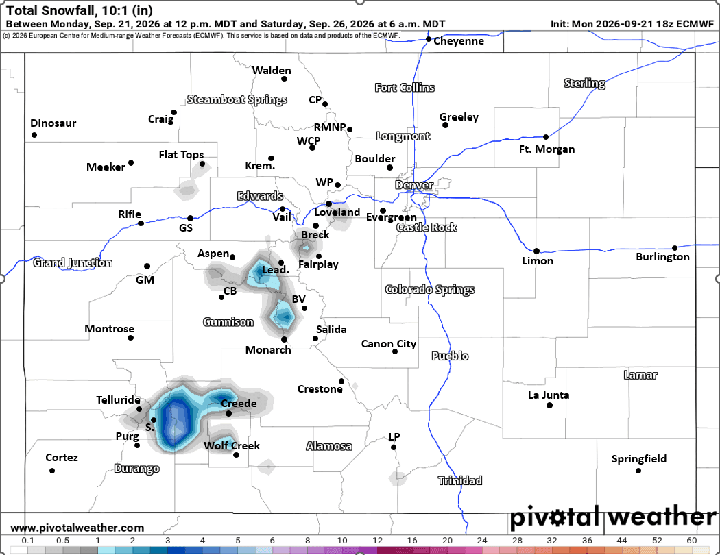
Also looks like there could be some snow on the higher peaks Wed night into Thu am, mostly above 12k ft, favoring the upper San Juans, Elks and parts of the Sawatch Range (Collegiate Peaks, etc). So maybe some fire and ice with the leaves on Thu and Fri mornings.
Den/Bou and the front-range could get a few rain showers Wed pm, some more Thu am, maybe some Thu pm and then likely best chance on Fri afternoon. But overall not looking like much precip, hit or miss storms, could be 0.10" to 0.40" in a few spots, or nothing, this southwest flow is not great for us.
The southern front-range and parts of the southeast plains (from Springs to Pueblo and east) could see some heavier rain / thunderstorms on Thu.
That is all for now. I'm loving this active weather pattern (as expected with El Nino). I know not everyone has received meaningful rainfall the last 2 weeks (parts of Den/Bou looking at you), but overall, a good portion of the state has had some very beneficial rain, and that looks to continue!
Front-range will come into better chances as we move towards later fall / early winter.
First two images show forecast total liquid precip from now through 6am Sat from latest GFS and ECMWF models, take exact precip amounts with a huge grain of salt as we are still dealing with thunderstorms, hit or miss rainfall but it just shows where the signals are the strongest for heavy rain. Third image shows forecast total snowfall through 6am Sat from latest ECMWF, take with a grain of salt. Fourth image shows the big surge of monsoon moisture via PWAT at 6am Thu from latest ECMWF model.

Like what you read?
Receive daily weather reports straight to your inbox with Seth's Daily Newsletter. Sign up below.
