Monsoon surge coming: Heavier rain (and snow up high) for the mountains from late Sun through Tue. More rain for front-range as well
Sep 13, 2026
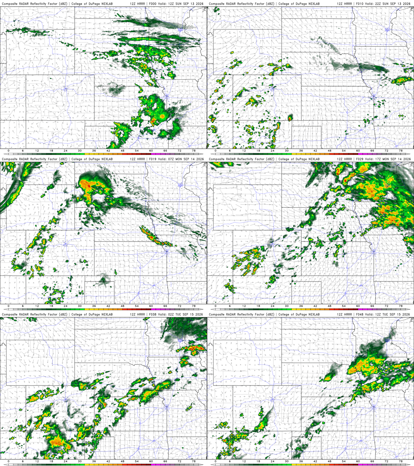
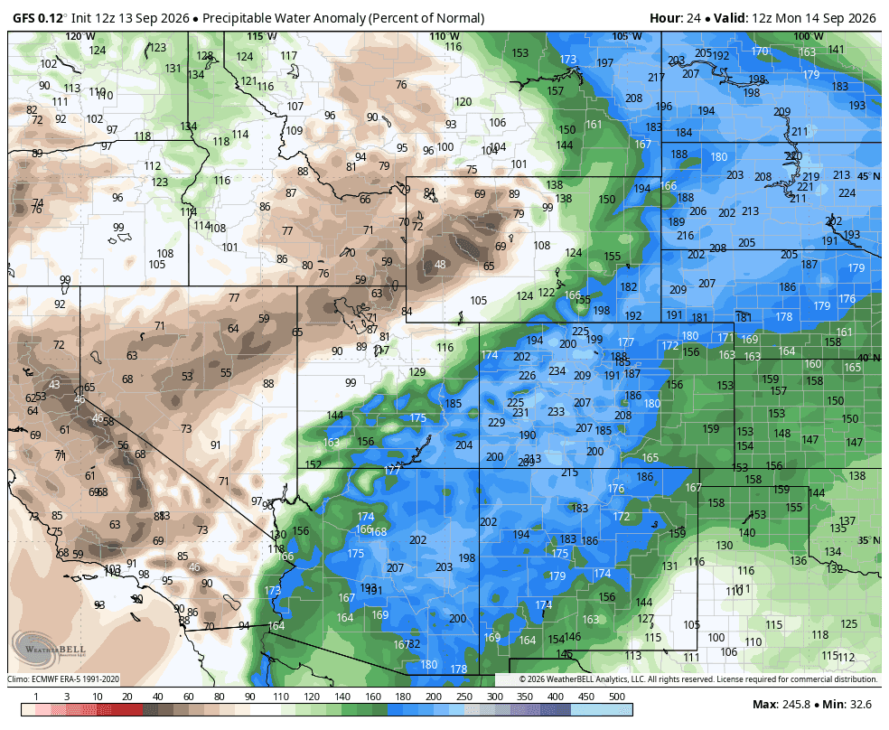
09/13/26 10am: Happy Sunday! We have some weather to talk about from tonight through Tue pm especially for the mountains. Models show a big surge of monsoon moisture combined with a short-wave that will move across the state Mon into Tue and this will produce some widespread rain across parts of the mountains and western CO with more scattered storms for the front-range (and also some snow above 12,500 ft).
First ahead of the main storm system (expected Mon/Tue) we will have some scattered thunderstorms for both the mountains and front-range today (Sun).
For the north-central and south-central mountains for today: scattered thunderstorms from 2pm-9pm initially
For Den/Bou and the front-range today (warm / hot) but then isolated to scattered storms from 4pm-10pm, hit or miss, likely won't be much.
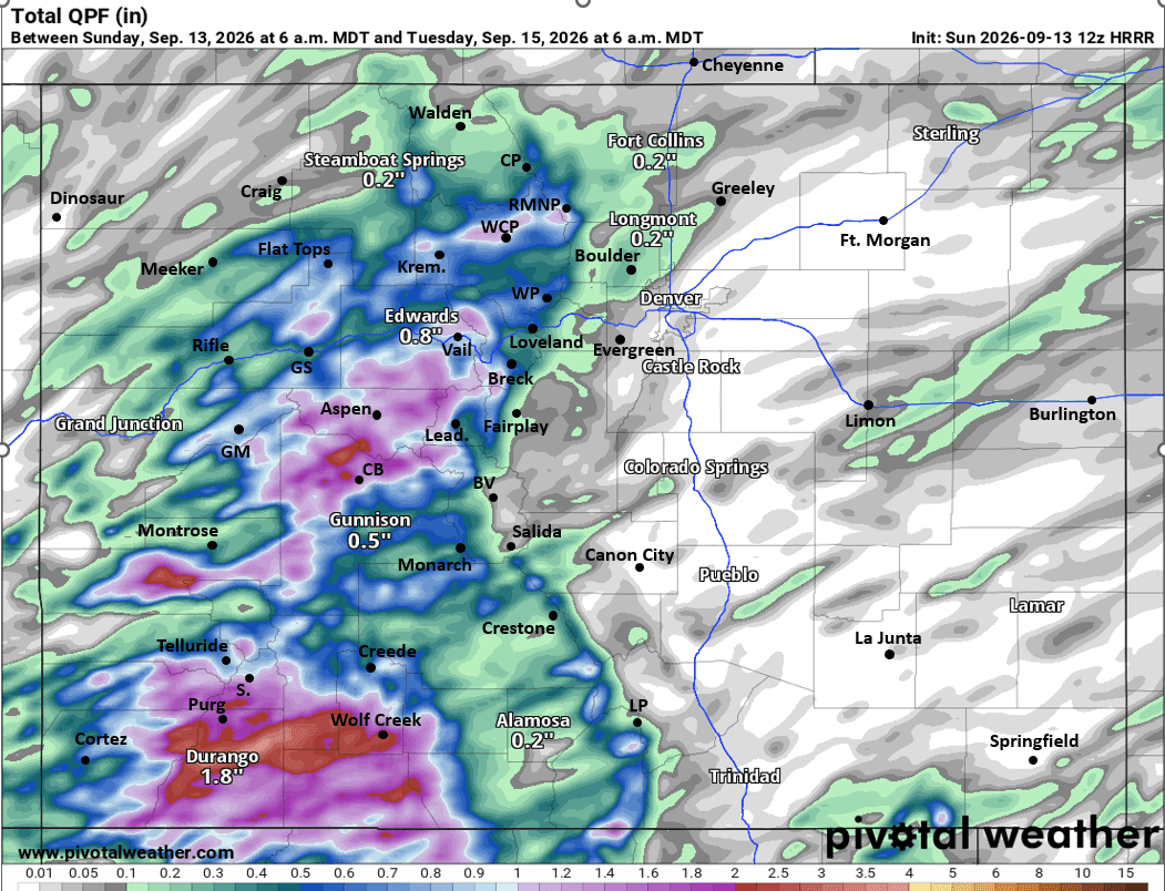
Then the main event for the mountains and western CO will be from about 12am Mon through 6am Tue. Rounds of heavier rain at times, favoring areas west of Vail Pass and especially from near the Elks to the San Juans. Parts of the mountains could get 0.75" to 1.75" of rain (heaviest for San Juans).
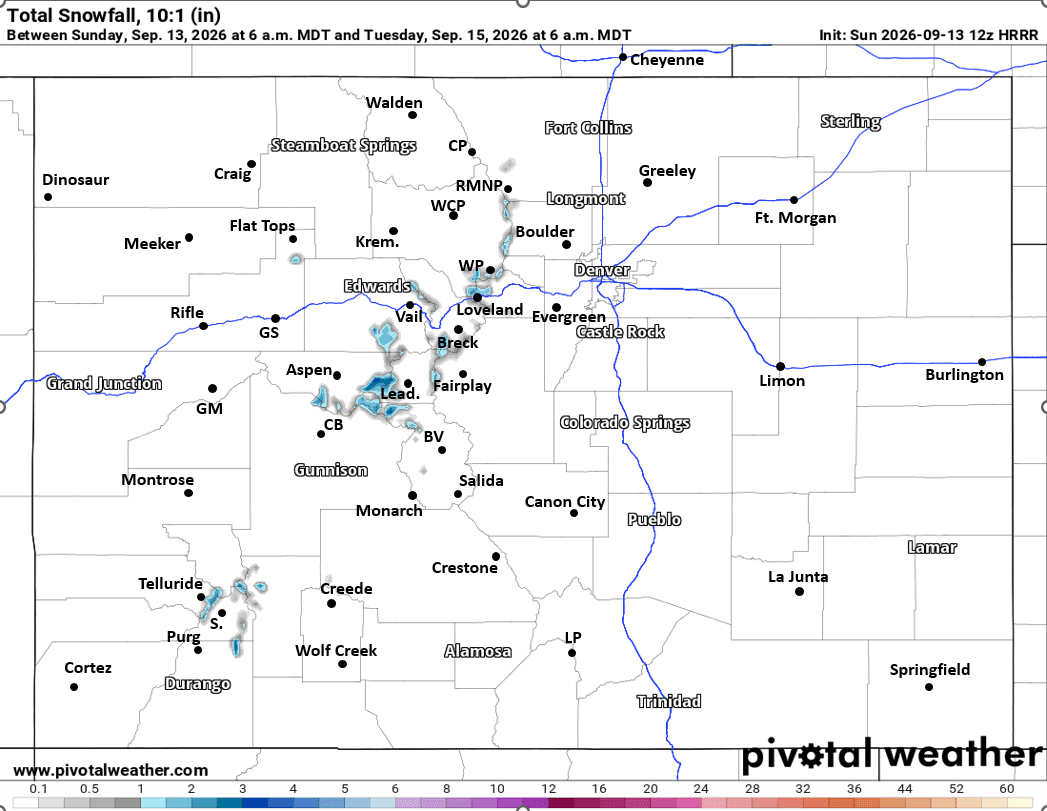
Also looks like some snow up high both Mon am and especially early Tue am. Initially a slight chance by early Mon am over the higher peaks. But then likely best chance for some snow above 12,500ft will be late Mon night into early Tue am. The 14ers in the northern Sawatch from near Quandary to Lincoln / Democrat group to the upper parts of the Elk Range (upper Bells, etc) will be favored for 1-3" of snow by Tue am (above 12,500ft)
More rain showers expected in the mountains on Tue afternoon as well.
For Den/Bou and the front-range also a chance for a few weak rain showers on Mon morning (will be socked in and cloudy, likely not much rain). Cooler Mon into Tue. Then another decent chance for rain from 2pm-9pm on Mon. Favoring areas from Denver south and especially from the Palmer Divide to Spring and Pueblo on Mon afternoon into Tue am (southeast CO will be favored).
There could be more rain showers for Den/Bou on Tue am as well. Then another chance for afternoon storms on Tue: 4pm-9pm again, favoring the foothills. Cooler on Tue as well.
More rain possible Wed into Thu but the details need to be worked out.
So you can see we will enter a much more unsettled period, especially through Tue am.
Also stoked on some snow for the high peaks... Speaking of snow I will open up / post the First Snowfall Contest tonight (look for that on this page and in the group), start thinking about your first snowfall dates for Silverthorne/Dillon and also Denver/Boulder, more on that soon.
First image loop shows forecast radar over the next 48hrs (6am this morning through 6am Tue) from latest HRRR. Second image shows the big surge of moisture via PWAT (percent above average) valid Mon am from GFS (big surge). Image 3 shows forecast total liquid precip from now through 6am Tue from latest HRRR and fourth image shows forecast total snowfall (10:1 ratio) by Tue am, most of this early Tue, take with a grain of salt, but you get the idea, its time!

Like what you read?
Receive daily weather reports straight to your inbox with Seth's Daily Newsletter. Sign up below.
