Latest rain/snow reports from the last 24hrs and a look ahead towards the last storm system for the week.
May 20, 2026
05/20/26 8am: Great to see more meaningful rain and snow across the state over the last 24hrs! Some recent rain and snow reports below.
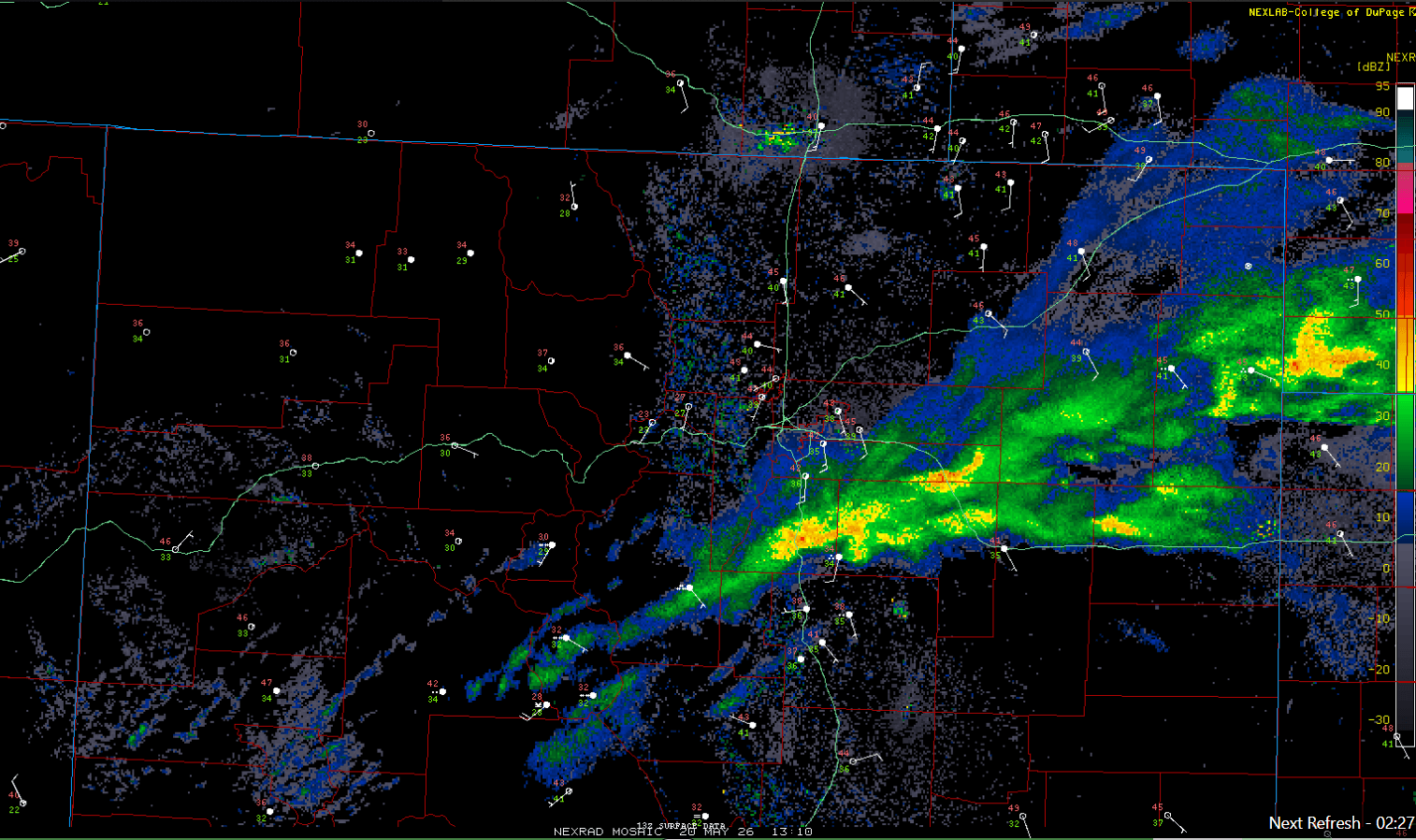
The sun is finally out along the front-range and over parts of the mountain, but it's still raining along parts of the Palmer Divide, closer to Springs and extending into parts of the eastern plains this morning and you can see on the near current radar image below (second image).
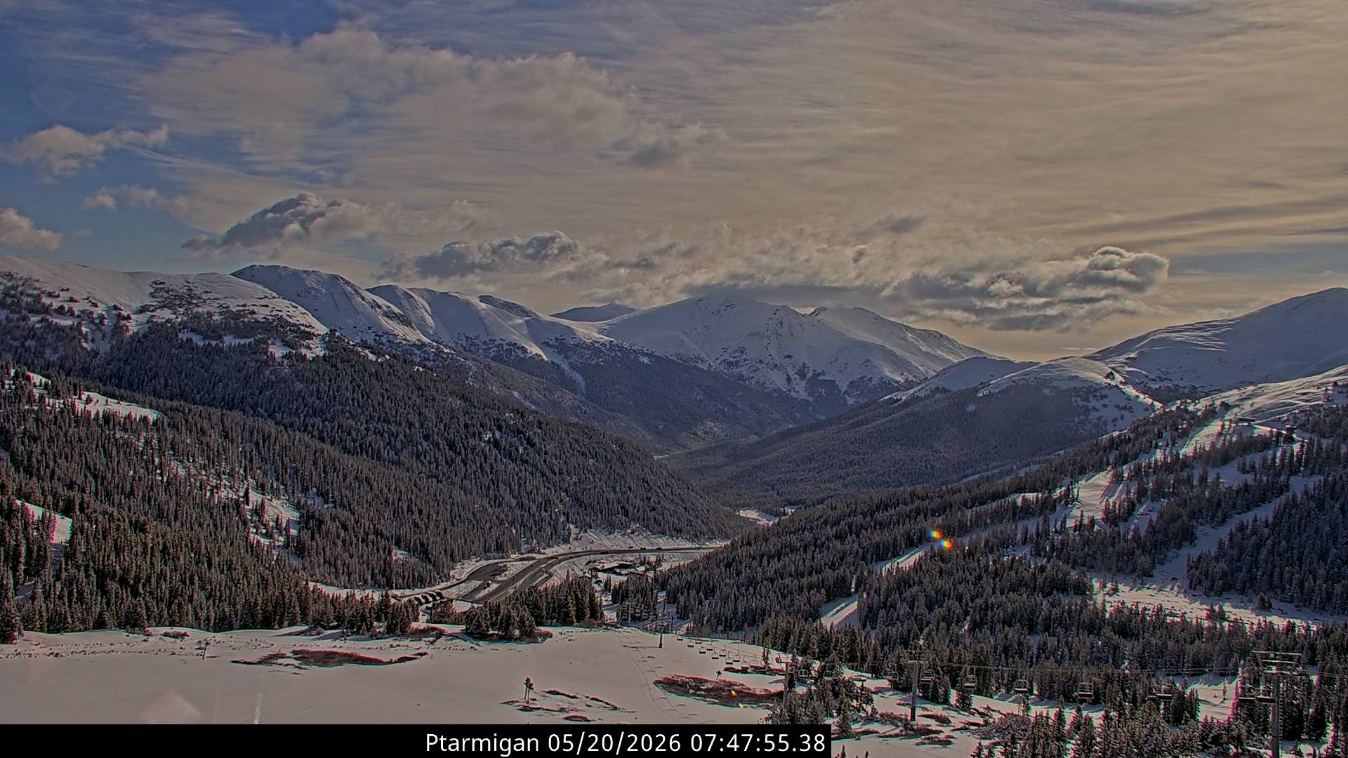
Nice to see more snow in the mountains. Sun is popping out near Loveland ski areas and after nearly 10" in the last 3 days, it's looking proper up there (for Mayuary that is lol). First image below from Loveland ski area this morning.
First here are some notable 24hr (and 3 day snow totals) from ski areas (snow-stake cams) and from SNOTEL (via CAIC):
Loveland: 4” (10”)
Lake Eldora snotel: 4” (10”)
Bear Lake snotel: 4” (9”)
A-Basin: 3” (9”)
Berthoud Pass snotel: 2.2” (9.4”)
Winter Park: 3” (8”)
Cameron Pass 1” (11”)
Copper: 1” (5”)
Next here are some notable 24hr snow reports from the foothills (this is on top of all the snow from Mon/Tue):
Buena Vista 4.0 WNW 5.6”
Woodland Park 1.2 NW 5.6”
Dumont 2.0 WNW 4.7”
Ward 4.6 NE 3.8”
Allenspark 0.9 W 3.2”
Divide 5.2 SSW 2.9”
Conifer 1.8 SSE 2.9”
Nederland 0.4 WNW 2.4”
Westcliffe 0.6 NW 2.0”
Monument 2.6 E 1.2”
Estes Park 1.8 S 1.1”
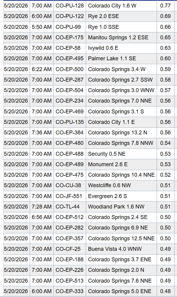
Lastly here are some notable 24hr rain reports from CoCoRaHS (again this is on top of all the rain from Mon/Tue). Much of the front-range including Den/Bou has picked up 0.75" to 1.50" of total rainfall in the last 3 days.
Colorado City 1.6 W 0.77”
Rye 2.0 ESE 0.69”
Manitou Springs 1.2 ESE 0.65”
Palmer Lake 1.1 SE 0.60
Colorado Springs 3.4 W 0.59”
Monument 2.6 E 0.53”
Westcliffe 0.6 NW 0.51”
Evergreen 2.6 S 0.51”
Buena Vista 4.0 WNW 0.49”
Pueblo 17 W 0.45”
Dumont 2.0 WNW 0.44”
Boulder 2.4 NW 0.33”
Lakewood 1.5 WSW 0.32”
Longmont 2.9 SSW 0.21”
Littleton 1.4 ENE 0.19”
Denver 2.9 SSE 0.17”
Westminster 1.1 SW (house) 0.03"
Anyway, we have another fairly active weather day in-store as another short-wave will move through. The focus will be along parts of the frontr-range, especially from Denver south and east.
For Den/Bou and the front-range a chance for scattered thunderstorms between: 12pm-8pm, best chances 2pm-5pm, with best coverage from Boulder south and east.
Some stronger storms in spots after 1pm today from Palmer Divide towards Springs and east / southeast, over the eastern plains (some hail, wind and brief heavy rain in spots).
In the mountains, most of the action will be over parts of the Front Range mountains, east of the Cont. Divide with a few storms after 1pm as well (Loveland, G/T, Berthoud, IPW and east).
Third image loop shows forecast radar over the next 48hrs (6am this morning through 6am Fri) from latest HRRR model.
Looking ahead, next storm system (a short-wave coming in from the northwest) will bring more rain/snow to northern CO and the front-range from about 12pm Thu to 6am Fri. Some questions on how far north this wave tracks and that will impact rain/snow amounts. But additional snow for the mountains is likely on Thu evening and more rain for the front-range. I'll have more on that later.
How are conditions in your neck of the woods? How much more rain and snow did you get?

Like what you read?
Receive daily weather reports straight to your inbox with Seth's Daily Newsletter. Sign up below.