Latest rain reports. More rain on the way today (already raining in spots).
Jul 27, 2026
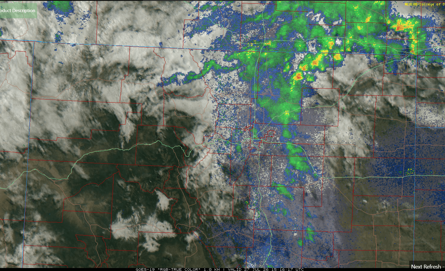
07/27/26 9:10am: Morning, its Monday. But at least its cloudy out there with some rain still falling in spots across northeast CO. Latest radar shows some rain showers just northeast of Denver, near and east of Ft. Collins to Greeley (third image).
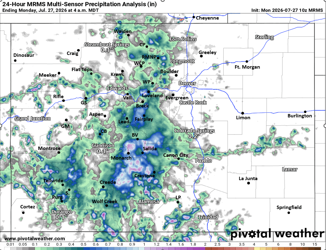
But more importantly another round of healthy rain totals across much of CO, especially southern CO from all the rain that fall yesterday and last night!
First image shows 24hr observed rainfall from MRMS (but via Pivotal Weather). I also show top 24hr reports from CoCoRaHS.
Here are some notable rain reports:
Pagosa Springs 6.8 WNW: 1.57"
La Veta 8.1 W: 1.20"
Durango 4.4 ENE: 0.82"
Buena Vista 4.0 WNW: 0.68"
Estes Park 1.8 S: 0.64"
Ridgway 3.3 NNW: 0.59"
Crested Butte 6.2 N: 0.50"
Leadville 6.3 S: 0.50"
Allenspark 2.3 N: 0.49"
Fairplay 2.7 WNW: 0.49"
Ouray 2.1 NNW: 0.49"
Salida 0.3 NW: 0.31"
Del Norte 2.5 ENE: 0.29"
Rollinsville 0.1 WNW: 0.27"
Vail 2.6 E: 0.06"
More rain and thunderstorms on the way today.
Some rain for northeast CO this morning but that won't last too long.
Then with the cooler and cloudier skies we will have to wait until late this afternoon for more rain in Den/Bou: a good chance for scattered storms between 4pm-9pm today, some stronger storms possible in spots (best chances in the foothills, along/east of I-25 and near/along the Palmer Divide today.
For the north-central and south-central mountains: another good chance for scattered thunderstorms from 12pm-10pm, heavy rain in spots.
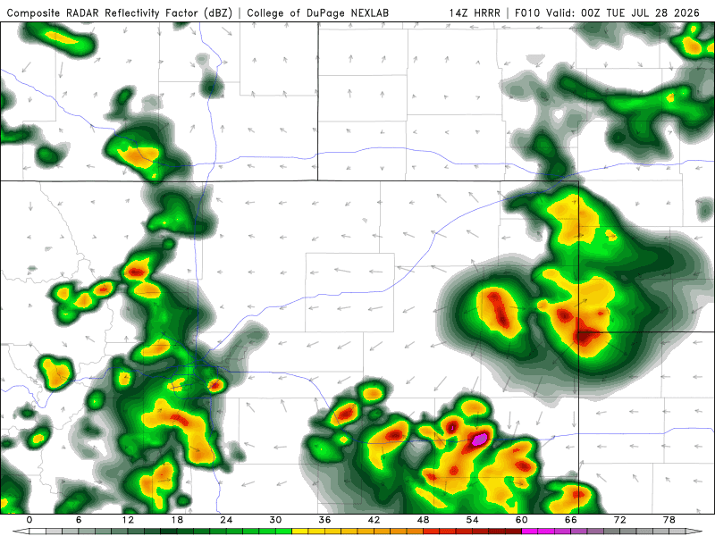
Third image is current, local satellite/radar overlay. Fourth image shows forecast radar at 6pm today from latest HRRR (zoomed in over northeast CO).
How are conditions in your neck of the woods this morning? How much rain did you get yesterday?


Like what you read?
Receive daily weather reports straight to your inbox with Seth's Daily Newsletter. Sign up below.
