Latest rain reports from Sun night. Cooler with better thunderstorm chances this week
Jun 22, 2026
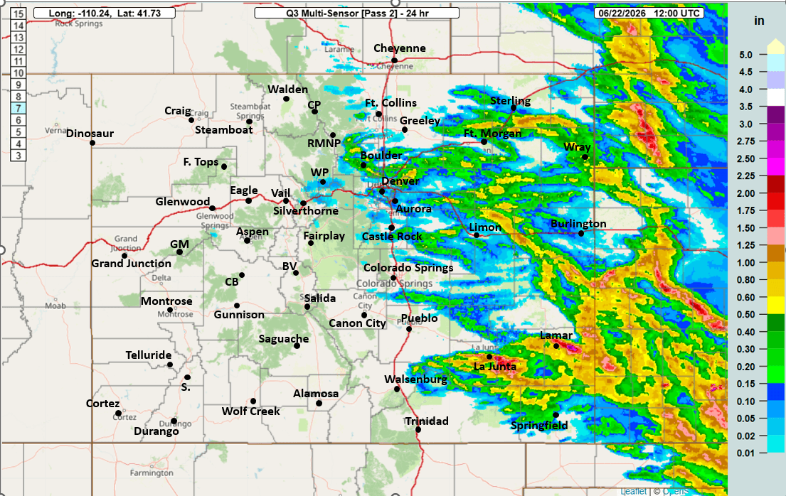
06/22/26 9:30am: Morning, its Monday. Frist good to see some meaningful rain in spots across parts of Den/Bou yesterday, mostly from the storms that moved through last night (around 10:30pm, and some before that).
Areas closer to Boulder, Louisville, Lafayette and Broomfield picked up 0.25" to 0.50" of rain with some hail and lots of lightning as well. At my house, mostly a miss, with just 0.03" of rain. Also come good rain across parts of southeast CO.
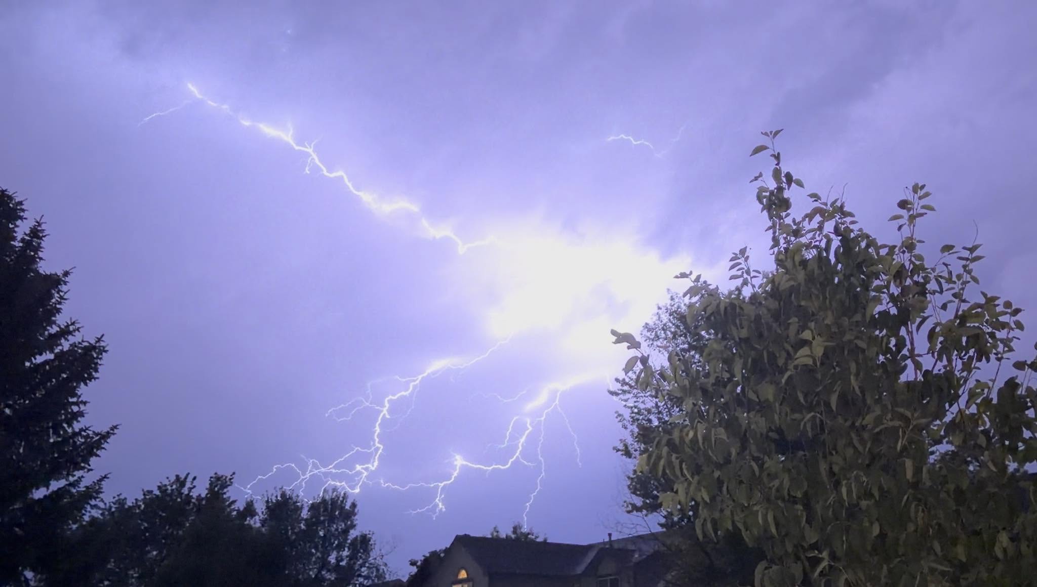
Photo 2 is from my work colleague Jared Lee: “Probably my best lightning photo ever!! This screen grab is from a video I took from the approaching thunderstorm that just rolled through about 10:30pm tonight. I was worried about 1” hail, but thankfully the worst we got was just a few peas while the rain was DUMPING. We got about 0.11” from the first storm an hour earlier, then another quick 0.18” or so from this second storm.”
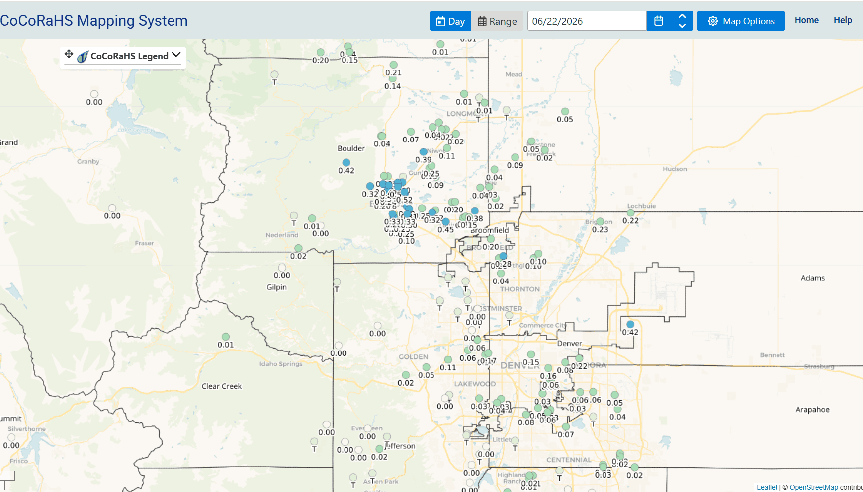
Anyway, here are some notable 24hr rain reports from CoCoRaHS:
Lamar 4.3 NE: 1.00"
Wray 4.2 NNE: 0.75"
Boulder 0.8 NE: 0.52"
Louisville 1.2 NNW: 0.45"
La Junta 17.5 S: 0.43"
Jamestown 2.5 SSE: 0.42"
Aurora 8.5 NNE: 0.42"
Niwot 2.3 W: 0.39"
Lafayette 0.9 NE: 0.38"
Broomfield 1.0 NE: 0.20"
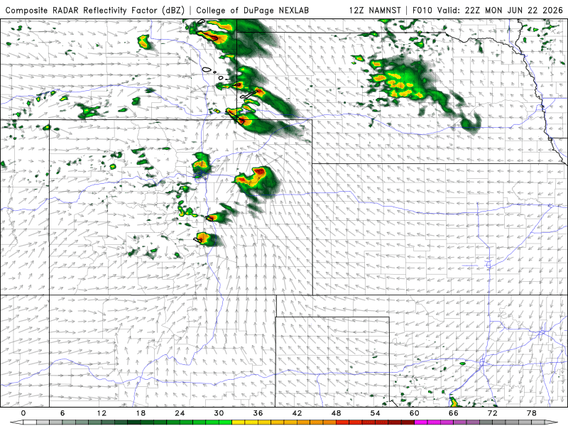
For today, a decent chance for some scattered, weak thunderstorms over the front-range (Den/Bou) between 1pm-6pm. Best chances and strongest storms likely just east / southeast of Denver, near the Palmer Divide and east.
Tomorrow also looks interesting with another cold-front pushing into northern CO / down the front-range on Tue evening, this will provide lift for more rounds of storms: 3pm-8pm initially on Tue.
Then a chance for some overnight storms on Tue night into Wed depending on how surface boundaries and fronts setup.
Cooler overall especially Tue-Thu on the front-range
Better rain chances return to the mountains on Thu and Fri, I'll have more on that soon.
First image shows 24hr rainfall from MRMS. Second image is from Jared Lee of the lightning last night. Third image shows 24hr rainfall reports over Den/Bou from CoCoRaHS. Fourth image shows forecast radar at 4pm today from NAM-3km model.

Like what you read?
Receive daily weather reports straight to your inbox with Seth's Daily Newsletter. Sign up below.