Latest on the forecast for the weekend and some cold and light snow next week.
Jan 31, 2026
01/31/26 10:20am: Morning, can you believe its the last day of January! Anyway, just a bit of weather to talk about.
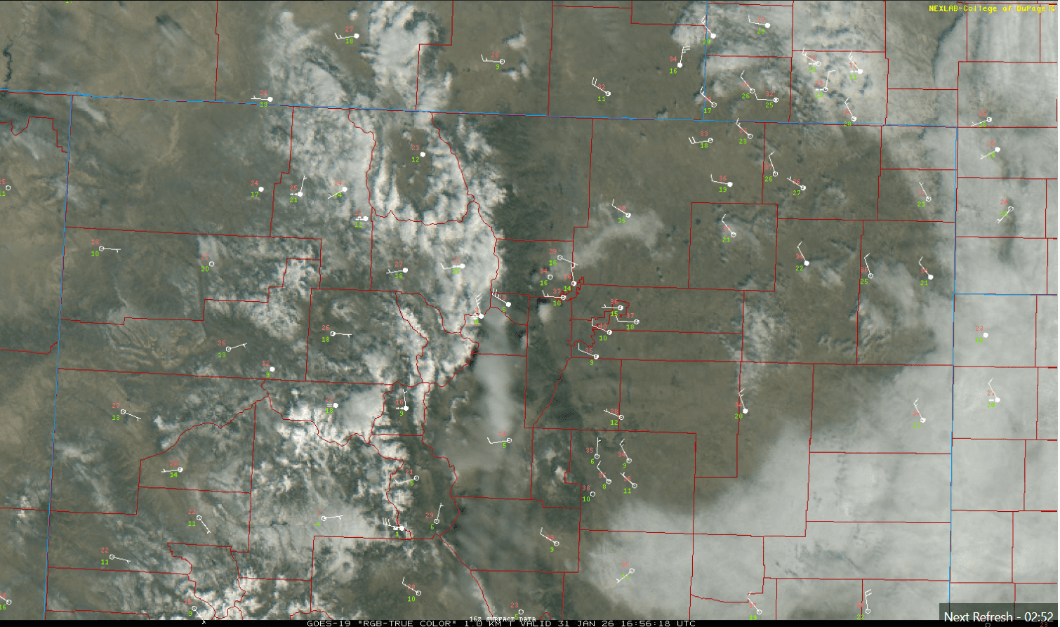
First some low clouds and fog are clearing out over parts of the front-range and eastern plains behind last night's cold front. Its warming up nicely in Den/Bou as the westerly wind scours out the colder air (already 49 at my house, after a low of 21) There were a few snow flurries in spots last night (I think southwest Boulder reported 0.1" of snow).
In the mountains just a little bit more snow overnight with some snow showers ongoing near the Cont. Divide. Areas like Loveland, Steamboat and Winter Park reported 1" of new snow over the last 24hrs. A few snow showers will linger in the mountains through this evening.
Anyway, some drier and seasonably warmer weather on tap from today/tomorrow through mid-day Tue, then a little storm system and cold-front for the front-range (with some snow for the mountains and snow flurries for Den/Bou).
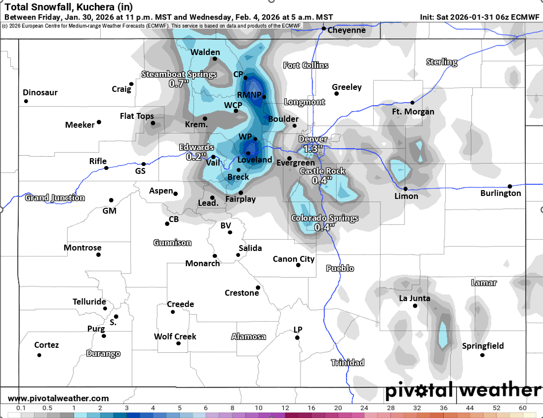
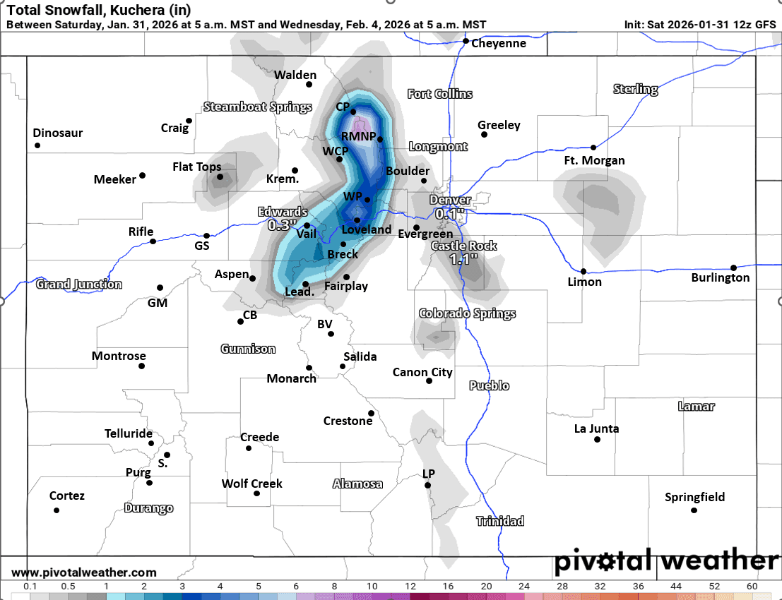
For the north-central mountains next round of light snow / snow-showers expected from 11am Tue to 11am Wed: 1-4" of new snow, favoring the Front Range mountains (near Cont. Divide), Loveland Pass, Berthoud Pass, WP, IPW, RMNP, Cameron Pass etc
For Den/Bou and the northern front-range a stronger cold-front will move in from the north on Tue afternoon / evening. Then a chance for some snow-showers / light snow mostly from 8pm Tue to 5am Wed. Trace-2" in a few spots, favoring the Palmer Divide and foothills west/southwest of Denver (likely not that much for Den/Bou proper) but will be chilly on Tue evening into Wed (20s and 30s).
Then a ridge of high pressure will dominate the weather across the state from about Wed, Feb 4th through Mon, Feb 9th.
Then potentially a more active pattern with a storm for the mountains starting around Feb 10th/11th, or 12th/13th depending on what model you look at, but snow and cold much more likely in the time-frame from Feb 10th-Feb15th (details have to be worked out).
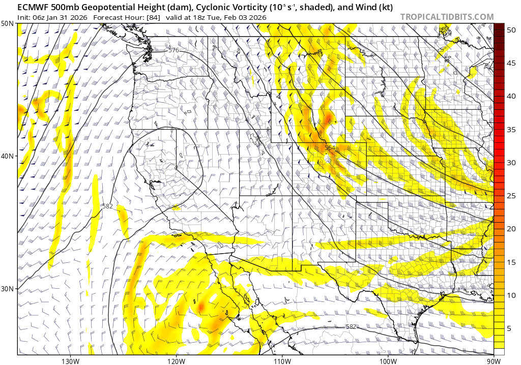
First image is current satellite / surface overlay showing the fog and colder air clearing out now. Second image shows the initial short-wave moving into CO on Tue afternoon via 500mb vorticity / wind from latest ECMWF. Image 3 and 4 compare forecast total snowfall from now through 5am Wed from latest ECMWF and GFS models, take amounts with grain of salt.

Like what you read?
Receive daily weather reports straight to your inbox with Seth's Daily Newsletter. Sign up below.