Latest on some snow in the mountains and more strong wind expected today and tomorrow.
Dec 10, 2025
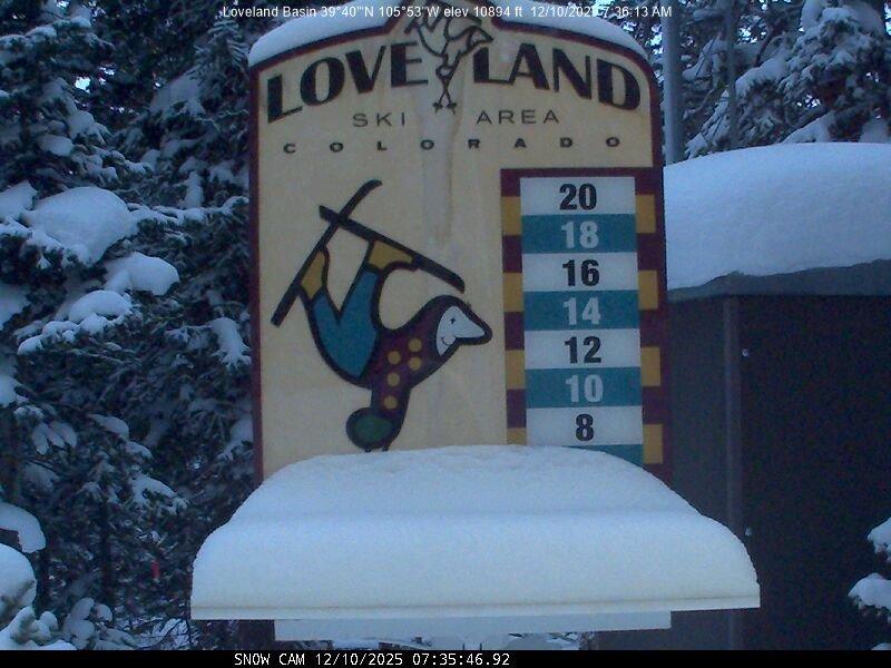
12/10/25 8am: Well at least there was a little snow at some of the ski areas last night as expected, because otherwise we are just talking about wind going forward. First, good to see 4" at Loveland, 2" at A-Basin and 1-2" at some of the other local ski areas.
Here are some notable snow reports:
Loveland: 4"
A-Basin: 2"
Keystone: 1"
Breck: 1"
Eldora: 1"
Winter Park: 1"
Steamboat: 1"
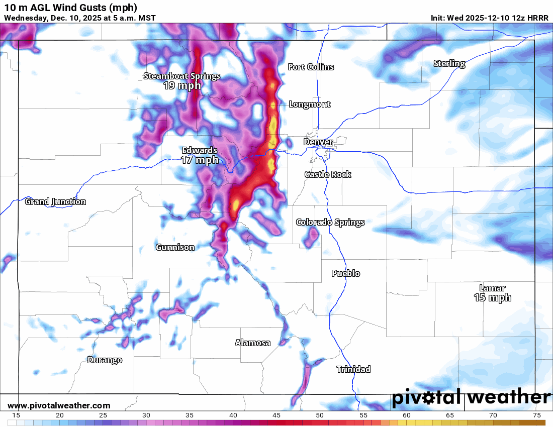
Anyway, we are looking at windy conditions at times, especially for the Front Range mountains and foothills along/east of the Cont. Divide above 9k ft. Both this afternoon / evening and tomorrow afternoon and evening.
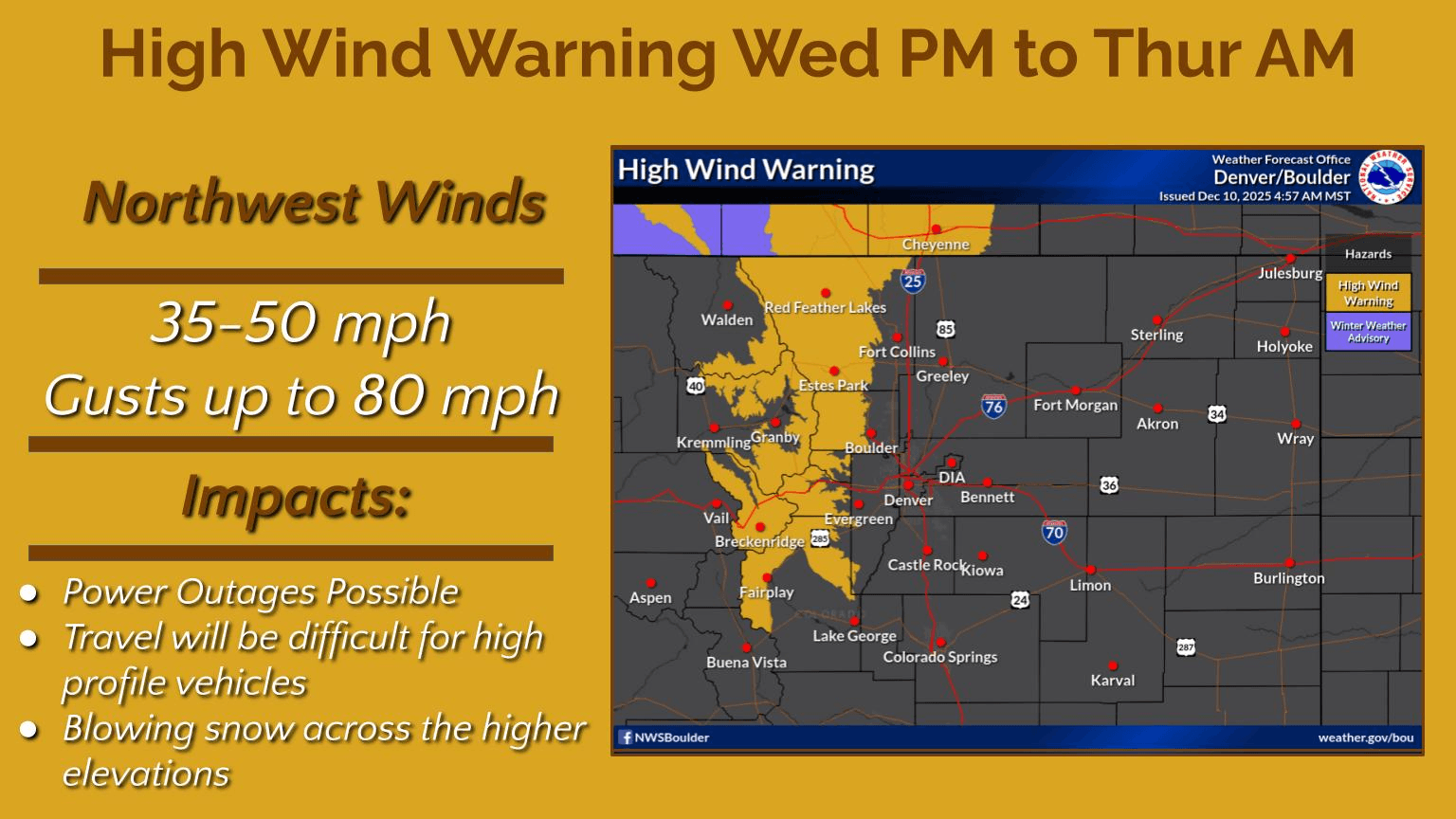
In fact most of the eastern north-central mountains and front-range mountains are under a High Wind Warning again from 11am today through 11am Thu for westerly wind-gusts of 40-80 mph (sustained 30-50). Strong wind will likely continue in the mountain through Thu evening. Looks much better on Fri/Sat.
For Den/Bou not nearly as breezy but more windy at times especially from 11am-5pm Wed and Thu: west / northwest wind-gusts of 20-40 mph.
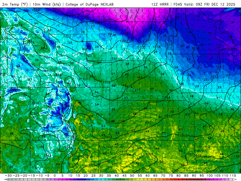
As mentioned, it will be very warm in Den/Bou tomorrow: highs near 65. Then models show a dry, backdoor cold-front moving into the front-range from the northeast on Fri am, this will cool things back down to the upper 50s on Fri. Then back in the low 60s and dry for the weekend.
For the mountains will be dry and breezy Fri-Sun with temps in the 40s/50s (mountains towns).
First image is current view of the Loveland snow-stake. Second image shows the current High Wind Warnings from NWS. Third image loop shows forecast wind-gusts over the next 48hrs (5am this morning to 5am Fri). Fourth image shows the cold-front moving into the front-range on early Fri am.

Like what you read?
Receive daily weather reports straight to your inbox with Seth's Daily Newsletter. Sign up below.