Increasing thunderstorm chances from today through Sun. Then snow possible for Den/Bou and especially the foothills on Mon
May 15, 2026
05/15/26 9:20am: Happy Friday. We will have increasing thunderstorm chances each day from today (Fri) to Sat, to Sun ahead of the main storm system which is till expected from Sun afternoon through Mon night and that is still looking potent (with a chance for snow for Den/Bou and some moderate / heavy snow for parts of the foothills and mountains).
For today best storm chances will be southeast of a line from Breck to Parker: Palmer Divide and south / east from 3pm-8pm.
For much of Den/Bou and the rest of the mountains just isolated, high-based storms this afternoon, won't be much, most areas stay dry (and will be hot again with highs in the upper 80s, breezy)
For tomorrow better storm chances as a short-wave moves through with a focus for severe storms over the northeast plains (east of Denver) after 2pm tomorrow.
For the north-central mountain tomorrow scattered thunderstorms from 12pm-8pm.
For Den/Bou tomorrow (Sat) a chance for some stronger, scattered storms from 1pm-7pm, best chances will along/east of I-25 and towards the eastern plains (2pm-6pm). Eastern plains will have some severe thunderstorms in spots with hail, brief heavy rain and wind.
Then it gets rather interesting on Sunday with more rain/snow moving in:
For the north-central mountains on Sun there could be an initial, early round of rain and thunderstorms (snow above 10kft): 10am-3pm. Then much more consistent rain/snow moves in after 5pm Sun.
For Den/Bou and the front-range on Sun, also the chance for an earlier round of thunderstorms: 11am-4pm. Then more consistent rain and stronger storms after 6pm Sun.
Then the main storm system will bring heavier rounds of rain / snow from about 6pm Sun through 9pm Mon.
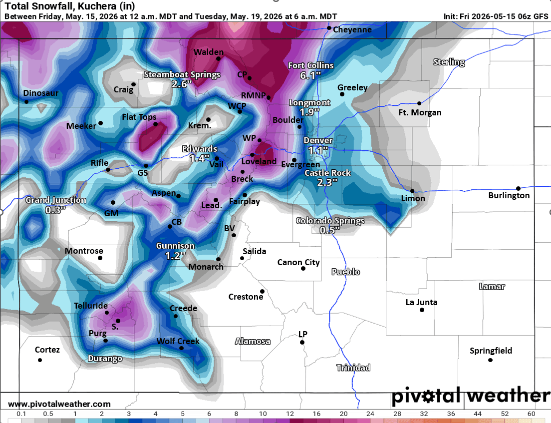
Does look like Den/Bou and the lower elevations will have a rain/snow mix or all snow falling between 3am-12pm on Mon. Could be 1/2" to 3" of wet snow on grassy surfaces by midday Mon, favoring western suburbs / higher terrain. More importantly likely 0.75" to 1.25" of liquid, favoring the northern front-range from Boulder to Ft. Collins again.
For the foothills west of Den/Bou/Ft.Collins looks like all snow above 7k ft from 2am-2pm Mon. Could be 4-10"+ of new snow above 7k ft again favoring parts of Jefferson, Gilpin, eastern ClearCreek and especially western Boulder and Larimer counties.
The north-central mountains will also get a good shot of snow from about 11pm Sun through 4pm Mon: Also 4-10"+ of new snow favoring the front-range mountains (Loveland, Jones, Berthoud Passes, Grays/Torreys, Winter Park, IPW, RMNP, Cameron Pass areas will be favored).
Cold Mon night into Tue, we will have to protect gardens and hose lines again!
Thats all for now.
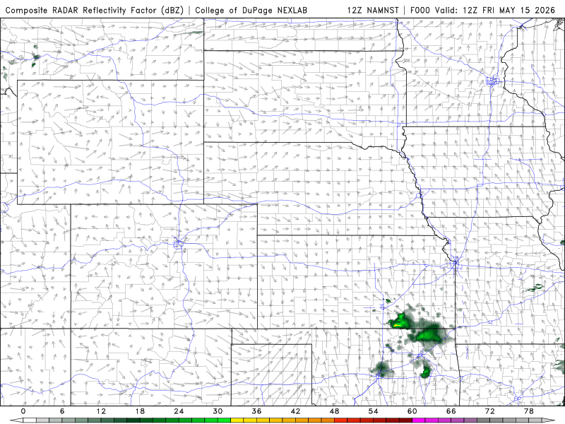
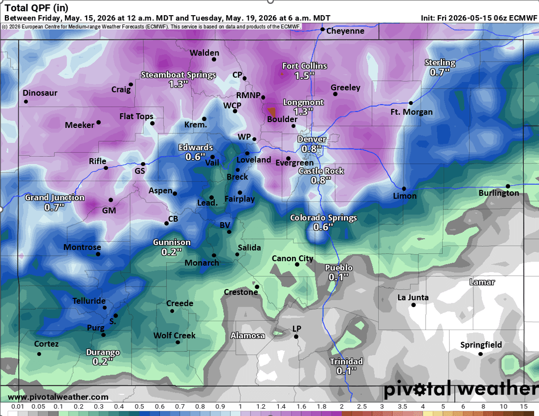
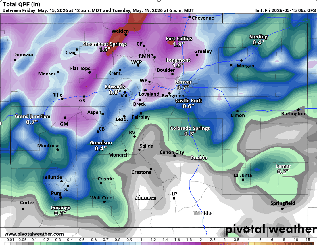
First image loop shows forecast radar over the next 60 hours (6am this morning through 6pm Sun) from latest NAM-3km model, take with grain of salt. Images 2 and 3 compare forecast total liquid precipitation (rain and melted snow) from now through 6am Tue from latest ECMWF and GFS models. Image 4 shows forecast total snowfall from GFS through 6am Tue (most of this on Mon), take with grain of salt (likely overdoing it in spots, like near Ft. Collins).

Like what you read?
Receive daily weather reports straight to your inbox with Seth's Daily Newsletter. Sign up below.