Impressive 24hr rain reports (from 08/26)
Aug 27, 2026
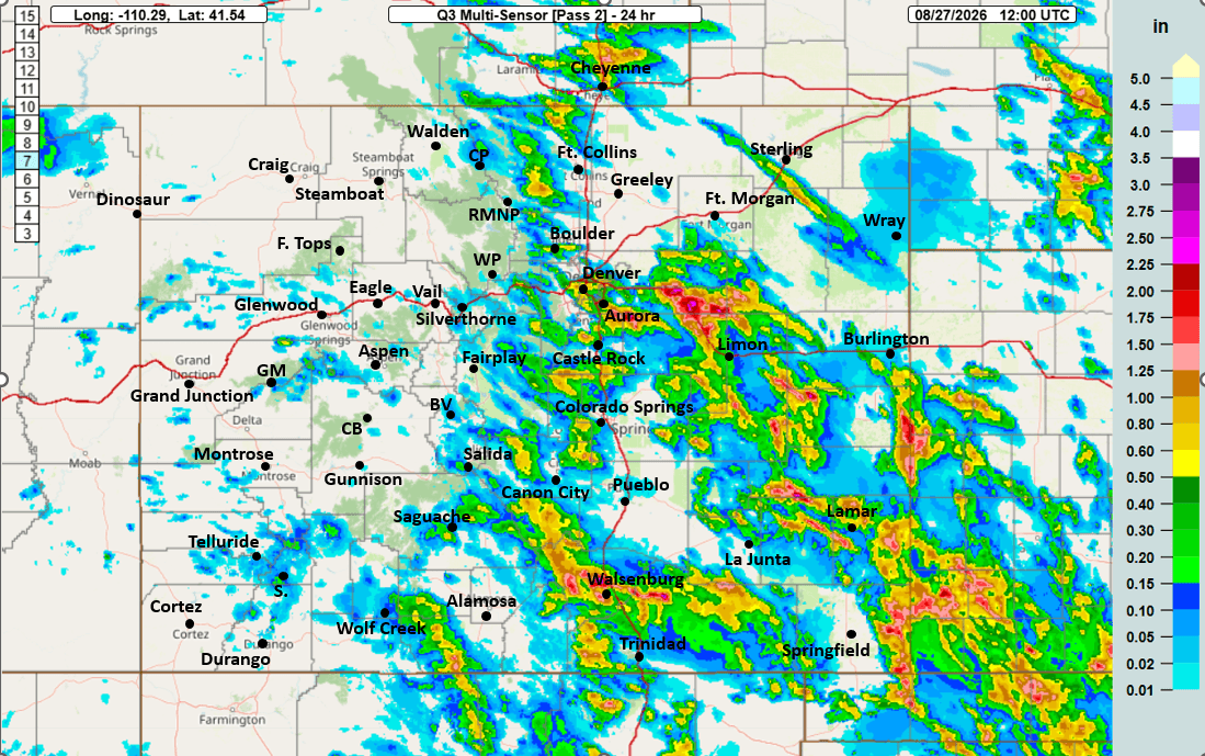
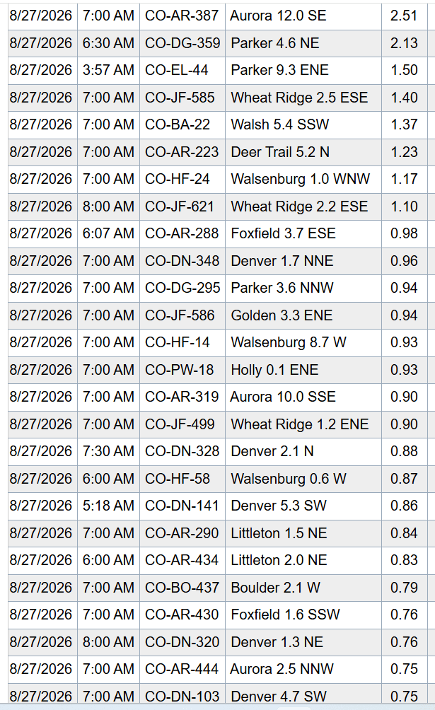
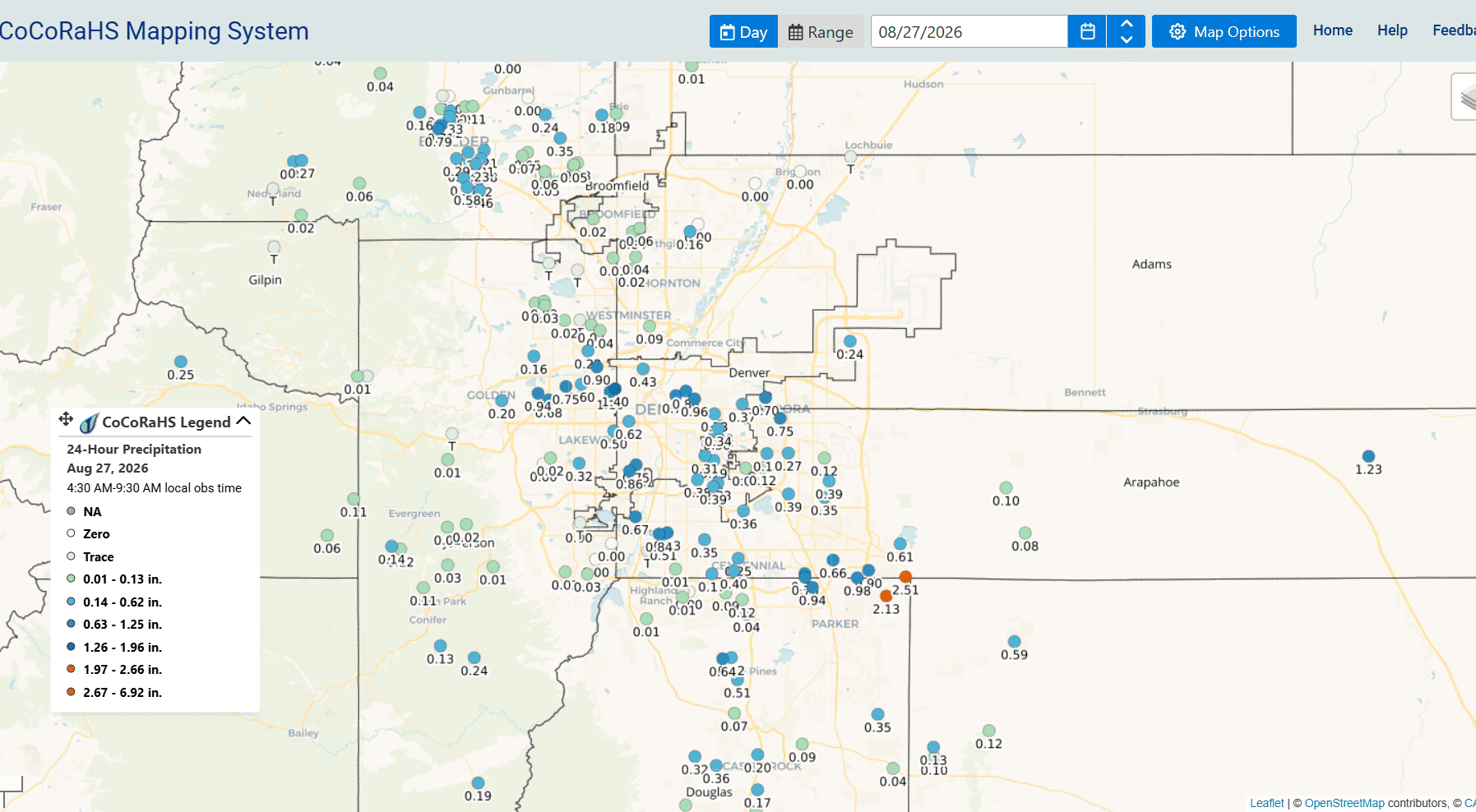
08/27/26 8:30am: Wow, some impressive rain totals in spots from yesterday's thunderstorms. Parts of Aurora picked up over 2.5" of rain with over 2" in parts of Parker and over 1.25" for areas near Wheat Ridge. Also great to see nearly 1.00" for parts of downtown Denver and 0.80" for Boulder. It was hit or miss though: at my house only 0.02" lol.
Below I show 24hr observed rainfall from MRMS, along with top 24hr reports from CoCoRaHS and a map snippet of reports over the Den/Bou area.
Here are some top notable reports from CoCoRaHS this morning:
Aurora 12.0 SE: 2.51"
Parker 4.6 NE: 2.13"
Wheat Ridge 2.5 ESE: 1.40"
Deer Trail 5.2 N: 1.23"
Walsenburg 1.0 WNW: 1.17"
Foxfield 3.7 ESE: 0.98"
Denver 1.7 NNE: 0.96"
Golden 3.3 ENE: 0.94"
Littleton 1.5 NE: 0.84"
Boulder 2.1 W: 0.79"
Centennial 3.9 ESE: 0.69"
Englewood 2.2 SW: 0.67"
Castle Pines 3.7 N: 0.62"
Lafayette 2.3 NW: 0.35"
For today less storms: Best coverage of thunderstorms initially will be over southeast CO (south of the Palmer Divide), from 2pm-8pm.
Den/Bou will have a chance for more isolated storms (but maybe a few strong storms) from 5-9pm today, very hit or miss.
North-central mountains, isolated storms as well 2pm-8pm, not that much.
How much rain did you get yesterday?

Like what you read?
Receive daily weather reports straight to your inbox with Seth's Daily Newsletter. Sign up below.
