Hot with storms over southwest CO on Mon/Tue better rain chances Wed/Thu
Jul 13, 2026
07/13/26 9:20am: Morning, its Monday. Going to be hot with a chance for storms mostly over southwest CO today and tomorrow.
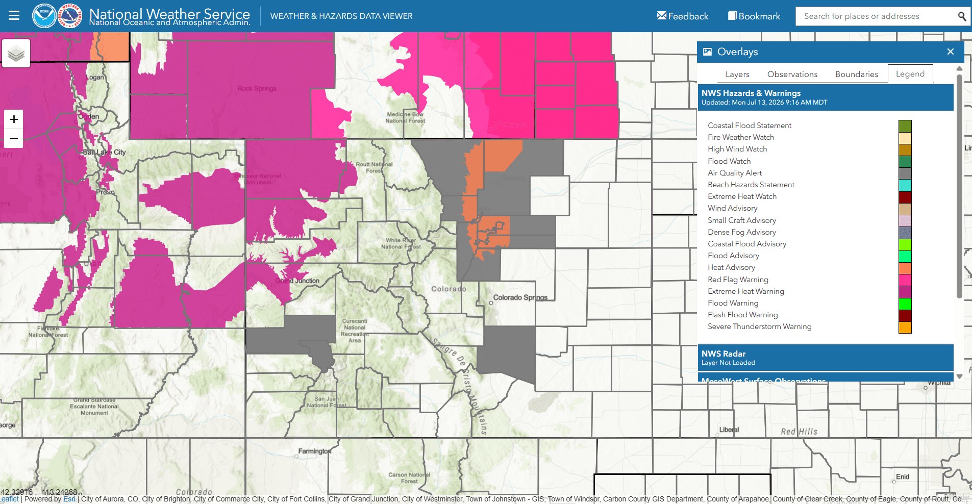
Den/Bou/Ft.Collins and the front-range urban corridor is under a Heat Advisory for today from 10am-9pm for high temps near/above 100 degF.
There are Heat Warnings in place for the Western Slope near Grand Junction to Craig (areas below 6k ft) for high temps of 102-108 degF today.
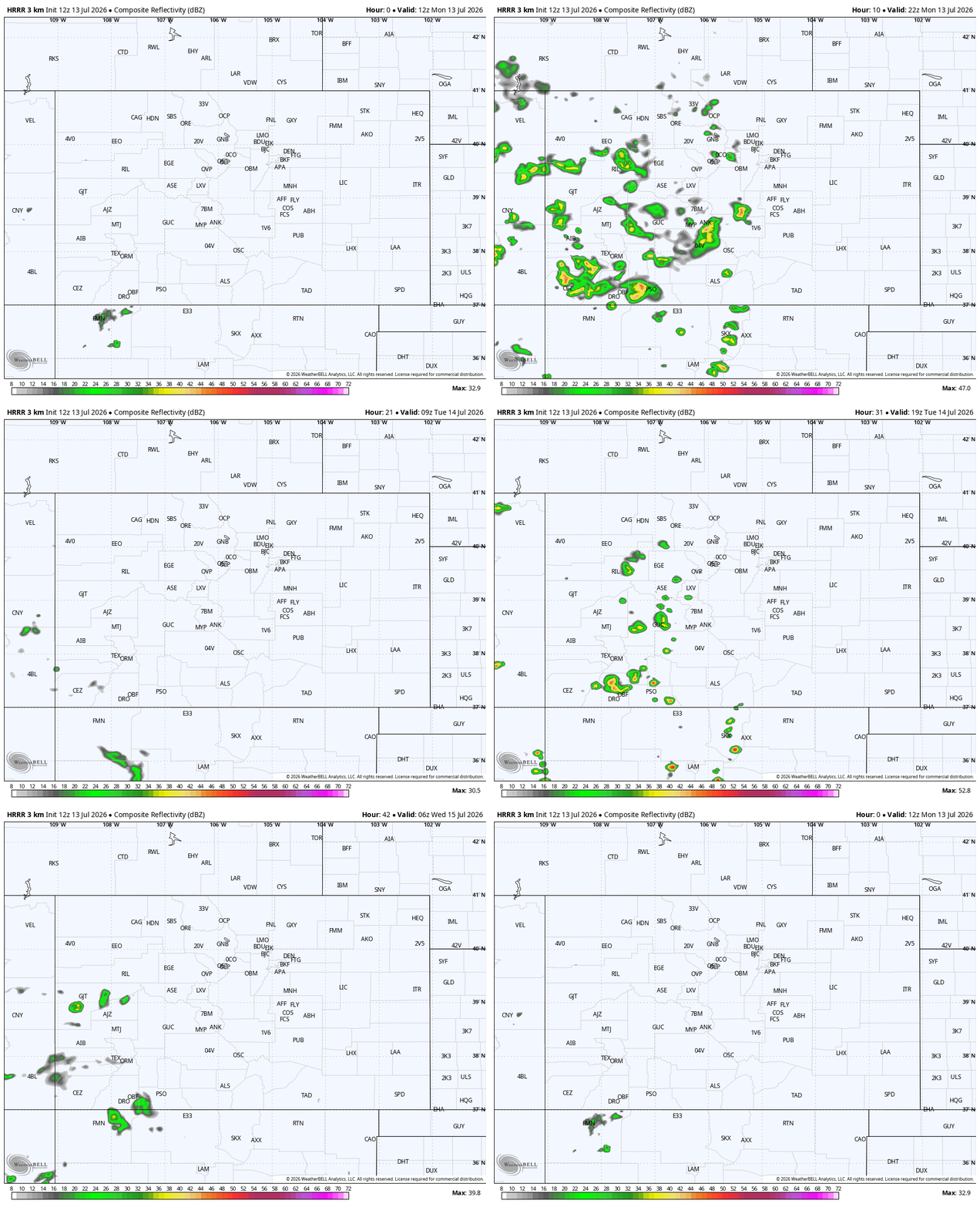
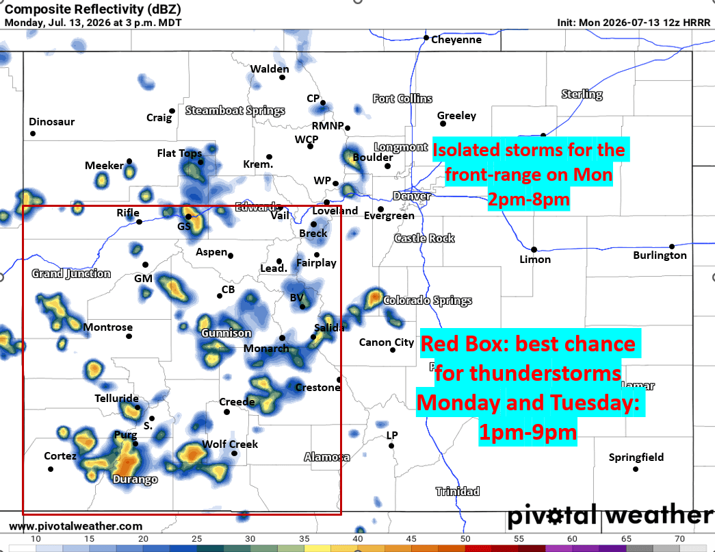
There will be some storms this afternoon. Best chances will be over southwest CO: west of the Cont. Divide and along/south of I-70 (favoring San Juans to Elks): 1pm-9pm
Mountains near Summit/Eagle counties will also have a chance for some isolated / scattered storms mostly after 2pm today.
Low chances for Den/Bou today but maybe a few in the Front Range mountains and foothills after 2pm today.
For tomorrow fairly similar, a chance for storms over west / southwest CO (same area that is favored today: San Juans to Elks).
Lightning strikes and new fire starts are a concern today and tomorrow.
Deeper moisture returns to the north-centra mountains Wed/Thu initially with scattered storms
Lastly, I saw that Forsyth, MT potentially set the new all-time record high temperature ever recorded for Montana, with a high temp of 118 yesterdy, that is bonkers, I'll have more on that later!
First image loop shows forecast radar over the next 48hrs (6am this morning through 6am Wed) from latest HRRR model. Second image shows forecast radar at 3pm today, but I indicate where best storm chances are today and tomorrow. Third image shows all the Heat Advisories (orange) and Heat Warnings (purple) today. Also an Air Quality Alert for Den/Bou and the front-range as well.

Like what you read?
Receive daily weather reports straight to your inbox with Seth's Daily Newsletter. Sign up below.
