Hot today and Mon, cold-front for the plains on Tue/Wed back to record highs next weekend, then more monsoon
Aug 2, 2026
08/02/26 3pm: Hi, I hopefully you are not melting yet lol. And finding some good ways to deal with this heat (unless you are in the high mountains lol).
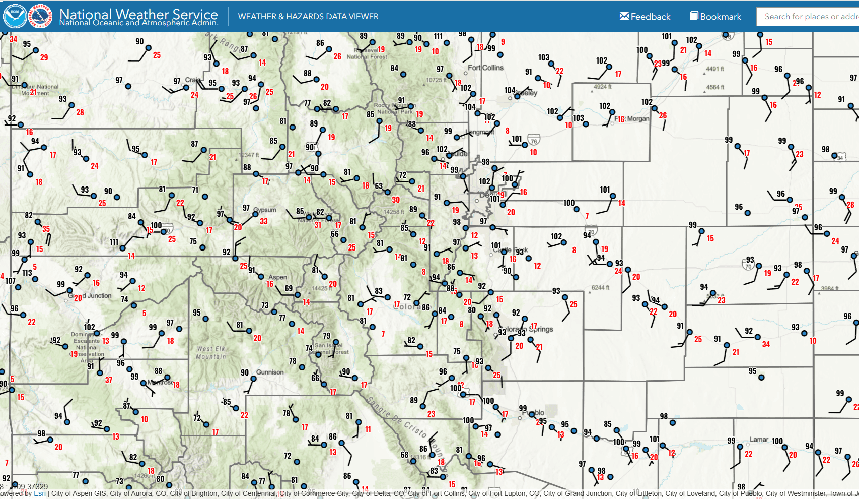
Its a scorcher out there as expected! Currently 104 at my house in Westminster (closer to 102 officially), its 104 near Greeley and Longmont, 102 in Boulder (at the airport) and 101 in downtown Denver and 100 at the airport! Even in the mountains, 84 in Dillon and 85 in Vail. But only 63 at the top of Berthoud Pass (thats where I need to be).
Anyway, I was able to get out earlier though (taking a break inside inside now). But earlier had a great road ride in Boulder between 10:30-12:30 when the temp as 90-95 but the breeze was not bad at all). And then followed that up with a wonderful dip in Boulder Creek, it was so cool and refreshing, sat in there for a bit. That is the ticket today, getting in some water / creeks!
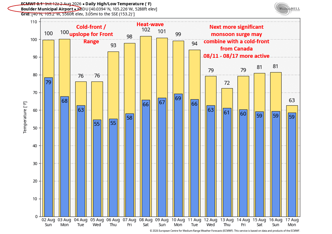
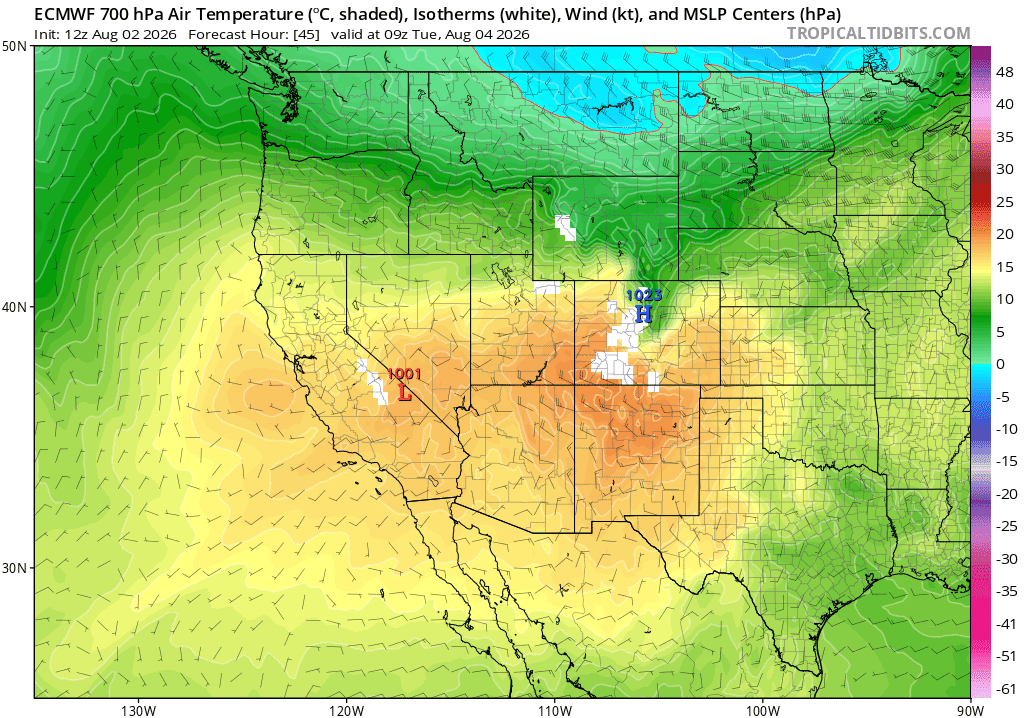
Hot has hell today and most of tomorrow but we do have some relief coming (at least for the front-range and eastern CO). Models show a nice cold-front moving down the front-range (and plains) tomorrow evening after 4pm and that will bring in some cooler air, clouds and a chance for some weak thunderstorms and rain showers: 4pm-10pm tomorrow (most of it over northeast CO, east of the Cont. Divide, includes Den/Bou).
Then cooler for Den/Bou, foothills and the front-range on Tue and Wed with highs in the low 80s. Also a better chance for afternoon thunderstorm/rain but a bit conditional on how capped we may be (cool at the surface) for Tue and Wed (a chance 1pm-8pm each day).
Little impact west of the Cont. Divide as I mentioned. It will remain hot in western / southern CO and the mountains. Front Range mountains will have some cooler wx and a better chances for storms Mon, Tue and Wed.
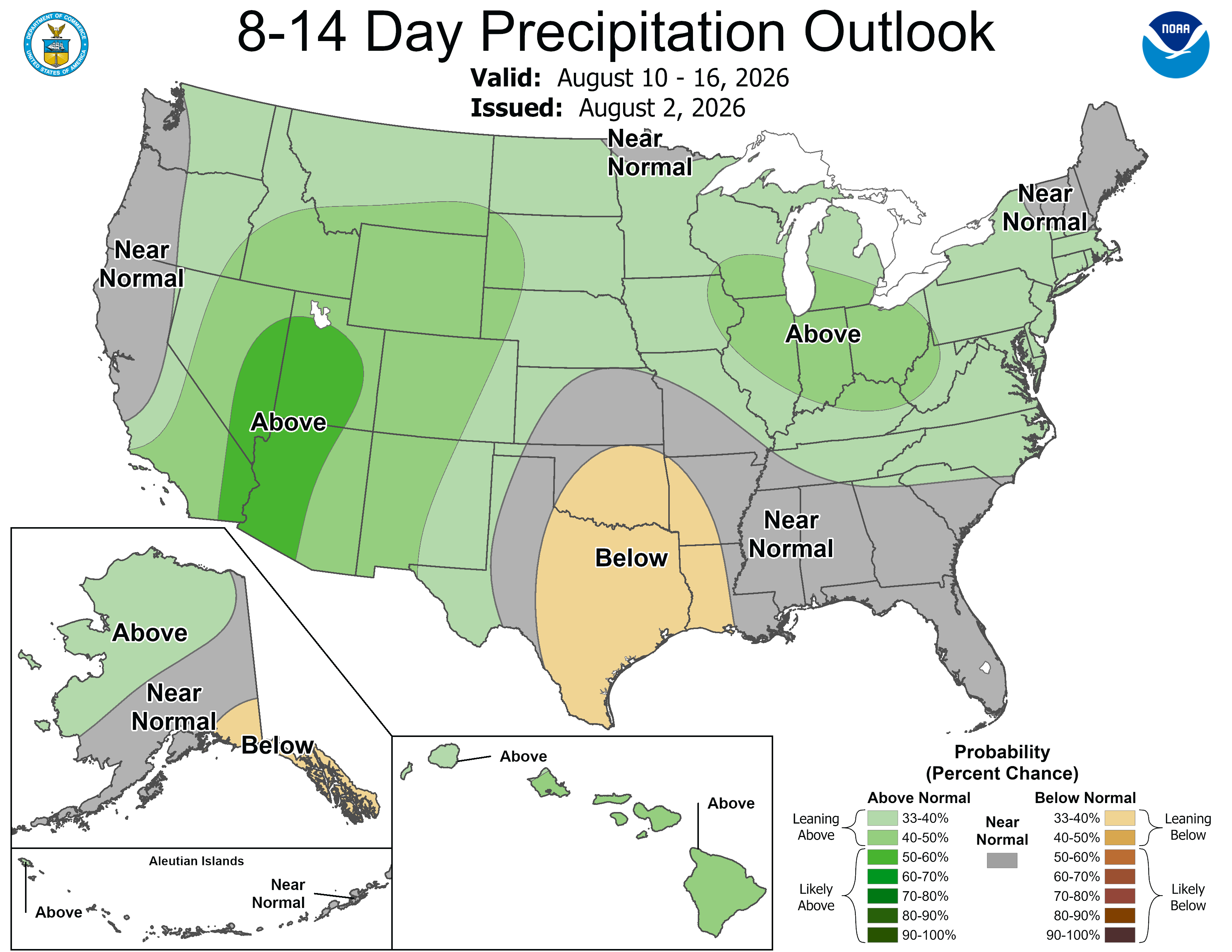
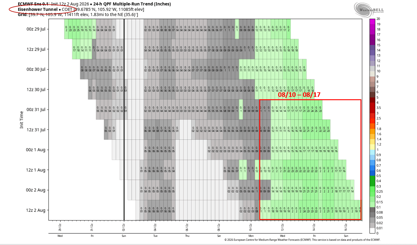
Looking ahead. There are consistent signs of a return to some more robust monsoon moisture as we get towards mid-August, especially in the Aug 10th-17th timeframe....as the main areas of high-pressure shifts southeast, this will open up the moisture tap for CO (and the southwest states). This is reflected in NCEP's latest 8-14 day forecast.
But prior to this we are going to have to get through likely another heat-wave next weekend and there is a chance its the hottest one we have had yet! Models like ECMWF and GFS show high temps for Den/Bou around 102-105 for next Fri-Sun (08/07-08/09). So its going to be very hot again (don't shoot the messenger lol).
But beyond that, looks like could be a more significant monsoon surge for both the mountains and front-range. And models show the chance for some monsoon moisture combining with a series of Canadian cold-fronts coming in from the north as we get towards mid-Aug (Aug 12-16th initially for the front-range), but its a ways out. So there is some relief in the long-terms, just have to get there first!
First image shows forecast max/min temps for Boulder over the next 10 days from latest ECMWF model. Second image shows latest surface map showing current temps, and wind-speed. Third image shows the much cooler air infiltrating northeast CO by early Tue morning (via 700mb temps: you can see the greens vs the oranges). Fourth image shows the 8-14 day precip outlook from NCEP. Fifth image shows the 24hr-precip chicklet chart for Eisenhower Tunnels showing a much more active pattern coming up towards mid-August.

Like what you read?
Receive daily weather reports straight to your inbox with Seth's Daily Newsletter. Sign up below.
