High Wind Warning for the Front Range, some snow for the mountains. Dry for the weekend
Dec 9, 2025
12/09/25 8am: Batten down the hatches if you haven't already! Very windy out there across northern CO this morning with the edge of the jet-stream moving in overhead.
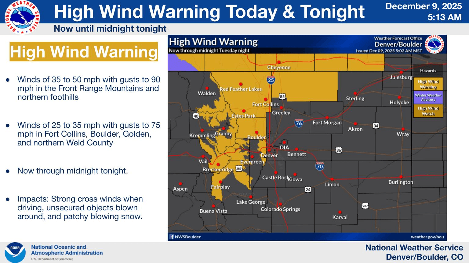
In fact a good portion of the north-central mountains, front-range mountains and foothills (including western parts of Den/Bou) are under a High Wind Warning from now through 12am Wed: sustained winds of 35-40 mph with wind-gusts of 40-80mph, especially along/east of the Cont. Divide (Front Range mountains above 9k ft will be favored).
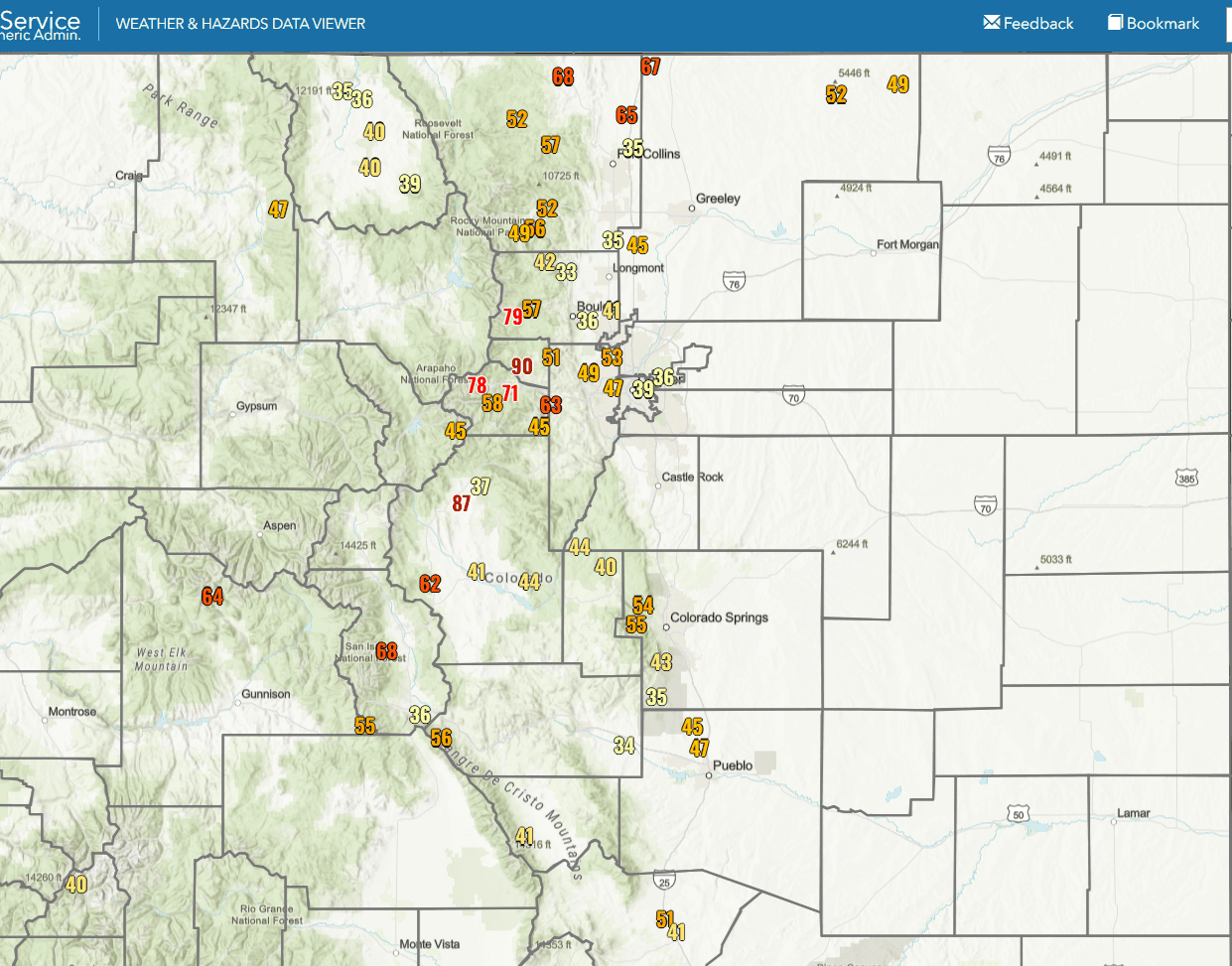
In fact already some very strong wind-gusts out there today. A station near Rollinsville (Dakota Hills AWOS) is reporting a gust of 90 mph recently. Berthoud Pass had a wind-gust of 78 mph.
Here in Den/Bou getting gusts of 40-50mph (several trash cans are knocked over on my street).
I also heard that Hwy 285 near Fairplay is currently closed due to ground blizzard conditions with blowing snow.
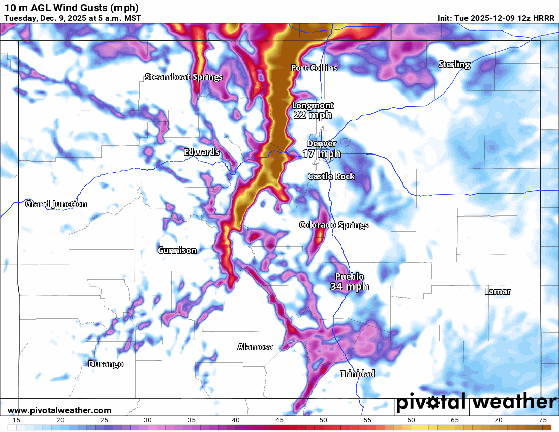
Strong wind will continue through tonight. It will calm down some tomorrow morning, only to pick up again tomorrow, especially windy from 11am-8pm tomorrow (Wed).
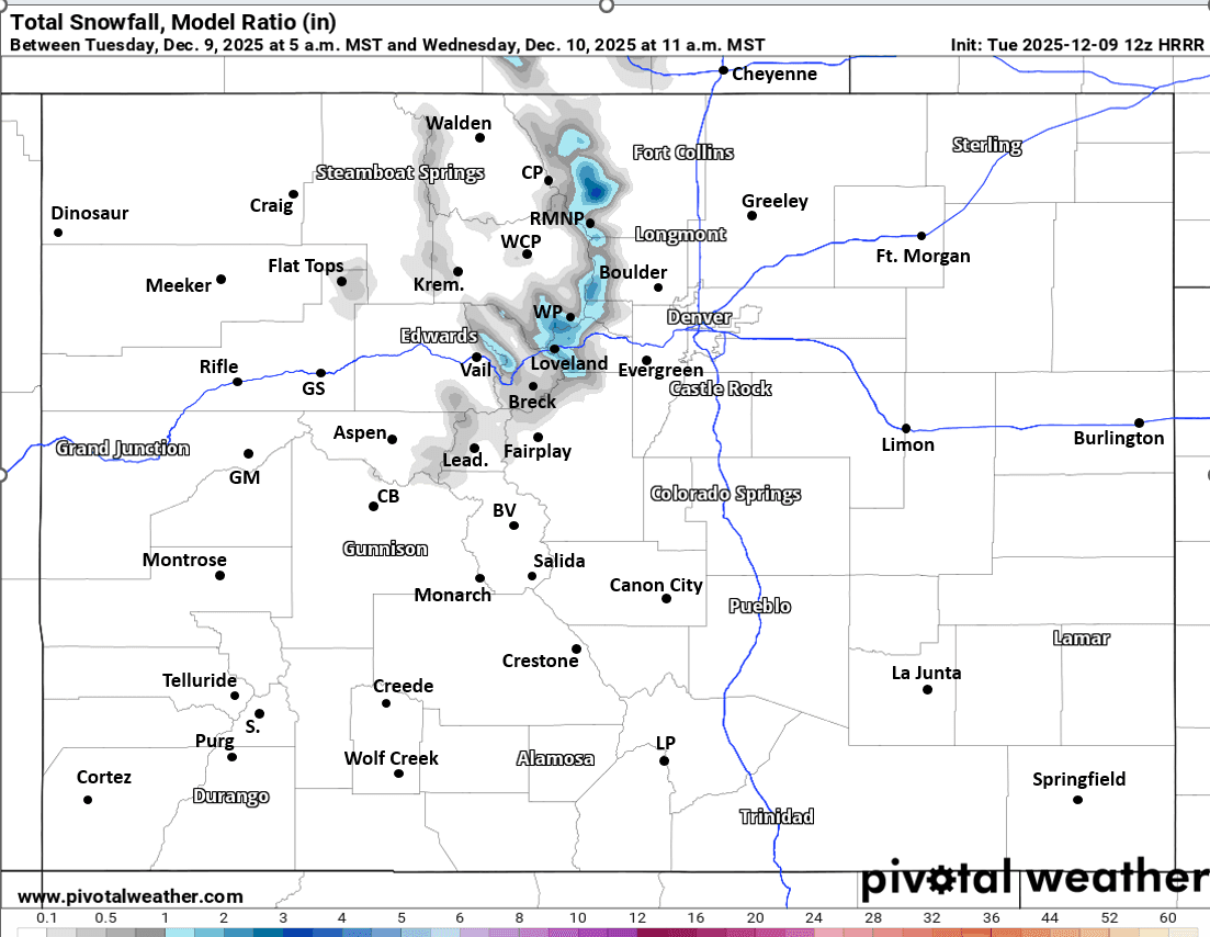
Models show a short-wave grazing northern CO (hence the wind) but it will also bring a bit of snow / snow showers to the north-central mountains primarily from 5pm this evening to 11am Wed (although there are already snow-showers near Loveland Pass and Berthoud Pass this morning). Most of the snow will be over the Front Range mountains (Loveland to Berthoud, to near WP, IPW, RMNP, parts of the Park Range), with 1-3" in spots. Outside of that a Trace-2" in a few spots.
Drier and warmer weather moves in Thu through the weekend. Looks dry and warm for this upcoming weekend (withs some wind at times).
First image shows max observed wind-gusts since midnight. Second image shows the current High Wind Warning from NWS. Third image loop shows forecast wind-gusts over the next 48hrs (5am this morning through 5am Thu) from latest HRRR. Fourth image shows forecast total snowfall from now through 11am Wed from latest HRRR, take amounts with grain of salt.

Like what you read?
Receive daily weather reports straight to your inbox with Seth's Daily Newsletter. Sign up below.